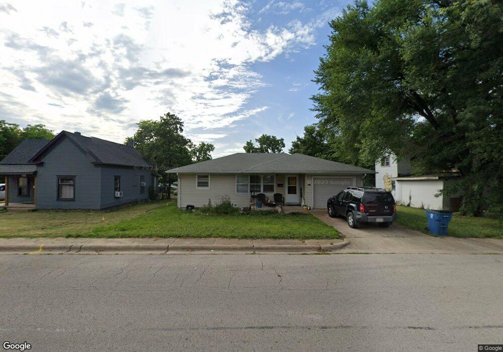
381 W Hayes St Lebanon, MO 65536
Estimated Value: $114,000 - $126,000
2
Beds
--
Bath
1,088
Sq Ft
$109/Sq Ft
Est. Value
About This Home
This home is located at 381 W Hayes St, Lebanon, MO 65536 and is currently estimated at $118,523, approximately $108 per square foot. 381 W Hayes St is a home located in Laclede County with nearby schools including Joe D. Esther Elementary School, Maplecrest Elementary School, and Boswell Elementary School.
Ownership History
Date
Name
Owned For
Owner Type
Purchase Details
Closed on
Jan 18, 2018
Sold by
Lightsing Investments Llc
Bought by
Joyce Aaron Peter
Current Estimated Value
Home Financials for this Owner
Home Financials are based on the most recent Mortgage that was taken out on this home.
Original Mortgage
$55,775
Outstanding Balance
$47,067
Interest Rate
3.94%
Mortgage Type
New Conventional
Estimated Equity
$71,456
Purchase Details
Closed on
Oct 17, 2007
Sold by
Light E Kim and Light Katherine Marie
Bought by
Light E Kim and E Kim Light Trust Agreement
Create a Home Valuation Report for This Property
The Home Valuation Report is an in-depth analysis detailing your home's value as well as a comparison with similar homes in the area
Home Values in the Area
Average Home Value in this Area
Purchase History
| Date | Buyer | Sale Price | Title Company |
|---|---|---|---|
| Joyce Aaron Peter | -- | None Available | |
| Light E Kim | -- | None Available | |
| Light E Kim | -- | None Available |
Source: Public Records
Mortgage History
| Date | Status | Borrower | Loan Amount |
|---|---|---|---|
| Open | Joyce Aaron Peter | $55,775 |
Source: Public Records
Tax History Compared to Growth
Tax History
| Year | Tax Paid | Tax Assessment Tax Assessment Total Assessment is a certain percentage of the fair market value that is determined by local assessors to be the total taxable value of land and additions on the property. | Land | Improvement |
|---|---|---|---|---|
| 2025 | $481 | $9,520 | $0 | $0 |
| 2024 | $481 | $8,440 | $0 | $0 |
| 2023 | $496 | $8,440 | $0 | $0 |
| 2022 | $462 | $8,440 | $0 | $0 |
| 2021 | $509 | $8,436 | $1,406 | $7,030 |
| 2020 | $511 | $8,436 | $1,406 | $7,030 |
| 2019 | $490 | $8,440 | $1,410 | $7,030 |
| 2018 | $460 | $8,440 | $1,410 | $7,030 |
| 2017 | $437 | $8,440 | $0 | $0 |
| 2016 | $436 | $8,440 | $0 | $0 |
| 2015 | $436 | $8,440 | $0 | $0 |
| 2014 | $436 | $8,440 | $0 | $0 |
| 2013 | -- | $8,440 | $0 | $0 |
Source: Public Records
Map
Nearby Homes
- 406 Perry St
- 545 W Pierce St
- 22781 U S Route 66
- 000 #25 U S Route 66
- 000-#72 U S Route 66
- 000#72 U S Route 66
- 000#25 U S Route 66
- 100 State Highway 32
- 14300 State Highway 32
- 31 Greenwood Dr
- 22 Stanwood Dr
- 704 W 2nd St
- 757 S Adams Ave
- 286 Polk Ave
- Lot 20 Missouri 64
- 1719 State Hwy 64
- 015 Missouri 64
- Lot 19 Missouri 64
- Lot 18 Missouri 64
- Lot 17 Missouri 64
- 385 W Hayes St
- 359 W Hayes St
- 360 S Jackson Ave
- 411 W Hayes St
- 352 W Hayes St
- 300 S Jackson Ave
- 326 W Pierce St
- 335 S Jackson Ave
- 423 W Hayes St
- 350 W Pierce St
- 400 S Jackson Ave
- 324 W Hayes St
- 435 W Hayes St
- 422 W Hayes St
- 435 S Jackson Ave
- 410 W Pierce St
- 411 S Monroe St
- 447 W Hayes St
- 434 W Pierce St
- 466 S Jackson Ave