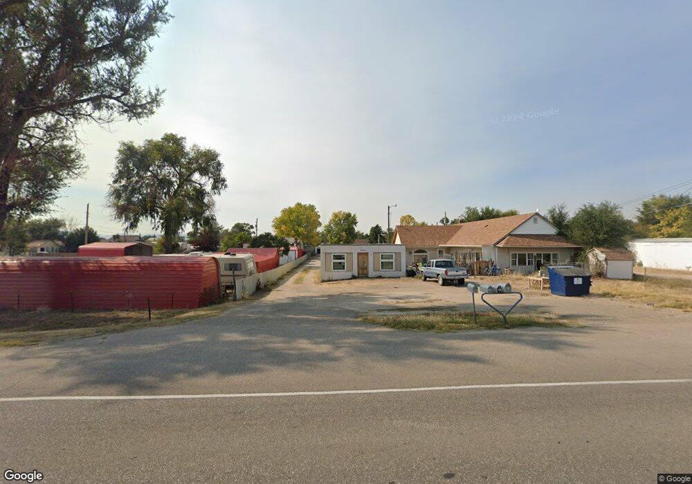
3810 Avenue I Unit 3810,3812,3814,3818 Scottsbluff, NE 69361
Estimated Value: $237,000
7
Beds
6
Baths
1,440
Sq Ft
$165/Sq Ft
Est. Value
About This Home
This home is located at 3810 Avenue I Unit 3810,3812,3814,3818, Scottsbluff, NE 69361 and is currently priced at $237,000, approximately $164 per square foot. 3810 Avenue I Unit 3810,3812,3814,3818 is a home located in Scotts Bluff County with nearby schools including Lincoln Heights Elementary School, Bluffs Middle School, and Scottsbluff Senior High School.
Ownership History
Date
Name
Owned For
Owner Type
Purchase Details
Closed on
Nov 18, 2024
Sold by
Premium Landholders Llc
Bought by
Soriano Dela Cruz Mario and Soriano Kimberly C
Current Estimated Value
Home Financials for this Owner
Home Financials are based on the most recent Mortgage that was taken out on this home.
Original Mortgage
$165,000
Outstanding Balance
$161,528
Interest Rate
6.44%
Mortgage Type
Credit Line Revolving
Purchase Details
Closed on
Apr 13, 2009
Sold by
Curtis David and Curtis Tara R
Bought by
Premium Landholders Llc
Home Financials for this Owner
Home Financials are based on the most recent Mortgage that was taken out on this home.
Original Mortgage
$239,400
Interest Rate
5.24%
Mortgage Type
Future Advance Clause Open End Mortgage
Create a Home Valuation Report for This Property
The Home Valuation Report is an in-depth analysis detailing your home's value as well as a comparison with similar homes in the area
Home Values in the Area
Average Home Value in this Area
Purchase History
| Date | Buyer | Sale Price | Title Company |
|---|---|---|---|
| Soriano Dela Cruz Mario | $220,000 | Nebraska Title | |
| Soriano Dela Cruz Mario | $220,000 | Nebraska Title | |
| Premium Landholders Llc | $115,000 | -- |
Source: Public Records
Mortgage History
| Date | Status | Borrower | Loan Amount |
|---|---|---|---|
| Open | Soriano Dela Cruz Mario | $165,000 | |
| Closed | Soriano Dela Cruz Mario | $165,000 | |
| Previous Owner | Premium Landholders Llc | $239,400 |
Source: Public Records
Tax History Compared to Growth
Tax History
| Year | Tax Paid | Tax Assessment Tax Assessment Total Assessment is a certain percentage of the fair market value that is determined by local assessors to be the total taxable value of land and additions on the property. | Land | Improvement |
|---|---|---|---|---|
| 2024 | $1,939 | $179,775 | $83,320 | $96,455 |
| 2023 | $3,262 | $176,432 | $81,867 | $94,565 |
| 2022 | $3,262 | $176,432 | $81,867 | $94,565 |
| 2021 | $3,754 | $199,737 | $81,867 | $117,870 |
| 2020 | $3,779 | $199,737 | $81,867 | $117,870 |
| 2019 | $3,773 | $199,716 | $81,846 | $117,870 |
| 2018 | $3,812 | $200,436 | $81,846 | $118,590 |
| 2017 | $3,826 | $200,436 | $81,846 | $118,590 |
| 2016 | $3,992 | $208,873 | $42,582 | $166,291 |
| 2015 | $3,960 | $208,873 | $42,582 | $166,291 |
| 2014 | $3,413 | $193,756 | $42,582 | $151,174 |
| 2012 | -- | $186,614 | $42,582 | $144,032 |
Source: Public Records
Map
Nearby Homes
- TBD W 36th St
- 0 W 36th St Unit 20254154
- 806 W 36th St
- 10 Stoney Creek Dr
- 414 W 33rd St
- 3017 Avenue F
- 3415 Ross Ave
- 2809 Avenue D
- Lot 1 31st St
- TBD U S Highway 26
- Lot 2 31st St
- 4301 Shady Ln
- 3428 Cary Ct
- 2401 Avenue E
- 512 E 35th St
- 2317 Kingsgate Rd
- 2417 Avenue A
- 2124 Avenue D
- 2510 Kingsgate Rd
- 2113 Avenue O
- 913 W Adler Dr
- 3824 Avenue I
- 917 W Adler Dr
- 3832 Avenue I
- 3710 Avenue I
- 3840 Avenue I
- 914 W Adler Dr
- 3618 Avenue I
- 918 W Adler Dr
- 1013 W Adler Dr
- 926 W Adler Dr
- 1002 W Adler Dr
- 1006 W Adler Dr
- 921 W 36th St Unit OFFICE BUILDING
- 921 W 36th St Unit north of maverick
- 1018 W Adler Dr
- 1026 W Adler Dr
- 1114 W Adler Dr
- 914 W 36th St Unit US 26 AND HIGHWAY 71
- 914 W 36th St