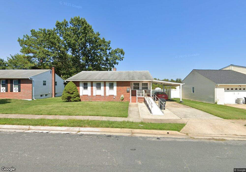
3810 Brentford Rd Randallstown, MD 21133
Estimated Value: $327,393 - $422,000
--
Bed
2
Baths
1,590
Sq Ft
$237/Sq Ft
Est. Value
About This Home
This home is located at 3810 Brentford Rd, Randallstown, MD 21133 and is currently estimated at $377,348, approximately $237 per square foot. 3810 Brentford Rd is a home located in Baltimore County with nearby schools including Randallstown Elementary School, Deer Park Middle Magnet School, and Randallstown High School.
Ownership History
Date
Name
Owned For
Owner Type
Purchase Details
Closed on
Sep 2, 2021
Sold by
Washington Minnie R
Bought by
Washington Minnie R and Taylor Pia Angela
Current Estimated Value
Purchase Details
Closed on
Oct 21, 2004
Sold by
Washington Carl L
Bought by
Washington Carl L and Washington Minnie R
Purchase Details
Closed on
Sep 30, 2004
Sold by
Washington Carl L
Bought by
Washington Carl L and Washington Minnie R
Purchase Details
Closed on
Mar 16, 1993
Sold by
Greenfeld Louis L
Bought by
Washington Carl L
Purchase Details
Closed on
Nov 13, 1980
Sold by
Saks Howard L
Bought by
Greenfeld Louis L
Create a Home Valuation Report for This Property
The Home Valuation Report is an in-depth analysis detailing your home's value as well as a comparison with similar homes in the area
Home Values in the Area
Average Home Value in this Area
Purchase History
| Date | Buyer | Sale Price | Title Company |
|---|---|---|---|
| Washington Minnie R | -- | Accommodation | |
| Washington Carl L | -- | -- | |
| Washington Carl L | -- | -- | |
| Washington Carl L | $108,000 | -- | |
| Greenfeld Louis L | $66,000 | -- |
Source: Public Records
Tax History Compared to Growth
Tax History
| Year | Tax Paid | Tax Assessment Tax Assessment Total Assessment is a certain percentage of the fair market value that is determined by local assessors to be the total taxable value of land and additions on the property. | Land | Improvement |
|---|---|---|---|---|
| 2025 | $4,263 | $301,200 | -- | -- |
| 2024 | $4,263 | $280,900 | $74,700 | $206,200 |
| 2023 | $1,669 | $267,833 | $0 | $0 |
| 2022 | $3,224 | $254,767 | $0 | $0 |
| 2021 | $3,047 | $241,700 | $56,700 | $185,000 |
| 2020 | $3,047 | $240,833 | $0 | $0 |
| 2019 | $2,965 | $239,967 | $0 | $0 |
| 2018 | $2,850 | $239,100 | $56,700 | $182,400 |
| 2017 | $2,635 | $215,533 | $0 | $0 |
| 2016 | $2,488 | $191,967 | $0 | $0 |
| 2015 | $2,488 | $168,400 | $0 | $0 |
| 2014 | $2,488 | $168,400 | $0 | $0 |
Source: Public Records
Map
Nearby Homes
- 9044 Allenswood Rd
- 3805 Terka Cir
- 3709 Fieldstone Rd
- 3714 Stoneybrook Rd
- 3510 Tali Dr
- 9202 Samoset Rd
- 3618 Briarstone Rd
- 3907 Roxanne Rd
- 3506 Bayer Ave
- 3816 Cassandra Rd
- 3822 Cassandra Rd
- 3823 Cassandra Rd
- 3659 Brenbrook Dr
- 8808 Church Ln
- 9303 Samoset Rd
- 9112 Meadow Heights Rd
- 3418 Carroll Ave
- 8829 Falcon Ridge Dr
- 8903 Flagstone Cir
- 28 Sunrise Ct
- 3808 Brentford Rd
- 3812 Brentford Rd
- 4 Brentgate Ct
- 3806 Brentford Rd
- 3811 Brentford Rd
- 3804 Brentford Rd
- 3805 Brentford Rd
- 5 Brentgate Ct
- 9001 Hamor Rd
- 3813 Brentford Rd
- 3816 Brentford Rd
- 3 Brentgate Ct
- 9000 Hamor Rd
- 3802 Brentford Rd
- 3803 Brentford Rd
- 3815 Brentford Rd
- 4 Aldersgate Ct
- 9003 Hamor Rd
- 3 Aldersgate Ct
- 3817 Brentford Rd