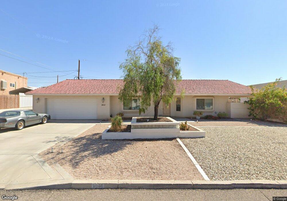
3810 Sloop Dr Lake Havasu City, AZ 86406
Estimated Value: $699,546 - $817,000
4
Beds
3
Baths
2,340
Sq Ft
$331/Sq Ft
Est. Value
About This Home
This home is located at 3810 Sloop Dr, Lake Havasu City, AZ 86406 and is currently estimated at $773,637, approximately $330 per square foot. 3810 Sloop Dr is a home located in Mohave County with nearby schools including Jamaica Elementary School, Thunderbolt Middle School, and Lake Havasu High School.
Ownership History
Date
Name
Owned For
Owner Type
Purchase Details
Closed on
Nov 3, 2010
Sold by
Wells Fargo Bank Na
Bought by
Willhite Donald S and Willhite Joy O
Current Estimated Value
Home Financials for this Owner
Home Financials are based on the most recent Mortgage that was taken out on this home.
Original Mortgage
$210,000
Outstanding Balance
$137,847
Interest Rate
4.17%
Mortgage Type
New Conventional
Estimated Equity
$635,790
Purchase Details
Closed on
Jun 19, 2002
Sold by
Dulin Douglas D
Bought by
Wooster John H and Wooster Tamara K
Create a Home Valuation Report for This Property
The Home Valuation Report is an in-depth analysis detailing your home's value as well as a comparison with similar homes in the area
Home Values in the Area
Average Home Value in this Area
Purchase History
| Date | Buyer | Sale Price | Title Company |
|---|---|---|---|
| Willhite Donald S | $262,500 | First American Title Ins Co | |
| Wooster John H | $20,000 | Capital Title Agency Inc |
Source: Public Records
Mortgage History
| Date | Status | Borrower | Loan Amount |
|---|---|---|---|
| Open | Willhite Donald S | $210,000 |
Source: Public Records
Tax History Compared to Growth
Tax History
| Year | Tax Paid | Tax Assessment Tax Assessment Total Assessment is a certain percentage of the fair market value that is determined by local assessors to be the total taxable value of land and additions on the property. | Land | Improvement |
|---|---|---|---|---|
| 2026 | $655 | -- | -- | -- |
| 2025 | $1,400 | $66,378 | $0 | $0 |
| 2024 | $1,400 | $65,242 | $0 | $0 |
| 2023 | $1,400 | $59,343 | $0 | $0 |
| 2022 | $1,429 | $43,778 | $0 | $0 |
| 2021 | $1,706 | $41,498 | $0 | $0 |
| 2019 | $1,786 | $37,267 | $0 | $0 |
| 2018 | $1,811 | $35,306 | $0 | $0 |
| 2017 | $1,866 | $32,573 | $0 | $0 |
| 2016 | $1,730 | $31,027 | $0 | $0 |
| 2015 | $1,766 | $26,340 | $0 | $0 |
Source: Public Records
Map
Nearby Homes
- 3808 Whaler Dr
- 3812 Yonder Dr
- 3873 Packard Place
- 3665 Pelican Place
- 3751 Mission Dr S
- 3781 Bluegrass Dr
- 3828 Cherry Tree Blvd
- 3830 Bluegrass Dr
- 3883 Sloop Dr
- 3770 Bluegrass Dr
- 361 Mcculloch Blvd S
- 3856 Mission Dr N
- 386 Mcculloch Blvd S
- 3852 Solar Dr
- 4019 Bluegrass Dr
- 3956 Cherry Tree Blvd
- 3565 El Rey Ln
- 3937 Comet Dr
- 4019 Black Hill Dr
- 4051 Northstar Dr