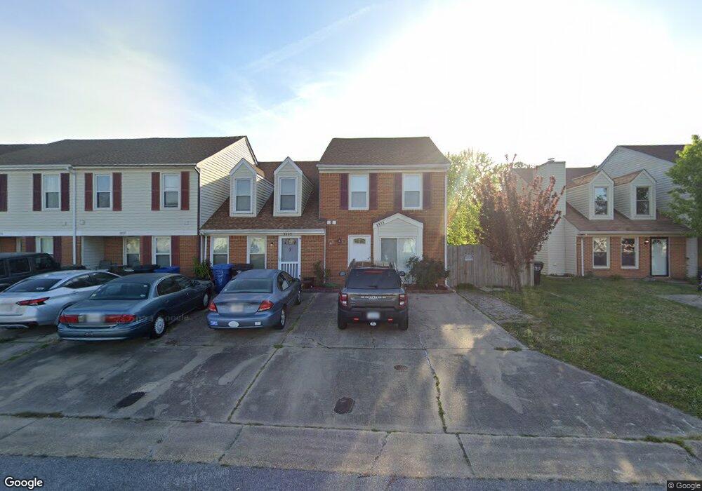
3811 Buchanan Dr Virginia Beach, VA 23453
Green Run NeighborhoodEstimated Value: $234,000 - $274,000
3
Beds
2
Baths
1,338
Sq Ft
$194/Sq Ft
Est. Value
About This Home
This home is located at 3811 Buchanan Dr, Virginia Beach, VA 23453 and is currently estimated at $259,177, approximately $193 per square foot. 3811 Buchanan Dr is a home located in Virginia Beach City with nearby schools including Landstown Elementary School, Landstown Middle School, and Landstown High School.
Ownership History
Date
Name
Owned For
Owner Type
Purchase Details
Closed on
Jul 14, 2017
Sold by
Wells Fargo Bank National Association As
Bought by
Malikzada Mohammad Daud
Current Estimated Value
Purchase Details
Closed on
Mar 14, 2017
Sold by
Surety Trustees Llc A Virginia Limited L and Norfleet Michael A
Bought by
Wells Fargo Bank National Association As
Purchase Details
Closed on
Jul 28, 2005
Sold by
Costas Ruben
Bought by
Norfleet Michael A
Home Financials for this Owner
Home Financials are based on the most recent Mortgage that was taken out on this home.
Original Mortgage
$113,600
Interest Rate
5.54%
Mortgage Type
New Conventional
Create a Home Valuation Report for This Property
The Home Valuation Report is an in-depth analysis detailing your home's value as well as a comparison with similar homes in the area
Home Values in the Area
Average Home Value in this Area
Purchase History
| Date | Buyer | Sale Price | Title Company |
|---|---|---|---|
| Malikzada Mohammad Daud | $97,484 | Attorney | |
| Wells Fargo Bank National Association As | $147,000 | None Available | |
| Norfleet Michael A | $144,200 | -- |
Source: Public Records
Mortgage History
| Date | Status | Borrower | Loan Amount |
|---|---|---|---|
| Previous Owner | Norfleet Michael A | $113,600 |
Source: Public Records
Tax History Compared to Growth
Tax History
| Year | Tax Paid | Tax Assessment Tax Assessment Total Assessment is a certain percentage of the fair market value that is determined by local assessors to be the total taxable value of land and additions on the property. | Land | Improvement |
|---|---|---|---|---|
| 2025 | $2,157 | $233,400 | $75,000 | $158,400 |
| 2024 | $2,157 | $222,400 | $73,000 | $149,400 |
| 2023 | $1,977 | $199,700 | $65,000 | $134,700 |
| 2022 | $1,786 | $180,400 | $56,000 | $124,400 |
| 2021 | $1,593 | $160,900 | $49,000 | $111,900 |
| 2020 | $1,571 | $154,400 | $47,000 | $107,400 |
| 2019 | $1,478 | $140,300 | $45,000 | $95,300 |
| 2018 | $1,407 | $140,300 | $45,000 | $95,300 |
| 2017 | $1,336 | $133,300 | $41,000 | $92,300 |
| 2016 | $1,282 | $129,500 | $40,000 | $89,500 |
| 2015 | $626 | $126,400 | $40,000 | $86,400 |
| 2014 | -- | $119,600 | $40,000 | $79,600 |
Source: Public Records
Map
Nearby Homes
- MM Covington II
- 3502 Remington Ct
- 3530 Dublin Ct
- 3518 Remington Ct
- 3546 Dublin Ct
- 3504 Irvington Ct
- 3516 Lankford Ct
- 3501 Markham Ct
- 1305 Snowflake Cir
- 1457 Ski Lodge Rd
- 1304 Eagle Ave
- 3814 Rica Dr
- 3554 Brigita Ct
- 1644 Fairfax Dr
- 3707 Sylvan Ln
- 3852 Lasalle Dr Unit 101
- 3519 Argo Ct
- 3848 Lasalle Dr Unit 101
- 1504 Northtree Cir
- 1300 Riverside Dr
- 3809 Buchanan Dr
- 3805 Buchanan Dr
- 3803 Buchanan Dr
- 3813 Buchanan Dr
- 3815 Buchanan Dr
- 3817 Buchanan Dr
- 3819 Buchanan Dr
- 3821 Buchanan Dr
- 3823 Buchanan Dr
- 3825 Buchanan Dr
- 3814 Buchanan Dr
- 3812 Buchanan Dr
- 3816 Buchanan Dr
- 3818 Buchanan Dr
- 3810 Buchanan Dr
- 3820 Buchanan Dr
- 3806 Buchanan Dr
- 3804 Buchanan Dr
- 3800 Buchanan Dr
- 3822 Buchanan Dr