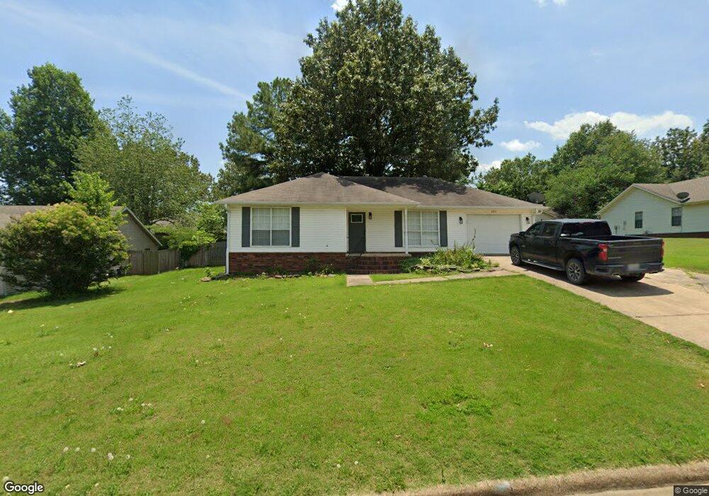
3811 Burdyshaw Dr Jonesboro, AR 72401
Estimated Value: $161,981 - $189,000
--
Bed
2
Baths
1,252
Sq Ft
$140/Sq Ft
Est. Value
About This Home
This home is located at 3811 Burdyshaw Dr, Jonesboro, AR 72401 and is currently estimated at $174,995, approximately $139 per square foot. 3811 Burdyshaw Dr is a home located in Craighead County with nearby schools including Nettleton High School, Montessori School of Jonesboro, and Blessed Sacrament School.
Ownership History
Date
Name
Owned For
Owner Type
Purchase Details
Closed on
Jul 6, 2022
Sold by
Haring Charles W and Haring Michelle L
Bought by
Jblack Holdings Llc
Current Estimated Value
Home Financials for this Owner
Home Financials are based on the most recent Mortgage that was taken out on this home.
Original Mortgage
$130,000
Outstanding Balance
$50,942
Interest Rate
4.31%
Mortgage Type
New Conventional
Estimated Equity
$124,053
Purchase Details
Closed on
Apr 16, 1999
Bought by
Haring
Create a Home Valuation Report for This Property
The Home Valuation Report is an in-depth analysis detailing your home's value as well as a comparison with similar homes in the area
Home Values in the Area
Average Home Value in this Area
Purchase History
| Date | Buyer | Sale Price | Title Company |
|---|---|---|---|
| Jblack Holdings Llc | -- | None Listed On Document | |
| Haring | $73,000 | -- |
Source: Public Records
Mortgage History
| Date | Status | Borrower | Loan Amount |
|---|---|---|---|
| Open | Jblack Holdings Llc | $130,000 |
Source: Public Records
Tax History Compared to Growth
Tax History
| Year | Tax Paid | Tax Assessment Tax Assessment Total Assessment is a certain percentage of the fair market value that is determined by local assessors to be the total taxable value of land and additions on the property. | Land | Improvement |
|---|---|---|---|---|
| 2025 | $1,243 | $25,863 | $6,000 | $19,863 |
| 2024 | $1,243 | $25,863 | $6,000 | $19,863 |
| 2023 | $1,207 | $25,863 | $6,000 | $19,863 |
| 2022 | $1,115 | $25,863 | $6,000 | $19,863 |
| 2021 | $1,044 | $21,720 | $4,400 | $17,320 |
| 2020 | $1,044 | $21,720 | $4,400 | $17,320 |
| 2019 | $1,044 | $21,720 | $4,400 | $17,320 |
| 2018 | $1,044 | $21,720 | $4,400 | $17,320 |
| 2017 | $1,044 | $21,720 | $4,400 | $17,320 |
| 2016 | $971 | $20,200 | $4,000 | $16,200 |
| 2015 | $971 | $20,200 | $4,000 | $16,200 |
| 2014 | $971 | $20,200 | $4,000 | $16,200 |
Source: Public Records
Map
Nearby Homes
- 4007 Sandra Ln
- 4120 Lynx Ln
- 4141 Bobcat Meadow Ln
- 4145 Bobcat Meadow Ln
- 610 Airport Rd
- 4201 Lynx Ln
- 3502 Burdyshaw Dr
- 1 E Johnson Ave
- 2412 E Johnson Ave
- 4064 Gabriel Ct
- 1008 Cypress Pointe Cove
- 500 N Airport
- 1021 Cypress Springs Cove
- 4328 Lynx
- 4345 Cypress Pointe Ln
- 3708 Aggie Rd
- 4124 Cypress Moss Rd
- 1820 First Security Way
- 4357 Cypress Pointe Ln
- 3413 Hudson Dr
- 3815 Burdyshaw Dr
- 3805 Burdyshaw Dr
- 3812 Sunset Dr
- 3816 Sunset Dr
- 3901 Burdyshaw Dr
- 3808 Burdyshaw Dr
- 3804 Sunset Dr
- 3816 Burdyshaw Dr
- 3900 Sunset Dr
- 3910 Burdyshaw Dr
- 3801 Burdyshaw Dr
- 3900 Burdyshaw Dr
- 3907 Burdyshaw Dr
- 3813 Sunset Dr
- 3904 Sunset Dr
- 1002 Kimberly Dr
- 3817 Sunset Dr
- 3800 Burdyshaw Dr
- 3500 Burdyshaw Dr
- 3904 Burdyshaw Dr