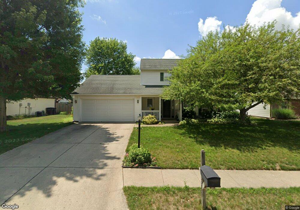
3812 John Adams Rd Lafayette, IN 47909
Estimated Value: $280,000 - $318,000
--
Bed
1
Bath
1,808
Sq Ft
$170/Sq Ft
Est. Value
About This Home
This home is located at 3812 John Adams Rd, Lafayette, IN 47909 and is currently estimated at $306,616, approximately $169 per square foot. 3812 John Adams Rd is a home located in Tippecanoe County with nearby schools including Wea Ridge Elementary School, Wea Ridge Middle School, and McCutcheon High School.
Ownership History
Date
Name
Owned For
Owner Type
Purchase Details
Closed on
Jul 23, 2019
Sold by
Carlson Casey A
Bought by
Carlson Casey A and Carlson Amanda M
Current Estimated Value
Purchase Details
Closed on
May 9, 2003
Sold by
Wadsworth Michael H and Wadsworth Shelly
Bought by
Carlson Casey A
Home Financials for this Owner
Home Financials are based on the most recent Mortgage that was taken out on this home.
Original Mortgage
$129,200
Outstanding Balance
$57,092
Interest Rate
6.02%
Mortgage Type
Unknown
Estimated Equity
$249,524
Purchase Details
Closed on
Mar 14, 2003
Sold by
Wadsworth Michael H and Macdermid Shelley
Bought by
Wadsworth Michael H and Wadsworth Shelley
Home Financials for this Owner
Home Financials are based on the most recent Mortgage that was taken out on this home.
Original Mortgage
$129,200
Outstanding Balance
$57,092
Interest Rate
6.02%
Mortgage Type
Unknown
Estimated Equity
$249,524
Create a Home Valuation Report for This Property
The Home Valuation Report is an in-depth analysis detailing your home's value as well as a comparison with similar homes in the area
Home Values in the Area
Average Home Value in this Area
Purchase History
| Date | Buyer | Sale Price | Title Company |
|---|---|---|---|
| Carlson Casey A | -- | None Available | |
| Carlson Casey A | -- | -- | |
| Wadsworth Michael H | -- | -- |
Source: Public Records
Mortgage History
| Date | Status | Borrower | Loan Amount |
|---|---|---|---|
| Open | Carlson Casey A | $129,200 | |
| Previous Owner | Wadsworth Michael H | $25,000 |
Source: Public Records
Tax History Compared to Growth
Tax History
| Year | Tax Paid | Tax Assessment Tax Assessment Total Assessment is a certain percentage of the fair market value that is determined by local assessors to be the total taxable value of land and additions on the property. | Land | Improvement |
|---|---|---|---|---|
| 2024 | $2,591 | $258,500 | $43,800 | $214,700 |
| 2023 | $2,411 | $241,100 | $43,800 | $197,300 |
| 2022 | $2,132 | $213,200 | $25,000 | $188,200 |
| 2021 | $1,933 | $193,300 | $25,000 | $168,300 |
| 2020 | $1,784 | $177,800 | $25,000 | $152,800 |
| 2019 | $1,662 | $165,600 | $25,000 | $140,600 |
| 2018 | $1,569 | $158,900 | $25,000 | $133,900 |
| 2017 | $1,492 | $151,900 | $23,000 | $128,900 |
| 2016 | $1,388 | $147,600 | $23,000 | $124,600 |
| 2014 | $1,279 | $143,300 | $23,000 | $120,300 |
| 2013 | $1,317 | $144,100 | $23,000 | $121,100 |
Source: Public Records
Map
Nearby Homes
- 3906 John Adams Rd
- 8151 John Adams Rd
- 8165 John Adams Rd
- 8171 John Adams Rd
- 8157 John Adams Rd
- TBD John Adams Rd
- 934 Ravenstone Dr
- 1120 Stoneripple Cir
- 1007 Waterstone Dr
- 4101 Lofton Dr
- 920 N Wagon Wheel Trail
- 936 Brookridge Ct
- 1817 Kingfisher Dr
- 51 Brookberry Dr
- 1821 Whisper Valley Dr
- 12 Brookhill Ct
- 3303 Crosspoint Ct S
- 2003 Kingfisher Dr
- 809 Red Oaks Ln
- 1800 E 430 S
- 3902 John Adams Rd
- 3808 John Adams Rd
- 3813 George Washington Rd
- 3809 George Washington Rd
- 3901 George Washington Rd
- 1007 Tory Dr
- 3811 John Adams Rd
- 1003 Tory Dr
- 3807 John Adams Rd
- 3907 George Washington Rd
- 3905 John Adams Rd
- 3914 John Adams Rd
- 3803 John Adams Rd
- 3915 George Washington Rd
- 3716 John Adams Rd
- 3717 John Adams Rd
- 3913 John Adams Rd
- 3913 John Adams Rd
- 3918 John Adams Rd
- 3719 George Washington Rd