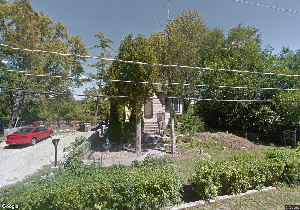
38127 N Watts Ave Spring Grove, IL 60081
Northeast Fox Lake NeighborhoodEstimated Value: $291,000 - $344,000
5
Beds
2
Baths
1,593
Sq Ft
$197/Sq Ft
Est. Value
About This Home
This home is located at 38127 N Watts Ave, Spring Grove, IL 60081 and is currently estimated at $314,556, approximately $197 per square foot. 38127 N Watts Ave is a home located in Lake County with nearby schools including Lotus Elementary School, Stanton Middle School, and Grant Community High School.
Ownership History
Date
Name
Owned For
Owner Type
Purchase Details
Closed on
Mar 18, 2022
Sold by
Johnson Iii William J and Johnson Margaret A
Bought by
Johnson William J and Michelau-Johnson Margaret A
Current Estimated Value
Purchase Details
Closed on
Nov 18, 2019
Sold by
Michelau Johnson Margaret
Bought by
Michelau Johnson Margaret and Johnson William
Create a Home Valuation Report for This Property
The Home Valuation Report is an in-depth analysis detailing your home's value as well as a comparison with similar homes in the area
Home Values in the Area
Average Home Value in this Area
Purchase History
| Date | Buyer | Sale Price | Title Company |
|---|---|---|---|
| Johnson William J | -- | Malik Thomas W | |
| Michelau Johnson Margaret | -- | None Available |
Source: Public Records
Tax History Compared to Growth
Tax History
| Year | Tax Paid | Tax Assessment Tax Assessment Total Assessment is a certain percentage of the fair market value that is determined by local assessors to be the total taxable value of land and additions on the property. | Land | Improvement |
|---|---|---|---|---|
| 2024 | $4,558 | $86,086 | $11,805 | $74,281 |
| 2023 | $5,132 | $77,082 | $10,570 | $66,512 |
| 2022 | $5,132 | $80,367 | $8,724 | $71,643 |
| 2021 | $5,283 | $74,990 | $8,140 | $66,850 |
| 2020 | $5,349 | $72,919 | $7,915 | $65,004 |
| 2019 | $5,026 | $69,732 | $7,569 | $62,163 |
| 2018 | $4,973 | $62,984 | $7,676 | $55,308 |
| 2017 | $4,915 | $59,950 | $7,306 | $52,644 |
| 2016 | $5,239 | $57,856 | $7,051 | $50,805 |
| 2015 | $5,277 | $56,385 | $6,872 | $49,513 |
| 2014 | $5,246 | $58,305 | $8,600 | $49,705 |
| 2012 | $5,216 | $60,921 | $8,600 | $52,321 |
Source: Public Records
Map
Nearby Homes
- 28624 W Kendall Ave
- 37925 N Lake Vista Terrace
- 38236 N Lee Ave
- 38265 N State Park Rd
- 37714 N Nippersink Place
- 37706 N Nippersink Place
- 37682 N US Highway 12
- 61 Aspen Colony Unit 2
- 38480 N 6th Ave
- 6415 N Shore Ave
- 13 Saint Thomas Colony Unit 7
- 56 Vail Colony Unit 5
- 53 Oak Hill Colony Unit 6
- 40 Bermuda Colony Unit 7
- 16 Saint Thomas Colony Unit 6
- 59 Vail Colony Unit 3
- 27849 W Lake Shore Dr
- 707 Kingston Blvd
- 38227 N 3rd Ave
- 5504 Louella Ave
- 38101 N Watts Ave
- 38136 N Watts Ave
- 38110 N Watts Ave
- 38085 N Watts Ave
- 38156 N Watts Ave Unit 1
- 38159 N Watts Ave
- 38092 N Watts Ave
- 38121 N Harold Place
- 38171 N Watts Ave
- 38105 N Harold Place
- 38067 N Watts Ave
- 38172 N Watts Ave
- 38060 N Watts Ave
- 38175 N Watts Ave
- 38055 N Watts Ave
- 38179 N Watts Ave
- 38141 N Harold Place
- 38085 N Harold Place
- 38049 N Watts Ave
- 38181 N Watts Ave