Estimated Value: $295,289 - $337,000
3
Beds
3
Baths
1,496
Sq Ft
$212/Sq Ft
Est. Value
About This Home
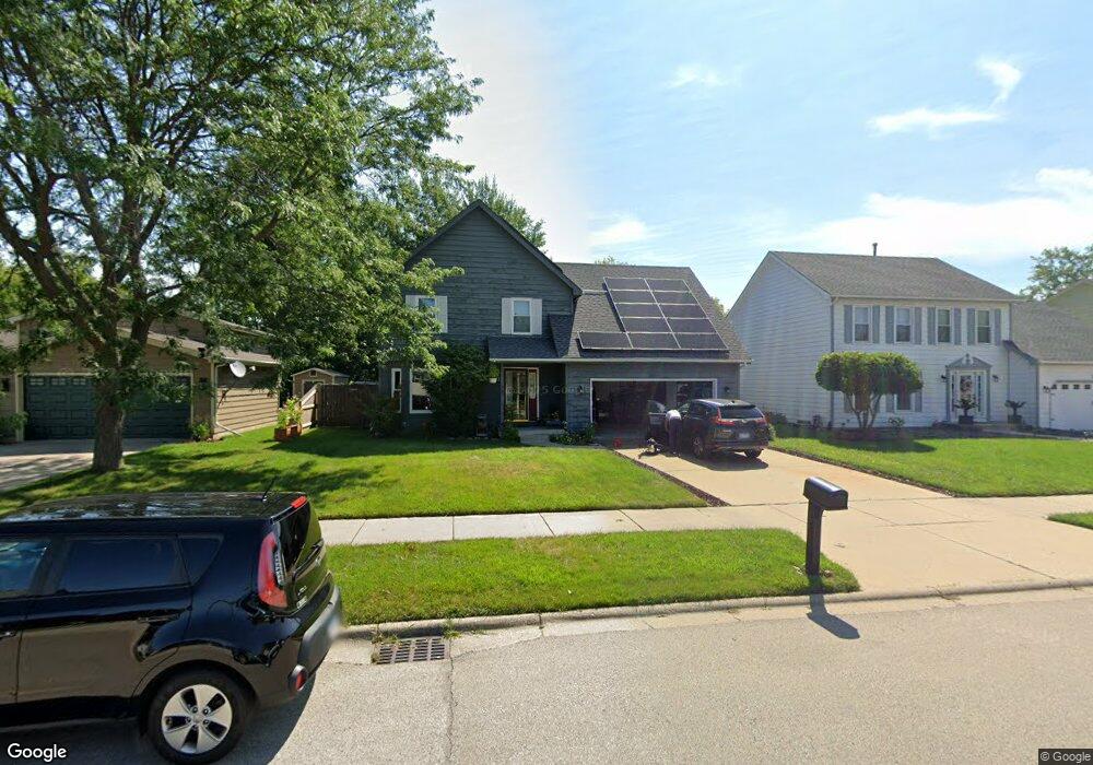
This home is located at 3813 Bertrand Ln, Zion, IL 60099 and is currently estimated at $316,572, approximately $211 per square foot. 3813 Bertrand Ln is a home located in Lake County with nearby schools including Howe Elementary School, Beach Park Middle School, and Zion-Benton Township High School.
Ownership History
Date
Name
Owned For
Owner Type
Purchase Details
Closed on
Dec 17, 2004
Sold by
Hutchison Michael A and Hutchison Sheryl L
Bought by
Simon Joseph W and Simon Dawn M
Current Estimated Value
Home Financials for this Owner
Home Financials are based on the most recent Mortgage that was taken out on this home.
Original Mortgage
$156,000
Outstanding Balance
$76,246
Interest Rate
5.37%
Mortgage Type
Purchase Money Mortgage
Estimated Equity
$240,326
Create a Home Valuation Report for This Property
The Home Valuation Report is an in-depth analysis detailing your home's value as well as a comparison with similar homes in the area
Home Values in the Area
Average Home Value in this Area
Purchase History
| Date | Buyer | Sale Price | Title Company |
|---|---|---|---|
| Simon Joseph W | $195,000 | Matc |
Source: Public Records
Mortgage History
| Date | Status | Borrower | Loan Amount |
|---|---|---|---|
| Open | Simon Joseph W | $156,000 | |
| Closed | Simon Joseph W | $29,250 |
Source: Public Records
Tax History Compared to Growth
Tax History
| Year | Tax Paid | Tax Assessment Tax Assessment Total Assessment is a certain percentage of the fair market value that is determined by local assessors to be the total taxable value of land and additions on the property. | Land | Improvement |
|---|---|---|---|---|
| 2024 | $6,889 | $71,801 | $5,703 | $66,098 |
| 2023 | $6,941 | $62,948 | $5,505 | $57,443 |
| 2022 | $6,941 | $60,222 | $5,378 | $54,844 |
| 2021 | $7,157 | $58,690 | $5,241 | $53,449 |
| 2020 | $7,020 | $56,007 | $5,001 | $51,006 |
| 2019 | $6,999 | $53,138 | $4,745 | $48,393 |
| 2018 | $6,490 | $48,361 | $5,656 | $42,705 |
| 2017 | $6,408 | $45,495 | $5,321 | $40,174 |
| 2016 | $6,246 | $43,312 | $5,066 | $38,246 |
| 2015 | $6,034 | $39,721 | $4,646 | $35,075 |
| 2014 | $7,734 | $51,247 | $12,495 | $38,752 |
| 2012 | $7,768 | $53,254 | $12,984 | $40,270 |
Source: Public Records
Map
Nearby Homes
- 38571 N Cedar Ave
- 3931 Bertrand Ln
- 1121 Otto Graham Ln
- 38362 N Manor Ave
- 10765 W Liberty Ave
- 38176 N De Woody Rd
- 1667 W Beach Rd Unit 1667
- 1677 W Beach Rd Unit 1677
- 11382 W Leland Ave
- 1730 W Beach Rd
- 11345 W Carnahan Ave
- 10295 W Crissy Ave
- 38683 N Lewis Ave
- 10381 Country Ln
- 37905 N Loyola Ave
- 10209 W Crissy Ave
- 38402 N Russell Ave
- 10156 W Beach Rd
- 11342-11346 W Wadsworth Rd
- 3411 N Lewis Ave