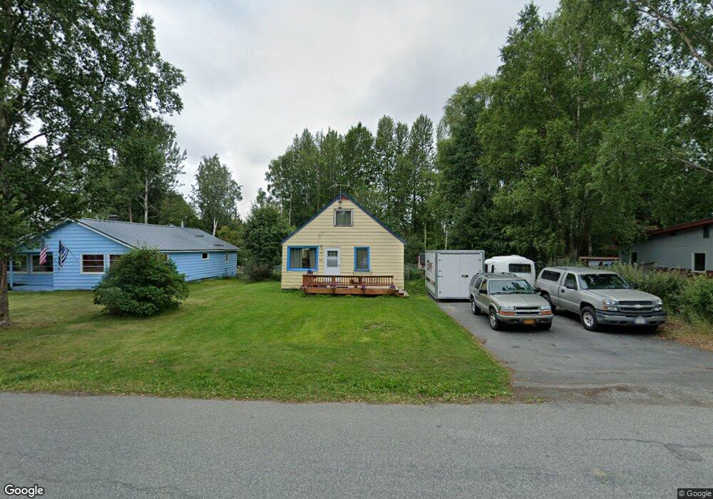
3814 Barbara Dr Anchorage, AK 99517
Spenard NeighborhoodEstimated Value: $225,000 - $355,000
3
Beds
2
Baths
1,296
Sq Ft
$230/Sq Ft
Est. Value
About This Home
This home is located at 3814 Barbara Dr, Anchorage, AK 99517 and is currently estimated at $298,263, approximately $230 per square foot. 3814 Barbara Dr is a home located in Anchorage Municipality with nearby schools including Northwood Elementary School, Romig Middle School, and West High School.
Ownership History
Date
Name
Owned For
Owner Type
Purchase Details
Closed on
Aug 17, 2005
Sold by
Croas John K and Croas Carmen C
Bought by
Croas John K and Croas Carmen C
Current Estimated Value
Purchase Details
Closed on
May 12, 1992
Sold by
Secretary/Housing & Urban Dev
Bought by
Croas John K and Croas Carmen C
Home Financials for this Owner
Home Financials are based on the most recent Mortgage that was taken out on this home.
Original Mortgage
$72,089
Interest Rate
8.99%
Mortgage Type
FHA
Create a Home Valuation Report for This Property
The Home Valuation Report is an in-depth analysis detailing your home's value as well as a comparison with similar homes in the area
Home Values in the Area
Average Home Value in this Area
Purchase History
| Date | Buyer | Sale Price | Title Company |
|---|---|---|---|
| Croas John K | -- | -- | |
| Croas John K | -- | -- |
Source: Public Records
Mortgage History
| Date | Status | Borrower | Loan Amount |
|---|---|---|---|
| Closed | Croas John K | $72,089 |
Source: Public Records
Tax History Compared to Growth
Tax History
| Year | Tax Paid | Tax Assessment Tax Assessment Total Assessment is a certain percentage of the fair market value that is determined by local assessors to be the total taxable value of land and additions on the property. | Land | Improvement |
|---|---|---|---|---|
| 2025 | $983 | $297,100 | $105,000 | $192,100 |
| 2024 | $983 | $285,900 | $105,000 | $180,900 |
| 2023 | $4,583 | $269,100 | $105,000 | $164,100 |
| 2022 | $1,088 | $264,600 | $105,100 | $159,500 |
| 2021 | $4,148 | $230,200 | $105,100 | $125,100 |
| 2020 | $641 | $236,100 | $105,100 | $131,000 |
| 2019 | $630 | $235,600 | $105,100 | $130,500 |
| 2018 | $3,140 | $239,300 | $105,100 | $134,200 |
| 2017 | $3,570 | $248,000 | $105,100 | $142,900 |
| 2016 | $3,060 | $238,600 | $105,100 | $133,500 |
| 2015 | $3,060 | $240,000 | $105,100 | $134,900 |
| 2014 | $3,060 | $228,300 | $105,100 | $123,200 |
Source: Public Records
Map
Nearby Homes
- 3913 Barbara Dr
- 4000 Iowa Dr
- 2820 Wiley Post Ave
- NHN Northwood Dr
- 5000 Northwood Dr
- 2702 Mcrae Rd
- 2925 W 36th Ave
- 2511 Abbey Ln
- 4302 Forrest Rd
- 3517 Vintage Cir
- 3900 Crosson Dr
- 3516 Vintage Cir
- 3100 W 35th Ave
- 2202 Lincoln Ave
- 2105 Mckinley Ave
- 2607 W 33rd Ave
- 2808 Iris Dr
- 3103 Barbara St
- 3333 Lakeshore Dr Unit 5
- 3333 Lakeshore Dr Unit 2
- 3900 Barbara Dr
- 3810 Barbara Dr
- 3808 Barbara Dr
- 3904 Barbara Dr
- 3815 Barbara Dr
- 3813 Barbara Dr
- 3901 Barbara Dr
- 3806 Barbara Dr
- 3906 Barbara Dr
- 3905 Barbara Dr
- 3809 Barbara Dr
- 3910 Barbara Dr
- 3804 Barbara Dr
- 3807 Barbara Dr
- 3909 Barbara Dr
- 3907 Barbara Dr
- 3911 E Turnagain Blvd
- 3909 E Turnagain Blvd
- 3911 Barbara Dr
- 3803 Barbara Dr