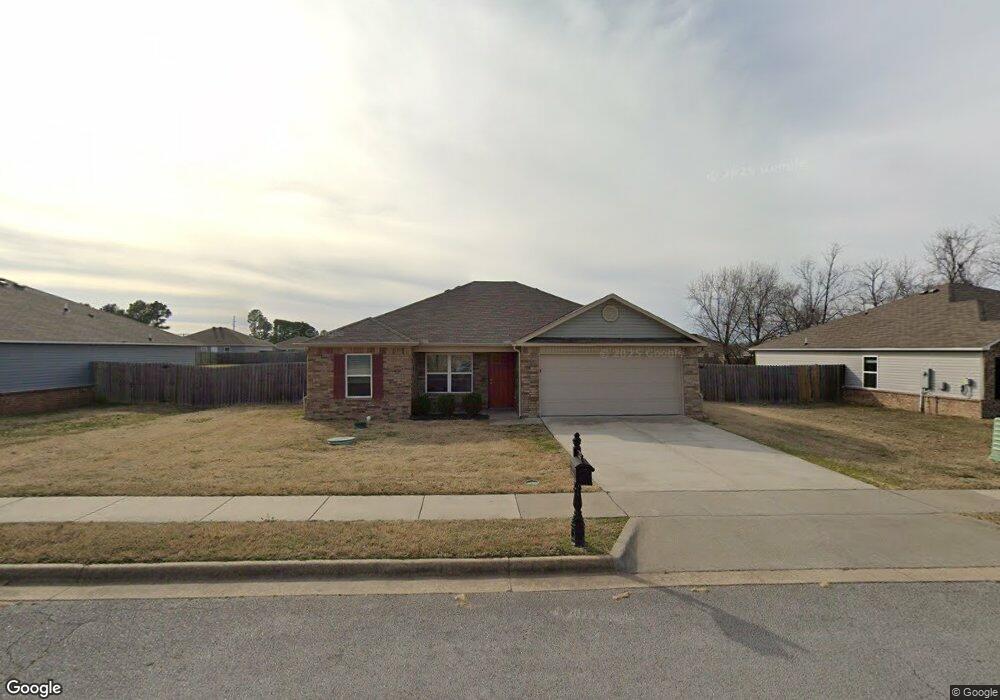
3814 Rosebud Ave Springdale, AR 72764
Estimated Value: $278,000 - $282,000
--
Bed
--
Bath
1,268
Sq Ft
$220/Sq Ft
Est. Value
About This Home
This home is located at 3814 Rosebud Ave, Springdale, AR 72764 and is currently estimated at $279,591, approximately $220 per square foot. 3814 Rosebud Ave is a home with nearby schools including Monitor Elementary School, Lakeside Junior High School, and Sonora Middle School.
Ownership History
Date
Name
Owned For
Owner Type
Purchase Details
Closed on
Sep 12, 2025
Sold by
Nexpoint Sfr Spe 2 Llc
Bought by
Henty Masao and Henty Tiltha Ami
Current Estimated Value
Home Financials for this Owner
Home Financials are based on the most recent Mortgage that was taken out on this home.
Original Mortgage
$274,928
Outstanding Balance
$274,928
Interest Rate
6.72%
Mortgage Type
FHA
Estimated Equity
$4,663
Purchase Details
Closed on
Aug 11, 2022
Sold by
Nexpoint Sfr Spe 1 Llc
Bought by
Nexpoint Spf Spe 2 Llc
Purchase Details
Closed on
Jun 8, 2022
Sold by
Arg Ii Borrower Llc
Bought by
Nexpoint Sfr Spe 1 Llc
Create a Home Valuation Report for This Property
The Home Valuation Report is an in-depth analysis detailing your home's value as well as a comparison with similar homes in the area
Home Values in the Area
Average Home Value in this Area
Purchase History
| Date | Buyer | Sale Price | Title Company |
|---|---|---|---|
| Henty Masao | $280,000 | None Listed On Document | |
| Nexpoint Spf Spe 2 Llc | -- | None Listed On Document | |
| Nexpoint Sfr Spe 1 Llc | $1,200,565 | Fayetteville Arg Ii |
Source: Public Records
Mortgage History
| Date | Status | Borrower | Loan Amount |
|---|---|---|---|
| Open | Henty Masao | $274,928 | |
| Closed | Henty Masao | $11,589 |
Source: Public Records
Tax History Compared to Growth
Tax History
| Year | Tax Paid | Tax Assessment Tax Assessment Total Assessment is a certain percentage of the fair market value that is determined by local assessors to be the total taxable value of land and additions on the property. | Land | Improvement |
|---|---|---|---|---|
| 2025 | $2,343 | $55,662 | $15,200 | $40,462 |
| 2024 | $2,196 | $55,662 | $15,200 | $40,462 |
| 2023 | $1,997 | $37,460 | $7,200 | $30,260 |
| 2022 | $1,903 | $37,460 | $7,200 | $30,260 |
| 2021 | $1,737 | $37,460 | $7,200 | $30,260 |
Source: Public Records
Map
Nearby Homes
- 337 Joy Carol Loop
- 3435 Alliance Dr
- 3621 Alliance Dr
- 3751 Alliance Dr
- 2996 Twin County St
- 2977 Kings Dr
- 985 Remington Dr
- 413 W Highway 264
- 3343 Grainger Cir
- 1337 Kendrick Ave
- 7.25 AC Thompson
- 2169 Harry St
- 5.06 AC Old Wire Rd
- 3450 Pasofino Loop
- 0 Old Wire Rd
- 4809 Kimberly Place
- 1308 W Stultz Rd
- 1483 Leesburg Ave
- 114 E Bailey Ave
- 1376 Lexington Cir
- 3816 Rosebud Ave
- 3812 Rosebud Ln
- 3795 Rosebud Ln
- 3810 Rosebud Ave
- 3981 Rosebud Ave
- 3771 Rosebud Ln
- 3795 Rosebud Ave
- 3817 Rosebud Ln
- 3817 Rosebud Ave
- 3771 Rosebud Ave
- 3387 Alliance Dr
- 3999 Rosebud Ln
- 3963 Rosebud Ln
- 3999 Rosebud Ave
- 3963 Rosebud Ave
- 3808 Rosebud Ln
- 3411 Alliance Dr
- 3841 Rosebud Ave
- 3841 Rosebud Ln
- 102 W Morris Ave