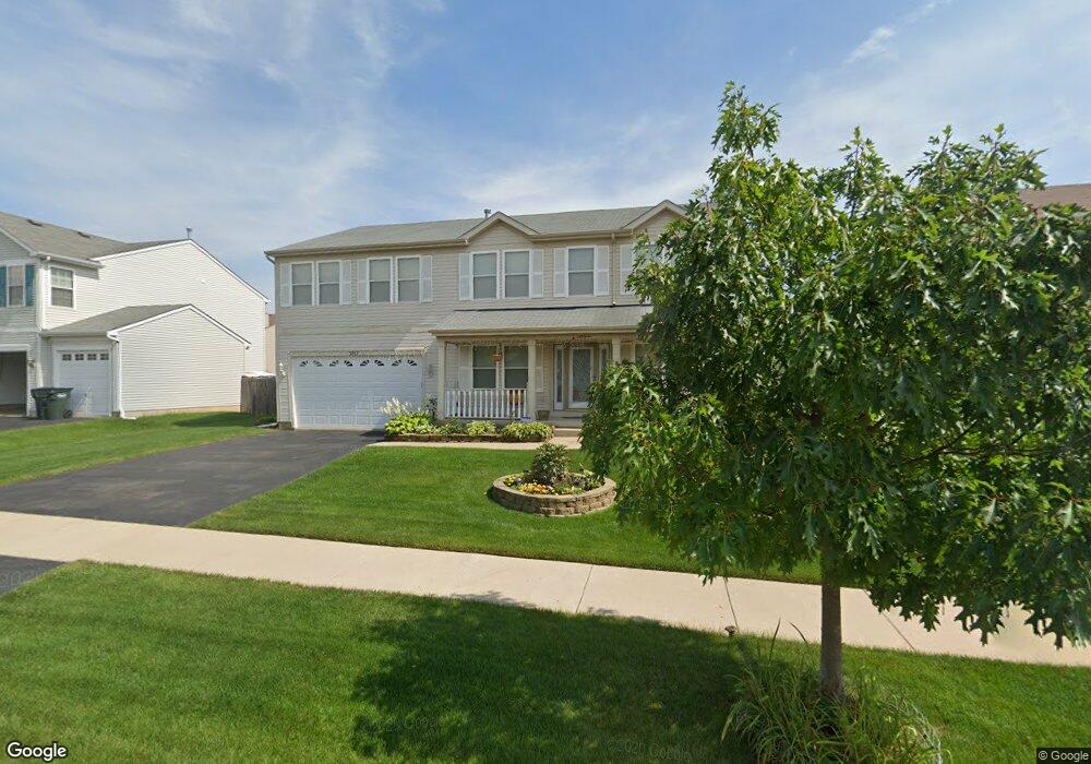
3817 Tickseed Dr Zion, IL 60099
West Zion NeighborhoodEstimated Value: $352,000 - $391,000
5
Beds
3
Baths
3,200
Sq Ft
$115/Sq Ft
Est. Value
About This Home
This home is located at 3817 Tickseed Dr, Zion, IL 60099 and is currently estimated at $369,558, approximately $115 per square foot. 3817 Tickseed Dr is a home located in Lake County with nearby schools including Newport Elementary School, Beach Park Middle School, and Zion-Benton Township High School.
Ownership History
Date
Name
Owned For
Owner Type
Purchase Details
Closed on
Mar 29, 2010
Sold by
Williams Althia J
Bought by
Davidson Howard A and Williams Althia
Current Estimated Value
Purchase Details
Closed on
Jan 23, 2006
Sold by
Kennedy Homes Lp
Bought by
Williams Althia J
Home Financials for this Owner
Home Financials are based on the most recent Mortgage that was taken out on this home.
Original Mortgage
$207,000
Outstanding Balance
$113,577
Interest Rate
5.87%
Mortgage Type
Fannie Mae Freddie Mac
Estimated Equity
$255,981
Create a Home Valuation Report for This Property
The Home Valuation Report is an in-depth analysis detailing your home's value as well as a comparison with similar homes in the area
Home Values in the Area
Average Home Value in this Area
Purchase History
| Date | Buyer | Sale Price | Title Company |
|---|---|---|---|
| Davidson Howard A | -- | None Available | |
| Williams Althia J | $259,000 | First American Title Ins |
Source: Public Records
Mortgage History
| Date | Status | Borrower | Loan Amount |
|---|---|---|---|
| Open | Williams Althia J | $207,000 |
Source: Public Records
Tax History Compared to Growth
Tax History
| Year | Tax Paid | Tax Assessment Tax Assessment Total Assessment is a certain percentage of the fair market value that is determined by local assessors to be the total taxable value of land and additions on the property. | Land | Improvement |
|---|---|---|---|---|
| 2024 | $10,896 | $104,626 | $15,804 | $88,822 |
| 2023 | $10,769 | $93,283 | $14,091 | $79,192 |
| 2022 | $10,769 | $88,535 | $11,588 | $76,947 |
| 2021 | $10,623 | $83,054 | $10,871 | $72,183 |
| 2020 | $10,254 | $78,117 | $10,225 | $67,892 |
| 2019 | $9,982 | $72,769 | $9,525 | $63,244 |
| 2018 | $9,637 | $69,124 | $9,061 | $60,063 |
| 2017 | $9,458 | $64,122 | $8,405 | $55,717 |
| 2016 | $8,786 | $58,208 | $7,630 | $50,578 |
| 2015 | $8,450 | $52,815 | $6,923 | $45,892 |
| 2014 | $8,173 | $52,578 | $6,527 | $46,051 |
| 2012 | $7,373 | $55,994 | $6,951 | $49,043 |
Source: Public Records
Map
Nearby Homes
- 1304 Lorelei Dr
- 1302 Lorelei Dr
- 1417 Westside Trail
- 4014 Ridge Rd
- 908 Countrywood Dr
- 3717 Willow Crest Dr
- 4539 Illinois 173
- 4533 Illinois 173
- 3707 Willow Crest Dr
- 41320 N Green Bay Rd
- 0 9th St
- 1304 Pelican Ct
- 1916 Sunshine Ct
- 2010 Sunset Ct
- 1531 Southport Ct
- 1521 Southport Ct
- 42334 N Heritage Lot 7 Trail
- 1405 Lewis Ave
- 12434 W Van Ct
- 42008 N Delany Rd
- 3815 Tickseed Dr
- 3819 Tickseed Dr
- 1306 Reed Rd
- 1304 Reed Rd
- 1308 Reed Rd
- 3813 Tickseed Dr
- 3160 Stonebridge Dr
- 2600 Stonebridge Dr
- 2860 Stonebridge Dr
- 3818 Tickseed Dr
- 3816 Tickseed Dr
- 1302 Reed Rd
- 3820 Tickseed Dr
- 3814 Tickseed Dr
- 3811 Tickseed Dr
- 3901 Stonebridge Dr
- 3903 Stonebridge Dr
- 1400 Reed Rd
- 1300 Reed Rd
- 3905 Stonebridge Dr