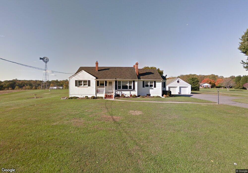
3818 Hardesty Rd Harwood, MD 20776
Harwood NeighborhoodEstimated Value: $630,000 - $836,992
--
Bed
1
Bath
1,732
Sq Ft
$430/Sq Ft
Est. Value
About This Home
This home is located at 3818 Hardesty Rd, Harwood, MD 20776 and is currently estimated at $744,248, approximately $429 per square foot. 3818 Hardesty Rd is a home located in Anne Arundel County with nearby schools including Central Elementary School, Central Middle School, and South River High School.
Ownership History
Date
Name
Owned For
Owner Type
Purchase Details
Closed on
Aug 9, 2021
Sold by
Smith Adam B and Smith Nicole M
Bought by
Smith Nicole M
Current Estimated Value
Purchase Details
Closed on
Oct 1, 2008
Sold by
Doepkens Bernard A
Bought by
Doepkens Bernard A
Purchase Details
Closed on
Feb 21, 2008
Sold by
Doepkens Bernard A
Bought by
Doepkens Bernard A
Purchase Details
Closed on
Nov 17, 1999
Sold by
Doepkens Bernard A
Bought by
Doepkens Bernard A and Doepkens Kathy L
Create a Home Valuation Report for This Property
The Home Valuation Report is an in-depth analysis detailing your home's value as well as a comparison with similar homes in the area
Home Values in the Area
Average Home Value in this Area
Purchase History
| Date | Buyer | Sale Price | Title Company |
|---|---|---|---|
| Smith Nicole M | -- | None Available | |
| Doepkens Bernard A | -- | -- | |
| Doepkens Bernard A | -- | -- | |
| Doepkens Bernard A | -- | -- |
Source: Public Records
Tax History Compared to Growth
Tax History
| Year | Tax Paid | Tax Assessment Tax Assessment Total Assessment is a certain percentage of the fair market value that is determined by local assessors to be the total taxable value of land and additions on the property. | Land | Improvement |
|---|---|---|---|---|
| 2025 | $6,461 | $623,900 | -- | -- |
| 2024 | $6,461 | $580,300 | $0 | $0 |
| 2023 | $6,263 | $536,700 | $245,300 | $291,400 |
| 2022 | $5,868 | $526,667 | $0 | $0 |
| 2021 | $11,530 | $516,633 | $0 | $0 |
| 2020 | $5,625 | $368,300 | $220,300 | $148,000 |
| 2019 | $4,099 | $364,400 | $0 | $0 |
| 2018 | $3,655 | $360,500 | $0 | $0 |
| 2017 | $3,818 | $356,600 | $0 | $0 |
| 2016 | -- | $339,600 | $0 | $0 |
| 2015 | -- | $322,600 | $0 | $0 |
| 2014 | -- | $316,300 | $0 | $0 |
Source: Public Records
Map
Nearby Homes
- 114 Jordan Taylor Ln
- 3721 Solomons Island Rd
- 3611 Solomons Island Rd
- 206 May Ln
- 13 Jessie Rd
- 3508 Marthas Vineyard Way
- 200 Black Skimmer Ct
- 3980 Solomons Island Rd
- 131 Brick Church Rd
- 3451 Blandford Way
- 0 Oak Ln
- 3208 Havenwood Ct
- 420 Hamlet Club Dr Unit 206
- 410 Hamlet Club Dr Unit 101
- 2058 Shore Dr
- 315 Brick Church Rd
- 311 Hamlet Cir
- 80 Beach Dr
- 3509 Russell Thomas Ln
- 2033 Shore Dr
- 3800 Hardesty Rd
- 3775 Hardesty Rd
- 3844 Hardesty Rd
- 3801 Hardesty Rd
- 3850 Hardesty Rd
- 3782 Hardesty Rd
- 3748 Hardesty Rd
- 3766 Hardesty Rd
- 3771 Hardesty Rd
- 3791 Solomons Island Rd
- 3749 Hardesty Rd
- 3750 Hardesty Rd
- 3710 Buffalo Ct
- 3712 S River Clubhouse Rd
- 3720 S River Clubhouse Rd
- 3722 S River Club House Rd
- 120 Jordan Taylor Ln
- 3712 Buffalo Ct
- 3722 Buffalo Ct
- 3744 Smiley Ln