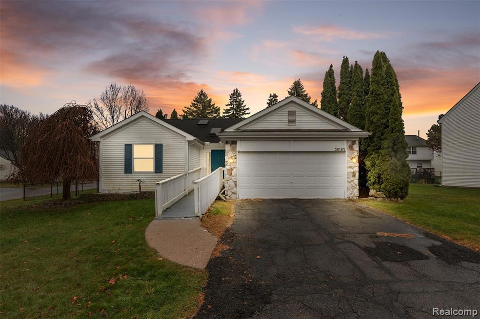
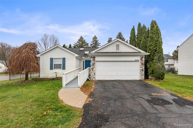
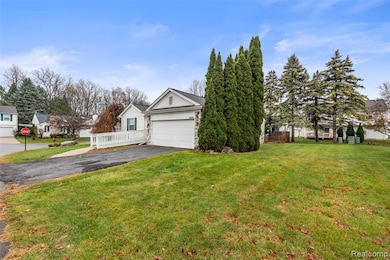
38185 Palmateer Rd Westland, MI 48186
Estimated payment $1,547/month
Highlights
- Hot Property
- Ranch Style House
- Forced Air Heating System
- Vaulted Ceiling
- 2 Car Attached Garage
About This Home
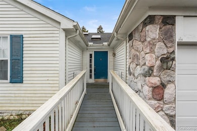
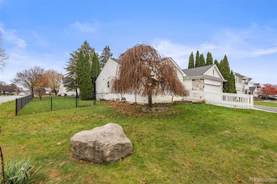
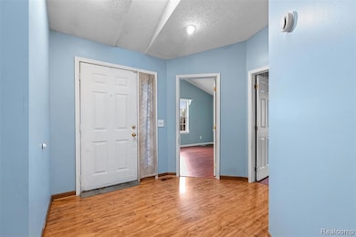
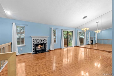
Welcome to this spacious three-bedroom, three-bath ranch offering 1,316 sq. ft. of main-level living with vaulted ceilings and an open feel throughout. The home features a partially finished basement that extends the usable living space and an attached garage for convenience. Sitting on a corner lot, the property includes a fenced backyard and a large deck ideal for outdoor enjoyment. Home is being sold as is and ready for its next chapter.
Home Details
Home Type
- Single Family
Est. Annual Taxes
Year Built
- Built in 1991
Lot Details
- 0.27 Acre Lot
- Lot Dimensions are 108x110
HOA Fees
- $47 Monthly HOA Fees
Parking
- 2 Car Attached Garage
Home Design
- Ranch Style House
- Poured Concrete
- Stone Siding
- Vinyl Construction Material
Interior Spaces
- 1,319 Sq Ft Home
- Vaulted Ceiling
- Partially Finished Basement
Bedrooms and Bathrooms
- 3 Bedrooms
- 3 Full Bathrooms
Location
- Ground Level
Utilities
- Forced Air Heating System
- Heating System Uses Natural Gas
Community Details
- Whitehall Association, Phone Number (248) 324-0400
- Millpointe Of Westland Subdivision
Listing and Financial Details
- Assessor Parcel Number 56078040047000
Map
Home Values in the Area
Average Home Value in this Area
Tax History
| Year | Tax Paid | Tax Assessment Tax Assessment Total Assessment is a certain percentage of the fair market value that is determined by local assessors to be the total taxable value of land and additions on the property. | Land | Improvement |
|---|---|---|---|---|
| 2025 | $3,372 | $134,100 | $0 | $0 |
| 2024 | $3,372 | $125,500 | $0 | $0 |
| 2023 | $2,542 | $116,400 | $0 | $0 |
| 2022 | $2,886 | $97,800 | $0 | $0 |
| 2021 | $2,814 | $92,200 | $0 | $0 |
| 2020 | $2,784 | $84,800 | $0 | $0 |
| 2019 | $2,683 | $80,800 | $0 | $0 |
| 2018 | $2,091 | $73,700 | $0 | $0 |
| 2017 | $858 | $72,100 | $0 | $0 |
| 2016 | $3,514 | $71,500 | $0 | $0 |
| 2015 | $5,127 | $62,470 | $0 | $0 |
| 2013 | $4,967 | $52,020 | $0 | $0 |
| 2012 | $3,598 | $50,820 | $0 | $0 |
Property History
| Date | Event | Price | List to Sale | Price per Sq Ft |
|---|---|---|---|---|
| 11/28/2025 11/28/25 | For Sale | $235,000 | -- | $178 / Sq Ft |
Purchase History
| Date | Type | Sale Price | Title Company |
|---|---|---|---|
| Interfamily Deed Transfer | -- | None Available | |
| Interfamily Deed Transfer | -- | None Available | |
| Deed | -- | -- |
Source: Realcomp
MLS Number: 20251056761
APN: 56-078-04-0047-000
Disclaimer: Certain information contained herein is derived from information provided by parties other than Homes.com. All information provided is deemed reliable, but is not guaranteed to be accurate and should be independently verified.
![]() IDX provided courtesy of Realcomp II Ltd. via Ten-X and MLS
IDX provided courtesy of Realcomp II Ltd. via Ten-X and MLS
Copyright 2025 Realcomp II Ltd. Shareholders
IDX information is provided exclusively for consumers' personal, noncommercial use and may not be used for any purpose other than to identify prospective properties consumers may be interested in purchasing. The accuracy of all information, regardless of source, is not guaranteed or warranted. All information should be independently verified.
Listing Information presented by local MLS brokerage: Ten-X, local REALTOR®- Arlene Richardson - (888)-952-6393
- 38692 Watson Cir
- 38560 Nellie Ln
- 38203 Avondale St
- 38227 Avondale St
- 1786 Daisey Ln Unit 32
- 2268 Minerva St
- 00000 Avondale St
- 00 S Newburgh Rd
- 0 S Newburgh Rd
- 2232 Wilshire St
- 3020 Rivers Edge Dr
- 3329 S Newburgh Rd
- 3018 Rivers Edge Dr N
- 511 S Bryar St
- 2610 Hannan Rd
- 2618 Hannan Rd
- 36753 Greenbush Rd
- 36255 Manila Ave
- 36650 Thinbark St
- 36795 Greenbush Rd
- 37140 Orchard Cir
- 1947 Cottrill Ln
- 1922 Pebble Creek Dr
- 313 Marigold Cir Unit 26
- 328 Marigold Cir Unit 94
- 1819 Knollwood Dr Unit 3
- 40433 Glen Eagle Ln Unit 94
- 40564 Blythefield Ln Unit 137
- 382 Marigold Cir Unit 75
- 2323 Knollwood Dr Unit 110
- 40433 Bluesprings Ct Unit 1
- 1962 Cedar Valley Dr Unit 46
- 2268 Arcadia Dr
- 370 Hickory Ln
- 147 S Carlson St
- 35700 E Michigan Ave
- 631 Tyler Ln
- 35240 W Michigan Ave
- 35200 Sims St
- 40645 Douglas Dr
