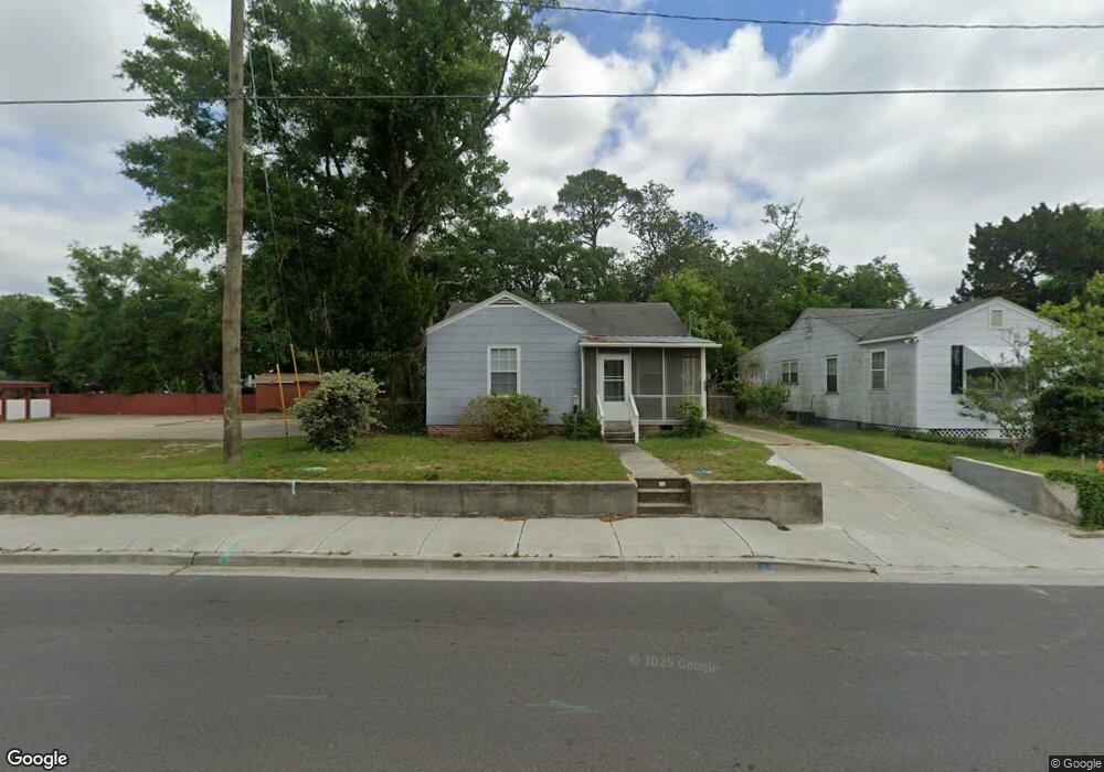
382 Forrest Ave Biloxi, MS 39530
Estimated Value: $80,832 - $187,000
About This Home
This home is located at 382 Forrest Ave, Biloxi, MS 39530 and is currently estimated at $126,458, approximately $164 per square foot. 382 Forrest Ave is a home located in Harrison County with nearby schools including Gorenflo Elementary School, Biloxi Junior High School, and Biloxi High School.
Ownership History
We collect this data history from publicly available records. To have your information removed, we recommend requesting removal directly through your county’s website.
Purchase Details
Purchase Details
Purchase Details
Home Values in the Area
Average Home Value in this Area
Purchase History
We collect this data history from publicly available records. To have your information removed, we recommend requesting removal directly through your county’s website.
| Date | Buyer | Sale Price | Title Company |
|---|---|---|---|
| -- | None Listed On Document | ||
| -- | None Available | ||
| -- | None Listed On Document | ||
| -- | None Available |
Tax History
We collect this data history from publicly available records. To have your information removed, we recommend requesting removal directly through your county’s website.
| Year | Tax Paid | Tax Assessment Tax Assessment Total Assessment is a certain percentage of the fair market value that is determined by local assessors to be the total taxable value of land and additions on the property. | Land | Improvement |
|---|---|---|---|---|
| 2025 | $747 | $6,687 | $0 | $0 |
| 2024 | $717 | $6,472 | $0 | $0 |
| 2023 | $707 | $6,445 | $0 | $0 |
| 2022 | $707 | $6,445 | $0 | $0 |
| 2021 | $707 | $6,445 | $0 | $0 |
| 2020 | $632 | $5,754 | $0 | $0 |
| 2019 | $627 | $5,707 | $0 | $0 |
| 2018 | $627 | $5,707 | $0 | $0 |
| 2017 | $627 | $5,707 | $0 | $0 |
| 2015 | $621 | $5,652 | $0 | $0 |
| 2014 | -- | $7,291 | $0 | $0 |
| 2013 | -- | $5,652 | $2,458 | $3,194 |
Map
- 367 Forrest Ave
- 364 Porter Ave
- 392 Porter Ave
- 1054 Columbus St
- 474 Forrest Ave
- 1050 Frank P Corso St
- 1090 Cherokee St
- 1085 Cherokee St
- 1067 Division St
- 440 Donwood Place
- 264 Forrest Ave
- 272 Benachi Ave
- 265 Benachi Ave Unit A & B
- 258 Querens Ave
- 255 Benachi Ave Unit A&B
- 000 Graham Ave
- 1126 Judge Sekul Ave
- 245 Benachi Ave
- 403 Gill Ave
- 440 Diaz Ave
- 378 Forrest Ave
- 376 Forrest Ave
- 375 Porter Ave
- 373 Porter Ave
- 379 Porter Ave
- 1093 Park Ct S
- 1097 Park Ct S
- 1089 Park Ct S
- 375 Forrest Ave
- 381 Forrest Ave
- 1085 Park Ct S
- 373 Forrest Ave
- 383 Forrest Ave
- 394 Forrest Ave
- 371 Forrest Ave
- 385 Forrest Ave
- 385 Porter Ave
- 367 Porter Ave
- 367 Porter Ave
- 363 Forrest Ave
Ask me questions while you tour the home.