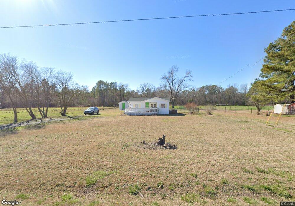
382 McGougan Rd Lumber Bridge, NC 28357
Estimated Value: $107,000 - $172,000
--
Bed
2
Baths
714
Sq Ft
$180/Sq Ft
Est. Value
About This Home
This home is located at 382 McGougan Rd, Lumber Bridge, NC 28357 and is currently estimated at $128,212, approximately $179 per square foot. 382 McGougan Rd is a home located in Hoke County with nearby schools including Sandy Grove Elementary School, Sandy Grove Middle School, and Hoke County High.
Ownership History
Date
Name
Owned For
Owner Type
Purchase Details
Closed on
Oct 26, 2021
Sold by
Blake Milton Willis and Blake Trudy A
Bought by
Craver Timothy M and Craver Stacy Carkeet
Current Estimated Value
Purchase Details
Closed on
Oct 2, 2015
Sold by
Black Joseph Daniel and Black Wanda Lucas
Bought by
Blake Milton Willis and Blake Trudy A
Home Financials for this Owner
Home Financials are based on the most recent Mortgage that was taken out on this home.
Original Mortgage
$63,333
Interest Rate
3.97%
Mortgage Type
VA
Create a Home Valuation Report for This Property
The Home Valuation Report is an in-depth analysis detailing your home's value as well as a comparison with similar homes in the area
Home Values in the Area
Average Home Value in this Area
Purchase History
| Date | Buyer | Sale Price | Title Company |
|---|---|---|---|
| Craver Timothy M | $80,000 | None Available | |
| Blake Milton Willis | $62,000 | None Available |
Source: Public Records
Mortgage History
| Date | Status | Borrower | Loan Amount |
|---|---|---|---|
| Previous Owner | Blake Milton Willis | $63,333 |
Source: Public Records
Tax History Compared to Growth
Tax History
| Year | Tax Paid | Tax Assessment Tax Assessment Total Assessment is a certain percentage of the fair market value that is determined by local assessors to be the total taxable value of land and additions on the property. | Land | Improvement |
|---|---|---|---|---|
| 2025 | $689 | $67,350 | $20,000 | $47,350 |
| 2024 | $316 | $67,350 | $20,000 | $47,350 |
| 2023 | $316 | $67,350 | $20,000 | $47,350 |
| 2022 | $678 | $67,350 | $20,000 | $47,350 |
| 2021 | $594 | $55,670 | $9,000 | $46,670 |
| 2020 | $590 | $55,670 | $9,000 | $46,670 |
| 2019 | $590 | $55,670 | $9,000 | $46,670 |
| 2018 | $590 | $55,670 | $9,000 | $46,670 |
| 2017 | $590 | $55,670 | $9,000 | $46,670 |
| 2016 | $581 | $55,670 | $9,000 | $46,670 |
| 2015 | $581 | $55,670 | $9,000 | $46,670 |
| 2014 | $561 | $55,670 | $9,000 | $46,670 |
| 2013 | -- | $51,110 | $7,500 | $43,610 |
Source: Public Records
Map
Nearby Homes
- 190 Payton Place Rd
- 232 Hendrix Rd
- 1098 Golf Course Rd
- 248 Zeppelin Ln
- 394 Zeppelin Ln
- 332 Zeppelin Ln
- 293 Hickory Dr
- 5422 Pittman Grove Church Rd
- 115 Cahill St Unit 62
- 145 Cahill Homesite 64
- 115
- 195 Presley St
- 144 Cayden Place
- 3575 Philippi Church Rd
- 3527 Philippi Church Rd
- 3563 Philippi Church Rd
- 754 Wicklow Ln
- 514 Wicklow Ln
- 634 Wicklow Ln
- 716 Wicklow Ln
- 350 McGougan Rd
- 335 McGougan Rd
- 300 McGougan Rd
- 240 McGougan Rd
- 210 McGougan Rd
- 225 McGougan Rd
- 186 McGougan Rd
- 160 McGougan Rd
- 156 McGougan Rd
- 146 McGougan Rd
- 5640 Arabia Rd
- 126 McGougan Rd
- 5694 Arabia Rd
- 136 McGougan Rd
- 5644 Arabia Rd
- 5708 Arabia Rd
- 5600 Arabia Rd
- 5778 Arabia Rd
- 0 Arabia Rd
- 5734 Arabia Rd