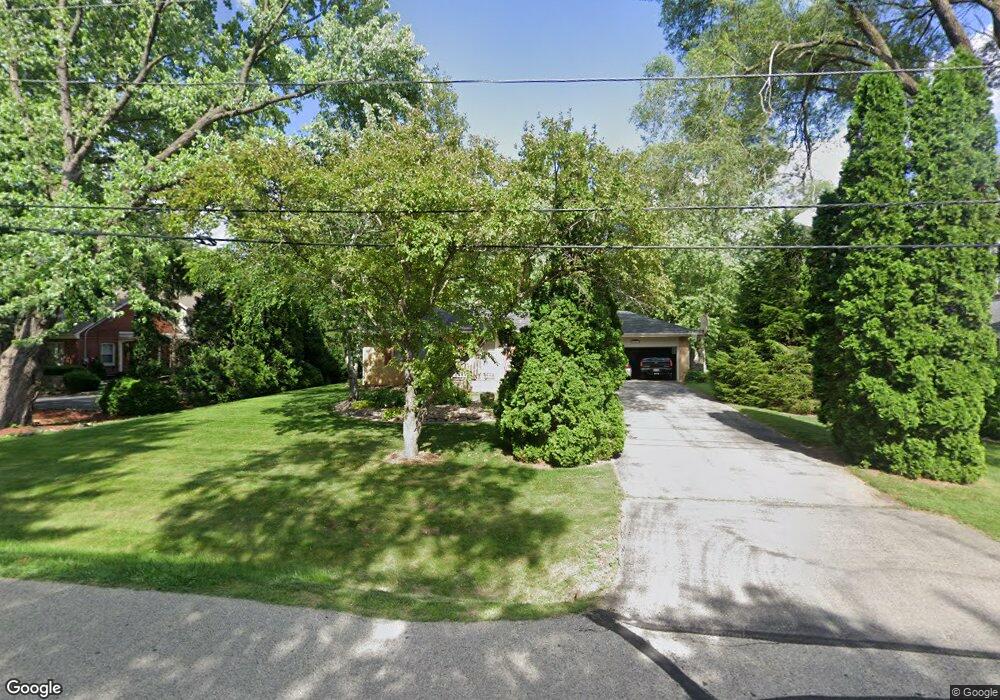
3820 Fiebrantz Dr Brookfield, WI 53005
Estimated Value: $376,000 - $421,000
3
Beds
2
Baths
1,342
Sq Ft
$300/Sq Ft
Est. Value
About This Home
This home is located at 3820 Fiebrantz Dr, Brookfield, WI 53005 and is currently estimated at $402,501, approximately $299 per square foot. 3820 Fiebrantz Dr is a home located in Waukesha County with nearby schools including Dixon Elementary School, Pilgrim Park Middle School, and Brookfield East High School.
Ownership History
Date
Name
Owned For
Owner Type
Purchase Details
Closed on
Jan 11, 2002
Sold by
Stoffield Michael A and Stoffield Jill M
Bought by
Anderson Gregory J
Current Estimated Value
Home Financials for this Owner
Home Financials are based on the most recent Mortgage that was taken out on this home.
Original Mortgage
$147,000
Outstanding Balance
$60,199
Interest Rate
7.07%
Mortgage Type
Purchase Money Mortgage
Estimated Equity
$342,302
Create a Home Valuation Report for This Property
The Home Valuation Report is an in-depth analysis detailing your home's value as well as a comparison with similar homes in the area
Home Values in the Area
Average Home Value in this Area
Purchase History
| Date | Buyer | Sale Price | Title Company |
|---|---|---|---|
| Anderson Gregory J | $167,000 | -- |
Source: Public Records
Mortgage History
| Date | Status | Borrower | Loan Amount |
|---|---|---|---|
| Open | Anderson Gregory J | $147,000 |
Source: Public Records
Tax History Compared to Growth
Tax History
| Year | Tax Paid | Tax Assessment Tax Assessment Total Assessment is a certain percentage of the fair market value that is determined by local assessors to be the total taxable value of land and additions on the property. | Land | Improvement |
|---|---|---|---|---|
| 2024 | $3,311 | $305,000 | $125,000 | $180,000 |
| 2023 | $3,302 | $305,000 | $125,000 | $180,000 |
| 2022 | $3,378 | $243,700 | $120,000 | $123,700 |
| 2021 | $3,571 | $243,700 | $120,000 | $123,700 |
| 2020 | $3,754 | $243,700 | $120,000 | $123,700 |
| 2019 | $3,595 | $243,700 | $120,000 | $123,700 |
| 2018 | $3,435 | $226,200 | $120,000 | $106,200 |
| 2017 | $3,453 | $226,200 | $120,000 | $106,200 |
| 2016 | $3,503 | $226,200 | $120,000 | $106,200 |
| 2015 | $3,914 | $226,200 | $120,000 | $106,200 |
| 2014 | $3,619 | $226,200 | $120,000 | $106,200 |
| 2013 | $3,619 | $226,200 | $120,000 | $106,200 |
Source: Public Records
Map
Nearby Homes
- 4075 N 127th St
- 3085 Santa Barbara Dr
- 13145 Kittridge Ct
- Lt0 Pilgrim Rd
- Lt2 Capitol Dr
- 15640 Brookhill Dr Unit 176984
- 12820 Winthrop Ct
- 14225 Forest View Ln
- 14910 Pomona Rd
- N48W14336 Hampton Rd
- W144N4822 Stone Dr Unit C
- W144N4821 Stone Dr
- 15875 Heather Hill Dr
- 15935 Hill Ct
- 2925 San Gabriel Dr
- 4685 N 150th St
- 4465 Pilgrim Rd
- 15800 Sky Cliff Dr
- 2600 Brookside Ln
- 4460 N 158th St
- 3800 Fiebrantz Dr
- 3840 Fiebrantz Dr
- 3815 Fiebrantz Dr
- 3805 Fiebrantz Dr
- 3780 Fiebrantz Dr
- 3860 Fiebrantz Dr
- 3825 Fiebrantz Dr
- 3785 Fiebrantz Dr
- 3870 Fiebrantz Dr
- 3845 Fiebrantz Dr
- 3760 Fiebrantz Dr
- 3765 Fiebrantz Dr
- 3865 Fiebrantz Dr
- 3740 Fiebrantz Dr
- 3880 Fiebrantz Dr
- 3885 Fiebrantz Dr
- 3920 Fiebrantz Dr
- 3745 Fiebrantz Dr
- 3725 Fiebrantz Dr
- 3925 Fiebrantz Dr