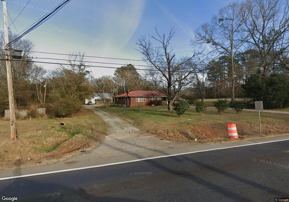
3820 Highway 53 Hoschton, GA 30548
Estimated Value: $359,000 - $813,000
3
Beds
2
Baths
1,404
Sq Ft
$380/Sq Ft
Est. Value
About This Home
This home is located at 3820 Highway 53, Hoschton, GA 30548 and is currently estimated at $533,956, approximately $380 per square foot. 3820 Highway 53 is a home with nearby schools including West Jackson Elementary School, West Jackson Middle School, and Jackson County High School.
Ownership History
Date
Name
Owned For
Owner Type
Purchase Details
Closed on
Apr 10, 2025
Sold by
Tng Ironwood Llc
Bought by
Niki Group Llc and Niki Rdre Llc
Current Estimated Value
Purchase Details
Closed on
Jan 29, 2024
Sold by
Langford Ryan Lyndall
Bought by
Tng Ironwood Llc and Niki Rdre Llc
Purchase Details
Closed on
Jul 12, 2023
Sold by
Bettis Frederick Henry
Bought by
Langford Ryan Lyndall
Purchase Details
Closed on
Sep 3, 2020
Sold by
Bettis Robbie Lynn
Bought by
Langford Ryan Lyndall
Create a Home Valuation Report for This Property
The Home Valuation Report is an in-depth analysis detailing your home's value as well as a comparison with similar homes in the area
Home Values in the Area
Average Home Value in this Area
Purchase History
| Date | Buyer | Sale Price | Title Company |
|---|---|---|---|
| Niki Group Llc | $1,020,523 | -- | |
| Tng Ironwood Llc | $970,000 | -- | |
| Langford Ryan Lyndall | -- | -- | |
| Langford Ryan Lyndall | -- | -- |
Source: Public Records
Tax History Compared to Growth
Tax History
| Year | Tax Paid | Tax Assessment Tax Assessment Total Assessment is a certain percentage of the fair market value that is determined by local assessors to be the total taxable value of land and additions on the property. | Land | Improvement |
|---|---|---|---|---|
| 2024 | $5,345 | $170,600 | $87,680 | $82,920 |
| 2023 | $5,345 | $160,560 | $87,680 | $72,880 |
| 2022 | $4,572 | $128,880 | $70,120 | $58,760 |
| 2021 | $4,108 | $128,880 | $70,120 | $58,760 |
| 2020 | $4,179 | $118,840 | $70,120 | $48,720 |
| 2019 | $4,254 | $118,840 | $70,120 | $48,720 |
| 2018 | $4,258 | $117,880 | $70,120 | $47,760 |
| 2017 | $4,216 | $115,850 | $70,156 | $45,694 |
| 2016 | $4,233 | $115,850 | $70,156 | $45,694 |
| 2015 | $2,375 | $64,732 | $19,038 | $45,694 |
| 2014 | $2,065 | $57,371 | $19,038 | $38,333 |
| 2013 | -- | $57,371 | $19,038 | $38,332 |
Source: Public Records
Map
Nearby Homes
- 38 Huntley Trace
- Astin Plan at Cambridge at Towne Center - Townhomes
- Edmund Plan at Cambridge at Towne Center - Townhomes
- 22 Huntley Trace Unit 230
- 60 Huntley Trace
- 22 Huntley Trace
- 41 Huntley Trace
- 41 Huntley Trace Unit 5
- 68 Regent Park
- 58 Buckingham Ln Unit 236
- 58 Buckingham Ln
- 116 Buckingham Ln
- 120 Buckingham Ln
- 228 Buckingham Ln
- 8422 Pendergrass Rd
- 513 Great Salt Ln
- 163 Storm Ln
- 193 Coffee Ln
- 137 Coffee Ln
- 147 Coffee Ln
- 3843 Highway 53
- 3756 Highway 53
- 0000 Highway 53
- 00 Highway 53
- 3955 Highway 53
- 127 Huntley Trace
- 133 Huntley Trace
- 111 Huntley Trace
- 88 Huntley Trace
- 110 Huntley Trace
- 106 Huntley Trace
- 94 Huntley Trc
- 102 Huntley Trace
- 94 Huntley Trace
- 1787 Holman Forest Ct
- 1906 Holman Forest Dr
- 1975 Holman Forest Dr
- 1784 Holman Forest Ct
- 1985 Holman Forest Dr
- 1846 Holman Forest Dr