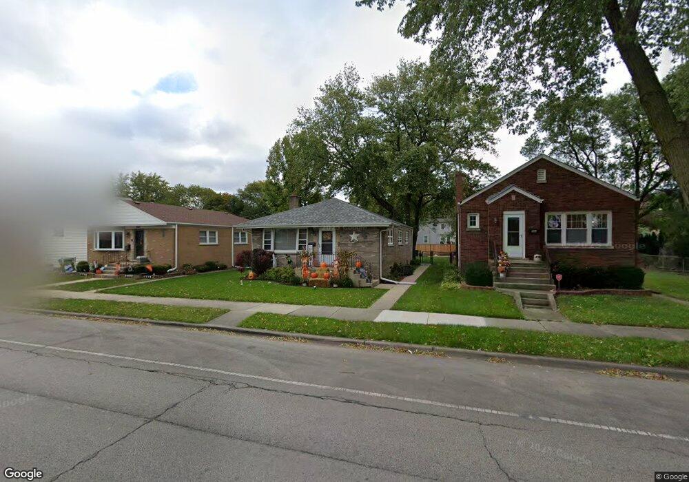
3821 Kemman Ave Brookfield, IL 60513
Estimated Value: $354,638 - $390,000
3
Beds
1
Bath
1,132
Sq Ft
$330/Sq Ft
Est. Value
About This Home
This home is located at 3821 Kemman Ave, Brookfield, IL 60513 and is currently estimated at $373,910, approximately $330 per square foot. 3821 Kemman Ave is a home located in Cook County with nearby schools including S. E. Gross Middle School, Brook Park Elementary School, and Riverside Brookfield High School.
Ownership History
Date
Name
Owned For
Owner Type
Purchase Details
Closed on
Jun 29, 2016
Sold by
Spaude Eric
Bought by
Tejack Joseph H and Tejack Rebecca
Current Estimated Value
Home Financials for this Owner
Home Financials are based on the most recent Mortgage that was taken out on this home.
Original Mortgage
$193,431
Outstanding Balance
$155,843
Interest Rate
3.87%
Mortgage Type
FHA
Estimated Equity
$218,067
Purchase Details
Closed on
Nov 17, 2002
Sold by
Spaude Donovan C and Spaude Marlene
Bought by
Spaude Donovan C and Donovan C Spaude Trust
Create a Home Valuation Report for This Property
The Home Valuation Report is an in-depth analysis detailing your home's value as well as a comparison with similar homes in the area
Home Values in the Area
Average Home Value in this Area
Purchase History
| Date | Buyer | Sale Price | Title Company |
|---|---|---|---|
| Tejack Joseph H | $197,000 | Near North National Title | |
| Spaude Donovan C | -- | -- |
Source: Public Records
Mortgage History
| Date | Status | Borrower | Loan Amount |
|---|---|---|---|
| Open | Tejack Joseph H | $193,431 |
Source: Public Records
Tax History Compared to Growth
Tax History
| Year | Tax Paid | Tax Assessment Tax Assessment Total Assessment is a certain percentage of the fair market value that is determined by local assessors to be the total taxable value of land and additions on the property. | Land | Improvement |
|---|---|---|---|---|
| 2024 | $7,743 | $25,000 | $4,219 | $20,781 |
| 2023 | $7,454 | $25,000 | $4,219 | $20,781 |
| 2022 | $7,454 | $21,309 | $3,656 | $17,653 |
| 2021 | $7,267 | $21,308 | $3,656 | $17,652 |
| 2020 | $7,169 | $21,308 | $3,656 | $17,652 |
| 2019 | $7,871 | $23,389 | $3,234 | $20,155 |
| 2018 | $7,555 | $23,389 | $3,234 | $20,155 |
| 2017 | $8,164 | $23,389 | $3,234 | $20,155 |
| 2016 | $6,737 | $18,099 | $2,953 | $15,146 |
| 2015 | $6,476 | $18,099 | $2,953 | $15,146 |
| 2014 | $6,382 | $18,099 | $2,953 | $15,146 |
| 2013 | $7,178 | $21,795 | $2,953 | $18,842 |
Source: Public Records
Map
Nearby Homes
- 326 Kemman Ave
- 314 Beach Ave
- 3800 Harrison Ave
- 4111 Eberly Ave
- 30 Washington Ave
- 525 Homestead Rd
- 3923 Madison Ave
- 4125 Deyo Ave
- 4167 Eberly Ave
- 148 Sawyer Ave
- 141 N La Grange Rd Unit 601
- 141 N La Grange Rd Unit 504
- 141 N La Grange Rd Unit 905
- 31 Bluff Ave
- 3931 Maple Ave
- 511 E Cossitt Ave
- 67 Bluff Ave
- 28 6th Ave Unit 1D
- 31 Richmond Ave
- 415 N Ashland Ave
- 3827 Kemman Ave
- 3817 Kemman Ave
- 3829 Kemman Ave
- 3813 Kemman Ave
- 3811 Kemman Ave
- 3831 Kemman Ave
- 3831 Kemman Ave
- 3822 Blanchan Ave
- 3818 Blanchan Ave
- 3805 Kemman Ave
- 3814 Blanchan Ave
- 3833 Kemman Ave
- 3826 Blanchan Ave
- 3810 Blanchan Ave
- 330 Kemman Ave
- 334 Kemman Ave
- 3808 Blanchan Ave
- 3808 Blanchan Ave Unit Garden
- 3832 Blanchan Ave
- 3835 Kemman Ave