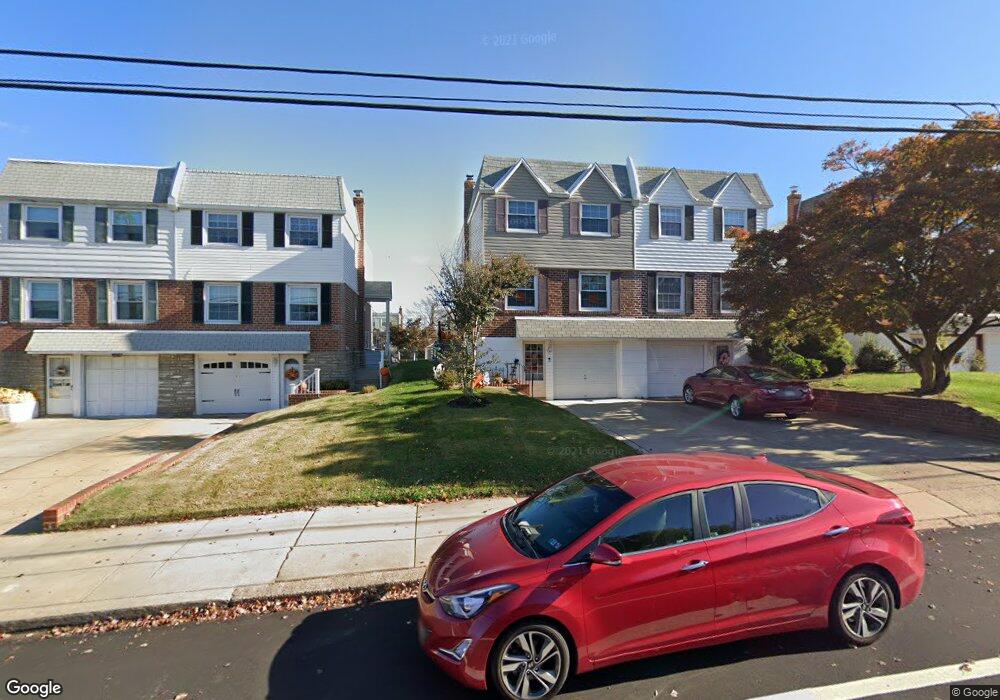
3821 Linden Ave Philadelphia, PA 19114
Torresdale NeighborhoodEstimated Value: $339,000 - $366,000
--
Bed
--
Bath
1,368
Sq Ft
$258/Sq Ft
Est. Value
About This Home
This home is located at 3821 Linden Ave, Philadelphia, PA 19114 and is currently estimated at $352,820, approximately $257 per square foot. 3821 Linden Ave is a home with nearby schools including Thomas Holme School, Lincoln High School, and Meehan Austin Middle School.
Ownership History
Date
Name
Owned For
Owner Type
Purchase Details
Closed on
May 19, 2004
Sold by
Larish Frank
Bought by
Delmont Joseph and Delmont Tara
Current Estimated Value
Home Financials for this Owner
Home Financials are based on the most recent Mortgage that was taken out on this home.
Original Mortgage
$132,000
Outstanding Balance
$64,015
Interest Rate
5.99%
Mortgage Type
Purchase Money Mortgage
Estimated Equity
$288,805
Create a Home Valuation Report for This Property
The Home Valuation Report is an in-depth analysis detailing your home's value as well as a comparison with similar homes in the area
Home Values in the Area
Average Home Value in this Area
Purchase History
| Date | Buyer | Sale Price | Title Company |
|---|---|---|---|
| Delmont Joseph | $165,000 | First American Title Ins Co |
Source: Public Records
Mortgage History
| Date | Status | Borrower | Loan Amount |
|---|---|---|---|
| Open | Delmont Joseph | $132,000 | |
| Closed | Delmont Joseph | $16,500 |
Source: Public Records
Tax History Compared to Growth
Tax History
| Year | Tax Paid | Tax Assessment Tax Assessment Total Assessment is a certain percentage of the fair market value that is determined by local assessors to be the total taxable value of land and additions on the property. | Land | Improvement |
|---|---|---|---|---|
| 2025 | $3,613 | $319,600 | $63,900 | $255,700 |
| 2024 | $3,613 | $319,600 | $63,900 | $255,700 |
| 2023 | $3,613 | $258,100 | $51,620 | $206,480 |
| 2022 | $2,485 | $213,100 | $51,620 | $161,480 |
| 2021 | $3,115 | $0 | $0 | $0 |
| 2020 | $3,115 | $0 | $0 | $0 |
| 2019 | $2,933 | $0 | $0 | $0 |
| 2018 | $2,445 | $0 | $0 | $0 |
| 2017 | $2,865 | $0 | $0 | $0 |
| 2016 | $2,445 | $0 | $0 | $0 |
| 2015 | $2,341 | $0 | $0 | $0 |
| 2014 | -- | $204,700 | $61,490 | $143,210 |
| 2012 | -- | $26,752 | $5,360 | $21,392 |
Source: Public Records
Map
Nearby Homes
- 9176 Frankford Ave
- 9235 Outlook Ave
- 9202 Treaty Rd
- 9214 Andover Rd
- 3264 Fordham Rd
- 9321 Walker St
- 9612 Convent Ave
- 3414 Aubrey Ave
- 3427 Aubrey Ave
- 9311 Andover Rd
- 9321 Jackson St
- 3108 Fairfield St
- 3038 Willits Rd
- 3544 Fitler St
- 4501 Aberdale Rd
- 3416 Holyoke Rd
- 4529 Pearson Ave
- 8820 Cottage St
- 3415 Holyoke Rd
- 5100 Convent Ln Unit 313