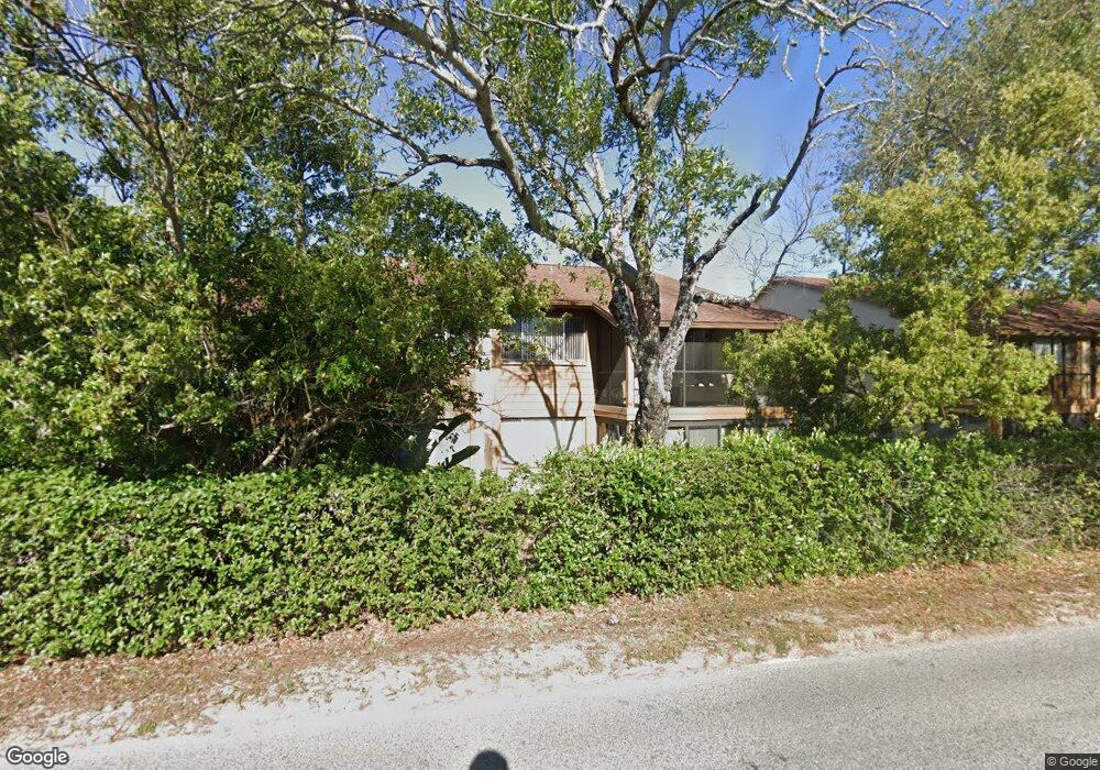
3824 Lanyard Ct New Port Richey, FL 34652
Estimated Value: $133,000 - $146,222
2
Beds
2
Baths
1,248
Sq Ft
$113/Sq Ft
Est. Value
About This Home
This home is located at 3824 Lanyard Ct, New Port Richey, FL 34652 and is currently estimated at $140,556, approximately $112 per square foot. 3824 Lanyard Ct is a home located in Pasco County with nearby schools including Mittye P. Locke Elementary School, Gulf Trace Elementary School, and Paul R. Smith Middle School.
Ownership History
Date
Name
Owned For
Owner Type
Purchase Details
Closed on
May 9, 2023
Sold by
Bellaver Jill
Bought by
Bellaver William and Bellaver Jill
Current Estimated Value
Purchase Details
Closed on
Nov 13, 2018
Sold by
Bellaver Jill
Bought by
Bellaver Jill and Doran Kathleen A
Purchase Details
Closed on
Oct 9, 2008
Sold by
Muschell Betty M and Muschell Fred T
Bought by
Muschell Betty M and Bellaver Jill
Purchase Details
Closed on
Nov 14, 2001
Sold by
Moschouris John and Moschouris Mary S
Bought by
Dawson Edward and Dawson Marie
Home Financials for this Owner
Home Financials are based on the most recent Mortgage that was taken out on this home.
Original Mortgage
$41,600
Interest Rate
6.57%
Mortgage Type
New Conventional
Create a Home Valuation Report for This Property
The Home Valuation Report is an in-depth analysis detailing your home's value as well as a comparison with similar homes in the area
Home Values in the Area
Average Home Value in this Area
Purchase History
| Date | Buyer | Sale Price | Title Company |
|---|---|---|---|
| Bellaver William | $100 | Partners Title Agency | |
| Bellaver Jill | -- | Attorney | |
| Muschell Betty M | -- | Attorney | |
| Dawson Edward | $39,000 | -- |
Source: Public Records
Mortgage History
| Date | Status | Borrower | Loan Amount |
|---|---|---|---|
| Previous Owner | Dawson Edward | $41,600 |
Source: Public Records
Tax History Compared to Growth
Tax History
| Year | Tax Paid | Tax Assessment Tax Assessment Total Assessment is a certain percentage of the fair market value that is determined by local assessors to be the total taxable value of land and additions on the property. | Land | Improvement |
|---|---|---|---|---|
| 2025 | $1,989 | $115,316 | $5,200 | $110,116 |
| 2024 | $1,989 | $145,400 | $5,200 | $140,200 |
| 2023 | $1,621 | $76,310 | $0 | $0 |
| 2022 | $1,441 | $103,093 | $5,200 | $97,893 |
| 2021 | $1,287 | $83,779 | $5,200 | $78,579 |
| 2020 | $1,196 | $78,471 | $5,200 | $73,271 |
| 2019 | $1,128 | $74,493 | $5,200 | $69,293 |
| 2018 | $996 | $60,748 | $5,200 | $55,548 |
| 2017 | $904 | $50,332 | $5,200 | $45,132 |
| 2016 | $761 | $39,175 | $5,200 | $33,975 |
| 2015 | $723 | $36,163 | $5,200 | $30,963 |
| 2014 | $680 | $36,660 | $5,200 | $31,460 |
Source: Public Records
Map
Nearby Homes
- 3832 Lanyard Ct
- 3838 Lanyard Ct Unit B
- 4446 Chart Ct
- 4423 Pelorus Dr Unit B
- 4424 Pelorus Dr
- 3862 Lighthouse Way
- 3847 Lighthouse Way
- 3926 Lighthouse Way Unit A
- 4028 Davit Dr Unit 4028
- 3707 Pinehurst Dr
- 3640 Connon Dr
- 4708 Salem Dr
- 4715 Manor Dr
- 4243 Stratfield Dr
- 4325 Newbury Dr
- 4245 Crestfield Ave
- 3902 Glissade Dr
- 3542 Connon Dr
- 4241 Newbury Dr
- 4516 Tidal Pond Rd
- 3828 Lanyard Ct
- 3822 Lanyard Ct Unit B
- 3826 Lanyard Ct
- 3822 Lanyard Ct
- 3822 Lanyard Ct Unit 1
- 3822 Lanyard Ct Unit 3822
- 3830 Lanyard Ct
- 3834 Lanyard Ct
- 3834 Lanyard Ct Unit 3834
- 3836 Lanyard Ct Unit C
- 3836 Lanyard Ct
- 3832 3832 Lanyard Ct
- 3842 Lanyard Ct
- 4444 Pelorus Dr Unit 242A
- 4441 Pelorus Dr Unit B
- 4438 Pelorus Dr
- 4445 Pelorus Dr
- 4434 Pelorus Dr
- 4426 Pelorus Dr
- 4444 Pelorus Dr Unit 1