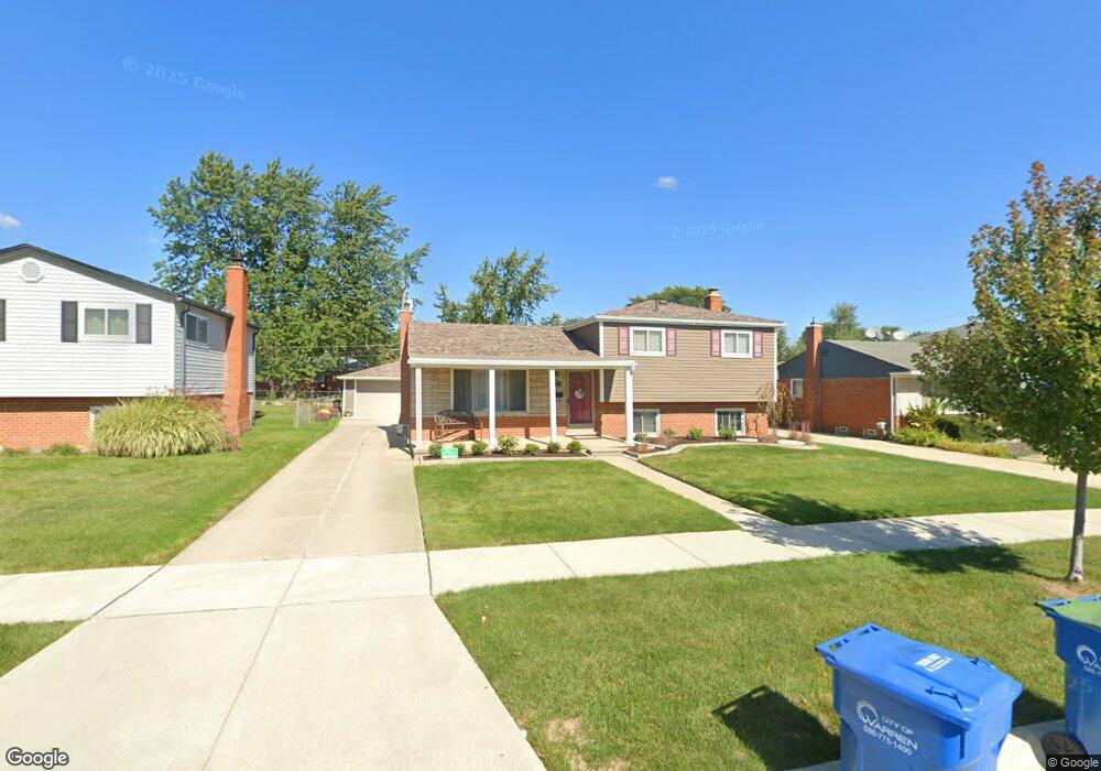
3829 Dawson Dr Warren, MI 48092
Northwest Warren NeighborhoodEstimated Value: $252,296 - $291,000
Studio
2
Baths
1,507
Sq Ft
$182/Sq Ft
Est. Value
About This Home
This home is located at 3829 Dawson Dr, Warren, MI 48092 and is currently estimated at $274,824, approximately $182 per square foot. 3829 Dawson Dr is a home located in Macomb County with nearby schools including Angus Elementary School, Beer Middle School, and Warren Mott High School.
Ownership History
Date
Name
Owned For
Owner Type
Purchase Details
Closed on
Oct 8, 2004
Sold by
Burnett Gary Main and Burnett Gail Susan
Bought by
Sopala John E and Sopala Lynette M
Current Estimated Value
Home Financials for this Owner
Home Financials are based on the most recent Mortgage that was taken out on this home.
Original Mortgage
$139,900
Outstanding Balance
$69,471
Interest Rate
5.81%
Mortgage Type
Purchase Money Mortgage
Estimated Equity
$205,353
Create a Home Valuation Report for This Property
The Home Valuation Report is an in-depth analysis detailing your home's value as well as a comparison with similar homes in the area
Home Values in the Area
Average Home Value in this Area
Purchase History
| Date | Buyer | Sale Price | Title Company |
|---|---|---|---|
| Sopala John E | $174,900 | Title One Inc |
Source: Public Records
Mortgage History
| Date | Status | Borrower | Loan Amount |
|---|---|---|---|
| Open | Sopala John E | $139,900 |
Source: Public Records
Tax History
| Year | Tax Paid | Tax Assessment Tax Assessment Total Assessment is a certain percentage of the fair market value that is determined by local assessors to be the total taxable value of land and additions on the property. | Land | Improvement |
|---|---|---|---|---|
| 2025 | $2,906 | $113,670 | $0 | $0 |
| 2024 | $28 | $106,790 | $0 | $0 |
| 2023 | $2,696 | $97,480 | $0 | $0 |
| 2022 | $2,605 | $85,020 | $0 | $0 |
| 2021 | $2,650 | $80,470 | $0 | $0 |
| 2020 | $2,556 | $74,290 | $0 | $0 |
| 2019 | $2,464 | $71,370 | $0 | $0 |
| 2018 | $2,503 | $63,190 | $0 | $0 |
| 2017 | $2,471 | $62,930 | $10,500 | $52,430 |
| 2016 | $2,468 | $62,930 | $0 | $0 |
| 2015 | -- | $51,920 | $0 | $0 |
| 2012 | -- | $43,020 | $0 | $0 |
Source: Public Records
Map
Nearby Homes
- 32291 Ryan Rd
- 32302 Ryan Rd
- 3651 Chicago Rd
- 3090 Brysons Cove Dr
- 32961 Wexford Dr
- 32246 Oakview Dr
- 4125 Derray Ct Unit 7
- 4580 Hampton Ct N
- 32960 Oakview Dr
- 5575 E 14 Mile Rd
- 4812 Berwyn Dr
- 32930 Chalfonte Dr
- 32416 Exeter Dr
- 32955 Hawthorne Dr
- 4519 Reader Dr
- 33735 Kennedy Dr
- 5211 Streefkerk Dr
- 33770 Orban Dr
- 4611 E 13 Mile Rd
- 5441 Arden Ave
- 3817 Dawson Dr
- 3841 Dawson Dr
- 3805 Dawson Dr
- 3903 Dawson Dr
- 3854 Hillcrest Ct
- 3842 Hillcrest Ct
- 3910 Hillcrest Ct
- 3830 Hillcrest Ct
- 3649 Dawson Dr
- 3917 Dawson Dr
- 3824 Dawson Dr
- 3836 Dawson Dr
- 3922 Hillcrest Ct
- 3812 Dawson Dr
- 3848 Dawson Dr Unit Bldg-Unit
- 3848 Dawson Dr
- 3816 Hillcrest Ct
- 3654 Dawson Dr
- 3934 Hillcrest Ct
- 3914 Dawson Dr
Your Personal Tour Guide
Ask me questions while you tour the home.