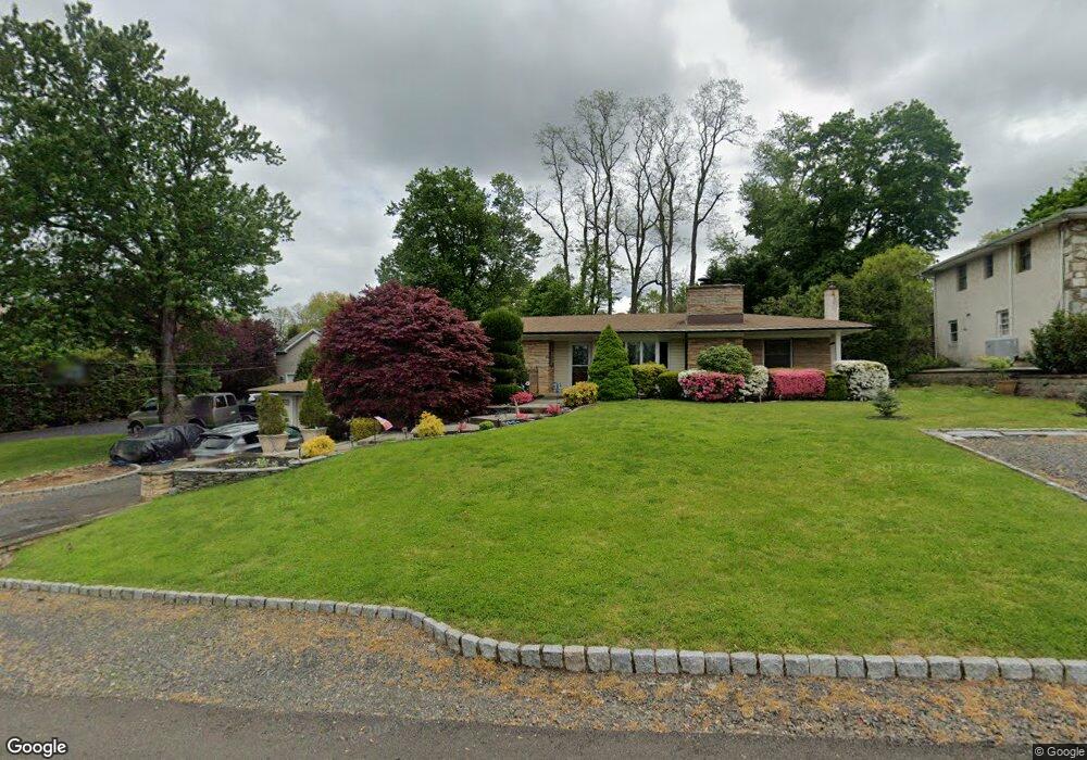
383 Cedar Ave Langhorne, PA 19047
Estimated Value: $488,000 - $544,000
3
Beds
2
Baths
1,728
Sq Ft
$299/Sq Ft
Est. Value
About This Home
This home is located at 383 Cedar Ave, Langhorne, PA 19047 and is currently estimated at $516,207, approximately $298 per square foot. 383 Cedar Ave is a home located in Bucks County with nearby schools including Tawanka Elementary School, Maple Point Middle School, and Neshaminy High School.
Ownership History
Date
Name
Owned For
Owner Type
Purchase Details
Closed on
Feb 29, 1996
Sold by
Larson John F and Potter Ernest L
Bought by
Ferri Scott A and Ferri Jacqueline J
Current Estimated Value
Home Financials for this Owner
Home Financials are based on the most recent Mortgage that was taken out on this home.
Original Mortgage
$122,400
Outstanding Balance
$4,788
Interest Rate
7%
Estimated Equity
$511,419
Purchase Details
Closed on
Nov 20, 1989
Bought by
Potter Ernest L
Create a Home Valuation Report for This Property
The Home Valuation Report is an in-depth analysis detailing your home's value as well as a comparison with similar homes in the area
Home Values in the Area
Average Home Value in this Area
Purchase History
| Date | Buyer | Sale Price | Title Company |
|---|---|---|---|
| Ferri Scott A | $153,000 | Lawyers Title Insurance Corp | |
| Potter Ernest L | $148,000 | -- |
Source: Public Records
Mortgage History
| Date | Status | Borrower | Loan Amount |
|---|---|---|---|
| Open | Ferri Scott A | $122,400 |
Source: Public Records
Tax History Compared to Growth
Tax History
| Year | Tax Paid | Tax Assessment Tax Assessment Total Assessment is a certain percentage of the fair market value that is determined by local assessors to be the total taxable value of land and additions on the property. | Land | Improvement |
|---|---|---|---|---|
| 2025 | $6,043 | $27,760 | $4,920 | $22,840 |
| 2024 | $6,043 | $27,760 | $4,920 | $22,840 |
| 2023 | $5,948 | $27,760 | $4,920 | $22,840 |
| 2022 | $5,791 | $27,760 | $4,920 | $22,840 |
| 2021 | $5,791 | $27,760 | $4,920 | $22,840 |
| 2020 | $5,722 | $27,760 | $4,920 | $22,840 |
| 2019 | $5,594 | $27,760 | $4,920 | $22,840 |
| 2018 | $5,491 | $27,760 | $4,920 | $22,840 |
| 2017 | $5,351 | $27,760 | $4,920 | $22,840 |
| 2016 | $5,351 | $27,760 | $4,920 | $22,840 |
| 2015 | $5,541 | $27,760 | $4,920 | $22,840 |
| 2014 | $5,541 | $27,760 | $4,920 | $22,840 |
Source: Public Records
Map
Nearby Homes
- 257 Wisteria Ave
- 230 Playwicki St
- 225 Playwicki St
- 166 N Hawthorne Ave
- 739 Bridgeview Rd
- 935 Edgewood Ln
- 1210 Brownsville Rd
- 2623 Sunnyside Ave
- 1021 W Maple Ave
- 29 Langhorne Ave
- 812 Green Ridge Cir
- 716 Ross Dr
- 518 Pebble Ridge Ct
- 147 Watergate Dr
- 527 Ashton Cir
- 523 Turtle Ln
- 737 Lynwood Dr
- 537 Ashton Cir
- 178 Buckshire Dr
- 722 Autumn Dr
- 389 Cedar Ave
- 371 Cedar Ave
- 399 Cedar Ave
- 342 N Buckthorne Ave
- 348 N Buckthorne Ave
- 328 N Buckthorne Ave
- 374 Cedar Ave
- 413 Cedar Ave
- 370 N Buckthorne Ave
- 320 N Buckthorne Ave
- 364 Cedar Ave
- 347 Cedar Ave
- 340 Cedar Ave
- 423 Cedar Ave
- 378 N Buckthorne Ave
- 426 Cedar Ave
- 435 Cedar Ave
- 445 Forrest Ave
- 330 Cedar Ave
- 300 N Buckthorne Ave