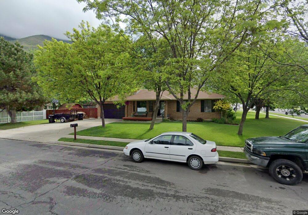
383 S 1650 E Springville, UT 84663
Estimated Value: $514,165 - $573,000
3
Beds
2
Baths
1,634
Sq Ft
$338/Sq Ft
Est. Value
About This Home
This home is located at 383 S 1650 E, Springville, UT 84663 and is currently estimated at $552,055, approximately $337 per square foot. 383 S 1650 E is a home located in Utah County with nearby schools including Art City School, Springville Junior High School, and Springville High School.
Ownership History
Date
Name
Owned For
Owner Type
Purchase Details
Closed on
Dec 30, 2003
Sold by
Harward Velda
Bought by
Crookston Peter L and Crookston Amy E
Current Estimated Value
Purchase Details
Closed on
Jan 26, 2001
Sold by
Harward Verdon and Harward Velda
Bought by
Harward Verdon and Harward Velda
Purchase Details
Closed on
Jun 3, 1998
Sold by
Harder Boyd S and Harder Jayne Ann
Bought by
Harward Verdon and Harward Velda
Create a Home Valuation Report for This Property
The Home Valuation Report is an in-depth analysis detailing your home's value as well as a comparison with similar homes in the area
Home Values in the Area
Average Home Value in this Area
Purchase History
| Date | Buyer | Sale Price | Title Company |
|---|---|---|---|
| Crookston Peter L | -- | Old Republic Title Company | |
| Harward Verdon | -- | -- | |
| Harward Verdon | -- | First American Title |
Source: Public Records
Tax History
| Year | Tax Paid | Tax Assessment Tax Assessment Total Assessment is a certain percentage of the fair market value that is determined by local assessors to be the total taxable value of land and additions on the property. | Land | Improvement |
|---|---|---|---|---|
| 2025 | $2,566 | $270,215 | -- | -- |
| 2024 | $2,566 | $262,900 | $0 | $0 |
| 2023 | $2,551 | $261,580 | $0 | $0 |
| 2022 | $2,673 | $269,170 | $0 | $0 |
| 2021 | $2,339 | $366,600 | $127,900 | $238,700 |
| 2020 | $2,157 | $327,900 | $102,300 | $225,600 |
| 2019 | $1,940 | $300,200 | $102,300 | $197,900 |
| 2018 | $1,784 | $263,400 | $91,300 | $172,100 |
| 2017 | $1,738 | $136,290 | $0 | $0 |
| 2016 | $1,641 | $126,115 | $0 | $0 |
| 2015 | $1,498 | $117,755 | $0 | $0 |
| 2014 | $1,498 | $116,930 | $0 | $0 |
Source: Public Records
Map
Nearby Homes
- 557 S 1470 E
- 1361 E 400 S
- 66 E 750 S Unit 23
- 1800 Spring Oaks Dr
- 1783 E Spring Oaks Dr N Unit 12 & 1
- 59 E 775 S Unit 21
- 52 E 775 S Unit 19
- 1185 Hillcrest Dr
- 1130 Hillcrest Dr
- 1518 E Pheasant Run Dr
- 1062 E 350 S
- 1618 E 970 S
- 1839 River Bottom Rd
- 802 S Brookside Dr
- 949 S 1060 E
- 1092 Valley Sage Dr
- 1096 Valley Sage Dr
- 883 E 700 S
- 805 E 400 S
- 829 S 2200 E
Your Personal Tour Guide
Ask me questions while you tour the home.