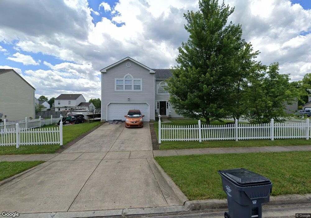
383 Thompson St Pataskala, OH 43062
Estimated Value: $381,000 - $430,000
3
Beds
3
Baths
2,960
Sq Ft
$133/Sq Ft
Est. Value
About This Home
This home is located at 383 Thompson St, Pataskala, OH 43062 and is currently estimated at $395,094, approximately $133 per square foot. 383 Thompson St is a home located in Licking County with nearby schools including Licking Heights High School.
Ownership History
Date
Name
Owned For
Owner Type
Purchase Details
Closed on
Mar 24, 2004
Sold by
Maronda Homes Inc Of Ohio
Bought by
Mercer Michael J and Mercer Ashley
Current Estimated Value
Home Financials for this Owner
Home Financials are based on the most recent Mortgage that was taken out on this home.
Original Mortgage
$137,520
Outstanding Balance
$64,586
Interest Rate
5.74%
Mortgage Type
Unknown
Estimated Equity
$330,508
Create a Home Valuation Report for This Property
The Home Valuation Report is an in-depth analysis detailing your home's value as well as a comparison with similar homes in the area
Home Values in the Area
Average Home Value in this Area
Purchase History
| Date | Buyer | Sale Price | Title Company |
|---|---|---|---|
| Mercer Michael J | $172,100 | Chicago Title |
Source: Public Records
Mortgage History
| Date | Status | Borrower | Loan Amount |
|---|---|---|---|
| Open | Mercer Michael J | $137,520 |
Source: Public Records
Tax History
| Year | Tax Paid | Tax Assessment Tax Assessment Total Assessment is a certain percentage of the fair market value that is determined by local assessors to be the total taxable value of land and additions on the property. | Land | Improvement |
|---|---|---|---|---|
| 2024 | $5,877 | $124,470 | $25,590 | $98,880 |
| 2023 | $6,129 | $124,470 | $25,590 | $98,880 |
| 2022 | $4,732 | $85,550 | $19,220 | $66,330 |
| 2021 | $4,823 | $85,550 | $19,220 | $66,330 |
| 2020 | $5,310 | $85,550 | $19,220 | $66,330 |
| 2019 | $4,555 | $68,080 | $12,810 | $55,270 |
| 2018 | $4,602 | $0 | $0 | $0 |
| 2017 | $4,709 | $0 | $0 | $0 |
| 2016 | $3,471 | $0 | $0 | $0 |
| 2015 | $3,309 | $0 | $0 | $0 |
| 2014 | $4,341 | $0 | $0 | $0 |
| 2013 | $3,286 | $0 | $0 | $0 |
Source: Public Records
Map
Nearby Homes
- 242 Monarch Dr
- 201 Fox Hall Dr
- 13756 Cleveland Rd SW
- 13734 Cleveland Rd SW
- 6725 Taylor Rd SW
- 15 Dover Ct SW
- 409 Lockmead Dr
- 8674 Aconite Dr Unit 460
- 8661 Crooked Maple Dr
- 8660 Crooked Maple Dr
- 8640 Melton Fields Dr
- 771 Lilly Landing Ln
- 5284 Taylor Rd SW
- 0 Havens Corners Rd
- 8176 Kennedy Rd
- 49 Summit Ridge Rd S
- 8810 Greylag Loop
- 392 Old Ivory Ct
- 725 Flowering Cherry Ct
- 8463 Haleigh Woods Dr
- 379 Thompson St
- 195 Wakefield Ave
- 203 Wakefield Ave
- 375 Thompson St
- 184 Windward Dr
- 180 Windward Dr
- 384 Thompson St
- 380 Thompson St
- 176 Windward Dr
- 207 Wakefield Ave
- 376 Thompson St
- 371 Thompson St
- 192 Windward Dr
- 172 Windward Dr
- 211 Wakefield Ave
- 367 Thompson St
- 200 Wakefield Ave
- 372 Thompson St
- 359 Bauer St
- 196 Wakefield Ave
Your Personal Tour Guide
Ask me questions while you tour the home.