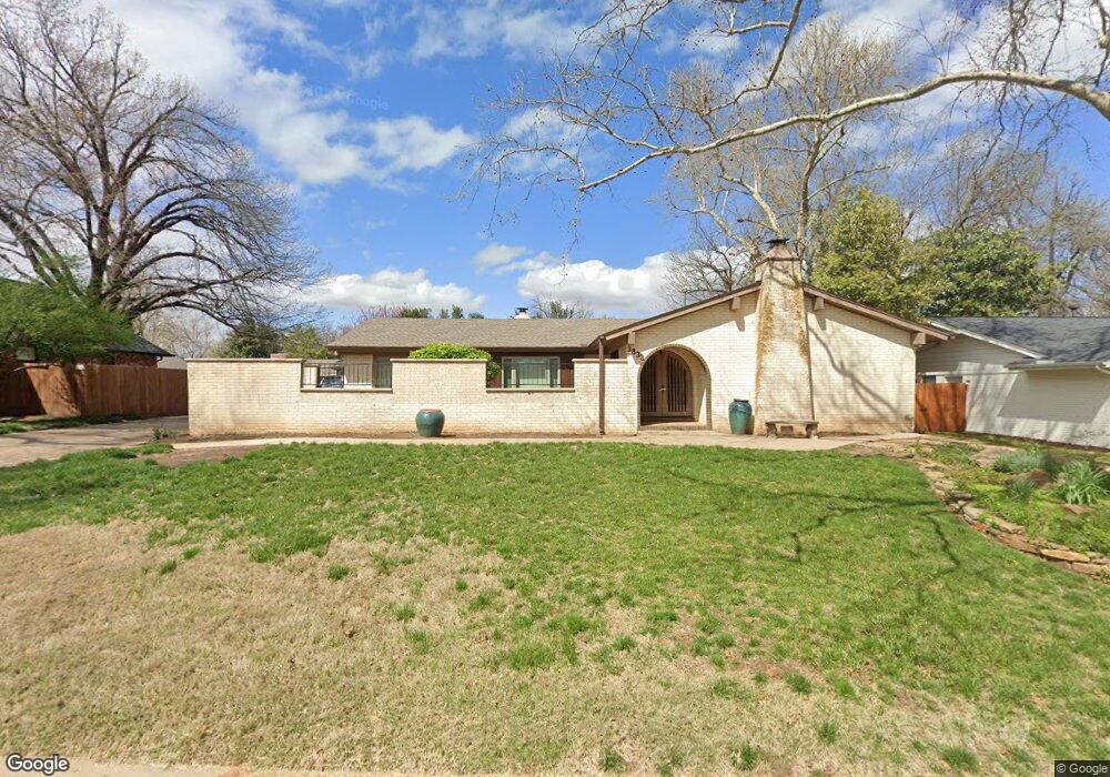
3833 Bristol Dr Norman, OK 73072
Northwest Norman NeighborhoodEstimated Value: $267,000 - $314,000
3
Beds
2
Baths
1,839
Sq Ft
$161/Sq Ft
Est. Value
About This Home
This home is located at 3833 Bristol Dr, Norman, OK 73072 and is currently estimated at $295,499, approximately $160 per square foot. 3833 Bristol Dr is a home located in Cleveland County with nearby schools including Cleveland Elementary School, Whittier Middle School, and Norman North High School.
Ownership History
Date
Name
Owned For
Owner Type
Purchase Details
Closed on
Oct 20, 2011
Sold by
Warner Eric Paul
Bought by
Warner Cindi
Current Estimated Value
Purchase Details
Closed on
Jan 24, 2005
Sold by
Lucas James Kent and Lucas Susan
Bought by
Paul Eric and Warner Cindi
Home Financials for this Owner
Home Financials are based on the most recent Mortgage that was taken out on this home.
Original Mortgage
$60,000
Outstanding Balance
$30,357
Interest Rate
5.68%
Mortgage Type
New Conventional
Estimated Equity
$265,142
Create a Home Valuation Report for This Property
The Home Valuation Report is an in-depth analysis detailing your home's value as well as a comparison with similar homes in the area
Home Values in the Area
Average Home Value in this Area
Purchase History
| Date | Buyer | Sale Price | Title Company |
|---|---|---|---|
| Warner Cindi | -- | None Available | |
| Paul Eric | $154,000 | None Available |
Source: Public Records
Mortgage History
| Date | Status | Borrower | Loan Amount |
|---|---|---|---|
| Open | Paul Eric | $60,000 |
Source: Public Records
Tax History Compared to Growth
Tax History
| Year | Tax Paid | Tax Assessment Tax Assessment Total Assessment is a certain percentage of the fair market value that is determined by local assessors to be the total taxable value of land and additions on the property. | Land | Improvement |
|---|---|---|---|---|
| 2024 | $2,431 | $21,298 | $4,844 | $16,454 |
| 2023 | $2,363 | $20,678 | $4,881 | $15,797 |
| 2022 | $2,196 | $20,076 | $3,960 | $16,116 |
| 2021 | $2,316 | $20,076 | $3,960 | $16,116 |
| 2020 | $2,266 | $20,076 | $3,960 | $16,116 |
| 2019 | $2,305 | $20,076 | $3,960 | $16,116 |
| 2018 | $2,235 | $20,076 | $3,960 | $16,116 |
| 2017 | $2,208 | $20,076 | $0 | $0 |
| 2016 | $2,177 | $19,069 | $3,761 | $15,308 |
| 2015 | $2,046 | $18,514 | $2,398 | $16,116 |
| 2014 | $2,066 | $18,514 | $2,398 | $16,116 |
Source: Public Records
Map
Nearby Homes
- 8 Bingham Place
- 3810 Bellwood Dr
- 1401 Brookdale Dr
- 3921 Coventry Ln
- 3616 Burlington Dr
- 3833 Ives Way
- 1005 Bentbrook Place
- 4211 Blue Sage Rd
- 4009 Harrogate Dr
- 4208 Briarcrest Dr
- 4000 Harrogate Dr
- 1700 Barwick Dr
- 3828 Northridge Rd
- 805 Cedarbrook Dr
- 3318 Pheasant Run Rd
- 4320 Hunters Hill Rd
- 3317 Greenwood Dr
- 614 Inverness Ct
- 1822 Brookhaven Blvd
- 4506 Alexander Ct
- 3825 Bristol Dr
- 3841 Bristol Dr
- 3834 Bellwood Dr
- 3826 Bellwood Dr
- 3900 Bellwood Dr
- 3832 Bristol Dr
- 3817 Bristol Dr
- 3824 Bristol Dr
- 3840 Bristol Dr
- 3849 Bristol Dr
- 3816 Bristol Dr
- 3818 Bellwood Dr
- 3906 Bellwood Dr
- 3809 Bristol Dr
- 3848 Bristol Dr
- 3835 Bellwood Dr
- 3922 Bellwood Dr
- 3901 Bellwood Dr
- 3827 Bellwood Dr
- 3808 Bristol Dr