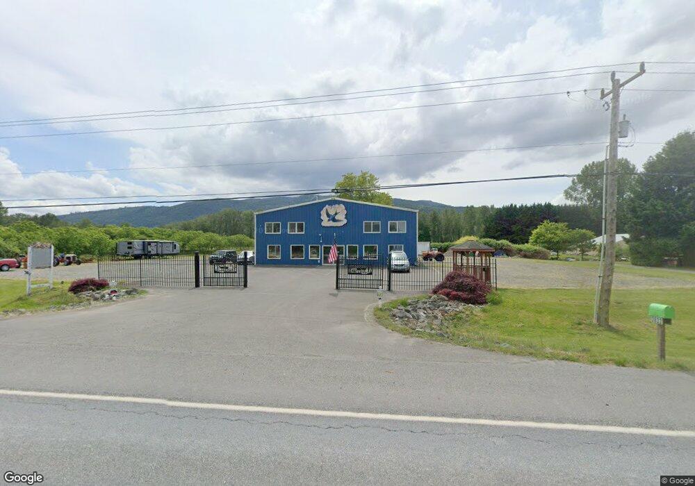
3833 Mt Baker Hwy Everson, WA 98247
Estimated Value: $1,169,917
2
Beds
1
Bath
1,800
Sq Ft
$650/Sq Ft
Est. Value
About This Home
This home is located at 3833 Mt Baker Hwy, Everson, WA 98247 and is currently estimated at $1,169,917, approximately $649 per square foot. 3833 Mt Baker Hwy is a home located in Whatcom County with nearby schools including Mount Baker Senior High School.
Ownership History
Date
Name
Owned For
Owner Type
Purchase Details
Closed on
Mar 20, 2017
Sold by
Kimball Richard and Kimball Susan
Bought by
Bush Ken and Binschus Allison
Current Estimated Value
Home Financials for this Owner
Home Financials are based on the most recent Mortgage that was taken out on this home.
Original Mortgage
$562,000
Interest Rate
4.17%
Mortgage Type
Commercial
Create a Home Valuation Report for This Property
The Home Valuation Report is an in-depth analysis detailing your home's value as well as a comparison with similar homes in the area
Home Values in the Area
Average Home Value in this Area
Purchase History
| Date | Buyer | Sale Price | Title Company |
|---|---|---|---|
| Bush Ken | $575,000 | Whatcom Land Title Co Inc |
Source: Public Records
Mortgage History
| Date | Status | Borrower | Loan Amount |
|---|---|---|---|
| Closed | Bush Ken | $562,000 |
Source: Public Records
Tax History Compared to Growth
Tax History
| Year | Tax Paid | Tax Assessment Tax Assessment Total Assessment is a certain percentage of the fair market value that is determined by local assessors to be the total taxable value of land and additions on the property. | Land | Improvement |
|---|---|---|---|---|
| 2024 | $5,210 | $745,720 | $374,963 | $370,757 |
| 2023 | $5,210 | $699,943 | $263,516 | $436,427 |
| 2022 | $5,327 | $636,298 | $239,554 | $396,744 |
| 2021 | $5,171 | $548,514 | $206,505 | $342,009 |
| 2020 | $5,395 | $498,636 | $187,727 | $310,909 |
| 2019 | $4,846 | $498,636 | $187,727 | $310,909 |
| 2018 | $4,901 | $484,725 | $182,490 | $302,235 |
| 2017 | $4,216 | $382,710 | $144,120 | $238,590 |
| 2016 | $4,248 | $325,710 | $87,120 | $238,590 |
| 2015 | $4,153 | $325,710 | $87,120 | $238,590 |
| 2014 | -- | $349,679 | $111,089 | $238,590 |
| 2013 | -- | $349,006 | $110,416 | $238,590 |
Source: Public Records
Map
Nearby Homes
- 3999 Deming Rd
- 5753 Lawrence Rd
- 3557 Cedarville Rd Unit 13
- 0 Hoff Cir
- 5947 Lawrence Rd
- 4290 Mt Baker Hwy
- 3246 Goshen Rd
- 7019 Mount Baker Hwy
- 5544 Sand Rd
- 3100 Mt Baker Hwy
- 5196 Sand Rd
- 8290 Mount Baker Hwy
- 5458 Mount Baker Hwy
- 0 Mt Baker Hwy Unit NWM2371192
- 6515 Lawrence Rd
- 0 Goshen Rd
- 5221 Mitchell Rd
- 2584 E Smith Rd
- 2802 Mount Baker Hwy
- 2807 Mt Baker Hwy
- 3813 Mt Baker Hwy
- 3804 Mt Baker Hwy
- 3791 Mt Baker Hwy
- 38 Mt Baker Hwy
- 3817 Mt Baker Hwy
- 5625 Putnam Rd
- 3764 Mt Baker Hwy
- 0 Putnam Rd Unit NWM2240506
- 0 Putnam Rd Unit NWM1970440
- 0 Putnam Rd
- 3757 Mount Baker Hwy
- 3766 Mt Baker Hwy
- 3911 Mt Baker Hwy
- 3792 Mt Baker Hwy
- 3766 Mount Baker Hwy
- 5651 Putnam Rd
- 3923 Mt Baker Hwy
- 5626 Lawrence Rd
- 5622 Putnam Rd
- 3770 Mt Baker Hwy