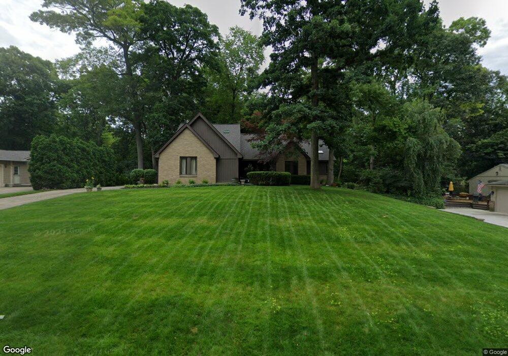
3834 Elder Rd S West Bloomfield, MI 48324
West Bloomfield Township NeighborhoodEstimated Value: $563,000 - $655,000
4
Beds
3
Baths
2,540
Sq Ft
$239/Sq Ft
Est. Value
About This Home
This home is located at 3834 Elder Rd S, West Bloomfield, MI 48324 and is currently estimated at $606,978, approximately $238 per square foot. 3834 Elder Rd S is a home located in Oakland County with nearby schools including Clifford H. Smart Middle School, Walled Lake Northern High School, and Our Lady Of Refuge School.
Ownership History
Date
Name
Owned For
Owner Type
Purchase Details
Closed on
Dec 4, 1997
Sold by
Loder Eileen M
Bought by
Shea Eileen M
Current Estimated Value
Home Financials for this Owner
Home Financials are based on the most recent Mortgage that was taken out on this home.
Original Mortgage
$209,300
Outstanding Balance
$31,838
Interest Rate
7.26%
Estimated Equity
$575,140
Purchase Details
Closed on
Jan 24, 1997
Sold by
Schwalm Robert S
Bought by
Loder Eileen M
Home Financials for this Owner
Home Financials are based on the most recent Mortgage that was taken out on this home.
Original Mortgage
$200,000
Interest Rate
7.73%
Create a Home Valuation Report for This Property
The Home Valuation Report is an in-depth analysis detailing your home's value as well as a comparison with similar homes in the area
Home Values in the Area
Average Home Value in this Area
Purchase History
| Date | Buyer | Sale Price | Title Company |
|---|---|---|---|
| Shea Eileen M | -- | -- | |
| Loder Eileen M | $297,500 | -- |
Source: Public Records
Mortgage History
| Date | Status | Borrower | Loan Amount |
|---|---|---|---|
| Open | Shea Eileen M | $209,300 | |
| Previous Owner | Loder Eileen M | $200,000 |
Source: Public Records
Tax History
| Year | Tax Paid | Tax Assessment Tax Assessment Total Assessment is a certain percentage of the fair market value that is determined by local assessors to be the total taxable value of land and additions on the property. | Land | Improvement |
|---|---|---|---|---|
| 2025 | $6,105 | $287,640 | $33,000 | $254,640 |
| 2024 | $3,499 | $249,640 | $0 | $0 |
| 2022 | $3,299 | $244,820 | $33,000 | $211,820 |
| 2021 | $5,381 | $218,640 | $0 | $0 |
| 2020 | $3,230 | $194,780 | $33,000 | $161,780 |
| 2018 | $5,189 | $195,390 | $30,000 | $165,390 |
| 2015 | -- | $161,650 | $0 | $0 |
| 2014 | -- | $149,550 | $0 | $0 |
| 2011 | -- | $133,420 | $0 | $0 |
Source: Public Records
Map
Nearby Homes
- 3765 Woodview Ave
- 6885 Aeroview St
- 6790 Grassland Ave
- 3991 Fieldview Ave
- 3965 Carrick Ave
- 6978 Colony Dr
- 7369 Sweetbriar
- 3575 Knollview Ave
- 3666 Walnut
- 6707 Heatherwood Dr
- 4212 Greendale Ave
- 4335 Crestdale Ave
- 3195 Green Oaks Dr
- 4383 Green Lake Rd
- 4405 Green Lake Rd
- 7110 Commerce Rd
- 4442 Rolling Pine Dr
- 6324 Wildwood Ln
- 6980 Hambro St
- 3701 Northwood
- 3838 Elder Rd S
- 3711 Alcott
- 6995 Meadowfield St
- 3698 Oakleaf Dr
- 3746 Alcott
- 3842 Elder Rd S
- 7050 Dandison Blvd
- 7030 Dandison Blvd
- 3823 Elder Rd S
- 6985 Meadowfield St
- 6985 Meadowfield St
- 3692 Oakleaf Dr Unit Bldg-Unit
- 3692 Oakleaf Dr
- 6990 Meadowfield St
- 3848 Elder Rd S
- 3739 Alcott
- 3796 Alcott
- 3740 Alcott
- 6988 Meadowfield St
- 3697 Oakleaf Dr
Your Personal Tour Guide
Ask me questions while you tour the home.