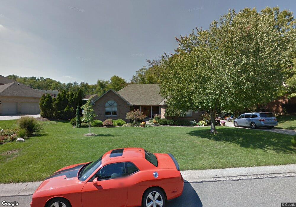
3837 Deerpath Ln Cincinnati, OH 45248
Estimated Value: $421,571 - $506,000
3
Beds
3
Baths
1,979
Sq Ft
$233/Sq Ft
Est. Value
About This Home
This home is located at 3837 Deerpath Ln, Cincinnati, OH 45248 and is currently estimated at $460,893, approximately $232 per square foot. 3837 Deerpath Ln is a home located in Hamilton County with nearby schools including Charles T. Young Elementary School, Taylor Middle School, and Taylor High School.
Ownership History
Date
Name
Owned For
Owner Type
Purchase Details
Closed on
May 18, 2006
Sold by
Mcdonough Eugene D and Mcdonough Marilyn
Bought by
Jent Terrence M and Jent Pamela A
Current Estimated Value
Home Financials for this Owner
Home Financials are based on the most recent Mortgage that was taken out on this home.
Original Mortgage
$156,000
Interest Rate
6.66%
Mortgage Type
Unknown
Create a Home Valuation Report for This Property
The Home Valuation Report is an in-depth analysis detailing your home's value as well as a comparison with similar homes in the area
Home Values in the Area
Average Home Value in this Area
Purchase History
| Date | Buyer | Sale Price | Title Company |
|---|---|---|---|
| Jent Terrence M | $305,000 | Advanced Land Title Agency |
Source: Public Records
Mortgage History
| Date | Status | Borrower | Loan Amount |
|---|---|---|---|
| Closed | Jent Terrence M | $156,000 |
Source: Public Records
Tax History
| Year | Tax Paid | Tax Assessment Tax Assessment Total Assessment is a certain percentage of the fair market value that is determined by local assessors to be the total taxable value of land and additions on the property. | Land | Improvement |
|---|---|---|---|---|
| 2025 | $6,531 | $121,748 | $19,705 | $102,043 |
| 2023 | $5,803 | $121,748 | $19,705 | $102,043 |
| 2022 | $5,468 | $89,674 | $17,010 | $72,664 |
| 2021 | $5,322 | $89,674 | $17,010 | $72,664 |
| 2020 | $5,367 | $89,674 | $17,010 | $72,664 |
| 2019 | $5,365 | $83,031 | $15,750 | $67,281 |
| 2018 | $5,161 | $83,031 | $15,750 | $67,281 |
| 2017 | $4,842 | $83,031 | $15,750 | $67,281 |
| 2016 | $4,912 | $86,786 | $16,380 | $70,406 |
| 2015 | $4,963 | $86,786 | $16,380 | $70,406 |
| 2014 | $5,000 | $86,786 | $16,380 | $70,406 |
| 2013 | $4,712 | $83,447 | $15,750 | $67,697 |
Source: Public Records
Map
Nearby Homes
- 3852 Deerpath Ln
- 7650 Dog Trot Rd
- 7087 Bridgetown Rd
- 6903 Taylor Rd
- 3841 Quadrant Dr
- 6880 Rackview Rd
- 3388 Markdale Ct
- 7105 Willowdale Dr
- B Dr
- 6684 Powner Farm Dr
- 7072 Wesselman Rd
- 4125 Sophias Way
- 7104 Wesselman Rd
- 7484 Zion Hill Rd
- 5042 Greenshire Dr
- 7854 Surreywood Dr
- 6560 Springmyer Dr
- 8134 Jordan Valley Ct
- 6981 Saint Helens Ct
- 5017 Zion Rd
- 3843 Deerpath Ln
- 3831 Deerpath Ln
- 3849 Deerpath Ln
- 3822 Foxtail Ln
- 3816 Foxtail Ln
- 3834 Foxtail Ln
- 3828 Foxtail Ln
- 3812 Foxtail Ln
- 3838 Foxtail Ln
- 3838 Deerpath Ln
- 3832 Deerpath Ln
- 3844 Deerpath Ln
- 3853 Deerpath Ln
- 3820 Deerpath Ln
- 3826 Deerpath Ln
- 3840 Foxtail Ln
- 3859 Deerpath Ln
- 3860 Deerpath Ln
- 3814 Deerpath Ln
- 3842 Foxtail Ln
Your Personal Tour Guide
Ask me questions while you tour the home.