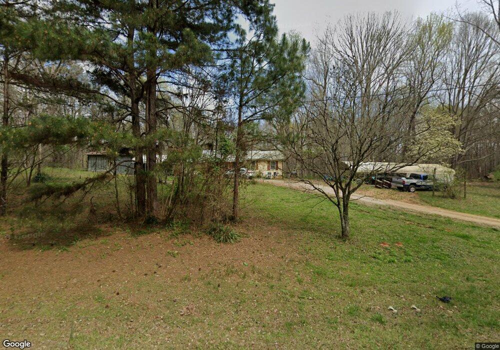
3838 Mooty Bridge Rd Unit 3816 Lagrange, GA 30240
Estimated Value: $147,275 - $278,000
3
Beds
1
Bath
1,276
Sq Ft
$164/Sq Ft
Est. Value
About This Home
This home is located at 3838 Mooty Bridge Rd Unit 3816, Lagrange, GA 30240 and is currently estimated at $209,069, approximately $163 per square foot. 3838 Mooty Bridge Rd Unit 3816 is a home located in Troup County with nearby schools including Hillcrest Elementary School, Franklin Forest Elementary School, and Hollis Hand Elementary School.
Ownership History
Date
Name
Owned For
Owner Type
Purchase Details
Closed on
Apr 25, 2018
Sold by
Bond James Thomas
Bought by
Sassamon Dois F
Current Estimated Value
Purchase Details
Closed on
Jan 25, 1984
Bought by
Bond Charlie F
Purchase Details
Closed on
Jan 24, 1984
Purchase Details
Closed on
Nov 22, 1982
Purchase Details
Closed on
Mar 9, 1982
Purchase Details
Closed on
Dec 1, 1981
Purchase Details
Closed on
Oct 11, 1981
Purchase Details
Closed on
Mar 20, 1981
Create a Home Valuation Report for This Property
The Home Valuation Report is an in-depth analysis detailing your home's value as well as a comparison with similar homes in the area
Home Values in the Area
Average Home Value in this Area
Purchase History
| Date | Buyer | Sale Price | Title Company |
|---|---|---|---|
| Sassamon Dois F | $8,000 | -- | |
| Bond Charlie F | -- | -- | |
| -- | -- | -- | |
| -- | -- | -- | |
| -- | -- | -- | |
| -- | -- | -- | |
| -- | -- | -- | |
| -- | -- | -- |
Source: Public Records
Tax History Compared to Growth
Tax History
| Year | Tax Paid | Tax Assessment Tax Assessment Total Assessment is a certain percentage of the fair market value that is determined by local assessors to be the total taxable value of land and additions on the property. | Land | Improvement |
|---|---|---|---|---|
| 2024 | $930 | $34,096 | $6,080 | $28,016 |
| 2023 | $851 | $31,212 | $6,080 | $25,132 |
| 2022 | $830 | $29,732 | $6,080 | $23,652 |
| 2021 | $574 | $19,036 | $5,400 | $13,636 |
| 2020 | $508 | $16,836 | $5,400 | $11,436 |
| 2019 | $506 | $16,776 | $5,400 | $11,376 |
| 2018 | $339 | $21,192 | $5,400 | $15,792 |
| 2017 | $339 | $21,192 | $5,400 | $15,792 |
| 2016 | $327 | $20,778 | $5,412 | $15,366 |
| 2015 | $626 | $22,738 | $5,220 | $17,518 |
| 2014 | $598 | $21,816 | $5,220 | $16,596 |
| 2013 | -- | $24,544 | $5,220 | $19,324 |
Source: Public Records
Map
Nearby Homes
- 57 Hubbard Rd
- 0 River Club Dr Unit 10311961
- 1006 Wares Cross Rd
- 305 Edgemont Dr
- 206 Sturbridge Dr
- 116 Firefly Run
- 110 Firefly Run
- 223 Village Dr
- 96 Firefly Run
- 56 Firefly Run
- 14 Firefly Run
- 147 Wolf Creek Cove
- 102 Plantation Ct
- 5 Firefly Run
- 178 Wolf Creek Cove
- 183 Indian Bend Dr
- 125 Montrose Way
- 115 Wolf Creek Cove
- 155 Indian Bend Dr
- 4555 Mooty Bridge Rd
- 3838 Mooty Bridge Rd
- 3786 Mooty Bridge Rd
- 3816 Mooty Bridge Rd
- 0 Riverbend Dr Unit 8454167
- 0 Riverbend Dr Unit 20108408
- 0 Riverbend Dr Unit 20040965
- 0 Riverbend Dr Unit 33 8060611
- 0 Riverbend Dr Unit 8683988
- 0 Riverbend Dr Unit 8678763
- 98 Beaver Cove Dr
- 0 Hubbard Rd Unit 4 8343343
- 0 Hubbard Rd Unit 3 8343337
- 0 Hubbard Rd Unit 4 8621574
- 0 Hubbard Rd Unit 2 8621569
- 3920 Mooty Bridge Rd
- 49 Beaver Cove Dr
- 31 Hubbard Rd
- 3720 Mooty Bridge Rd
- 3700 Mooty Bridge Rd
- 127 Beaver Cove Dr