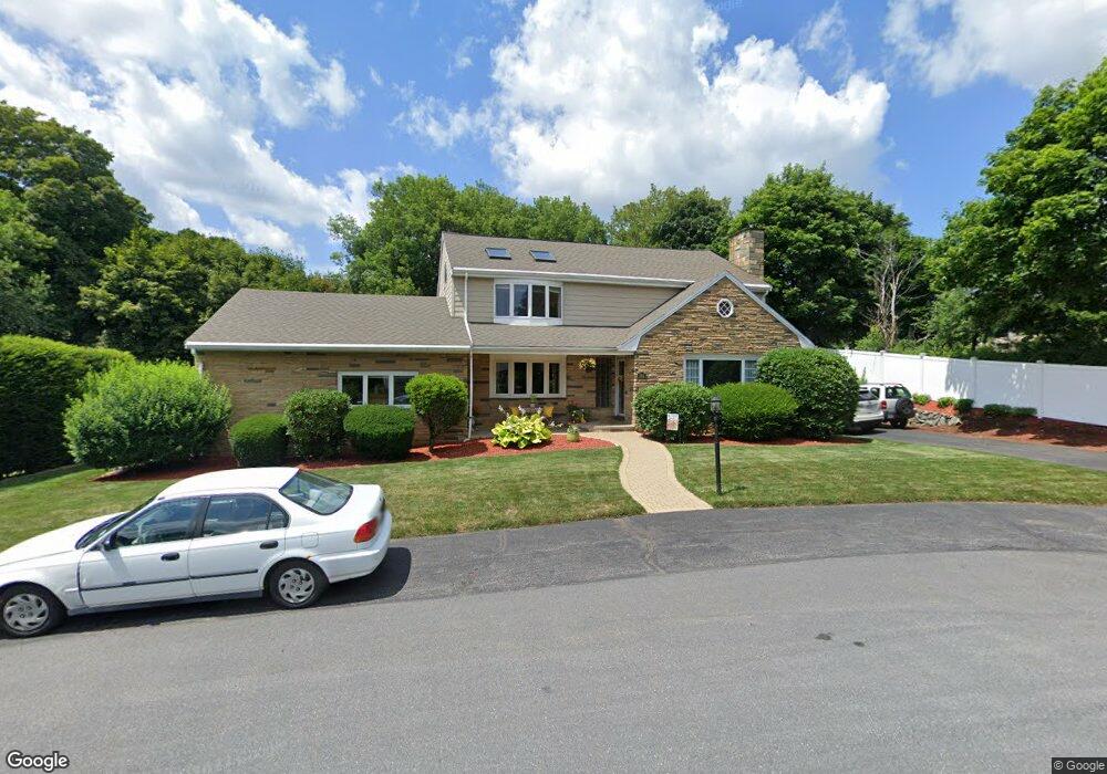
384 Brighton St Belmont, MA 02478
Belmont Hill NeighborhoodEstimated Value: $1,576,000 - $1,888,000
3
Beds
3
Baths
3,254
Sq Ft
$543/Sq Ft
Est. Value
About This Home
This home is located at 384 Brighton St, Belmont, MA 02478 and is currently estimated at $1,767,375, approximately $543 per square foot. 384 Brighton St is a home located in Middlesex County with nearby schools including Winn Brook Elementary School, Winthrop L Chenery Middle School, and Belmont High School.
Ownership History
Date
Name
Owned For
Owner Type
Purchase Details
Closed on
Aug 30, 1995
Sold by
Tsoumas Stephanie
Bought by
Rizzuto Leonard G and Rizzuto Georgianne P
Current Estimated Value
Home Financials for this Owner
Home Financials are based on the most recent Mortgage that was taken out on this home.
Original Mortgage
$291,450
Interest Rate
7.61%
Mortgage Type
Purchase Money Mortgage
Create a Home Valuation Report for This Property
The Home Valuation Report is an in-depth analysis detailing your home's value as well as a comparison with similar homes in the area
Home Values in the Area
Average Home Value in this Area
Purchase History
| Date | Buyer | Sale Price | Title Company |
|---|---|---|---|
| Rizzuto Leonard G | $291,500 | -- |
Source: Public Records
Mortgage History
| Date | Status | Borrower | Loan Amount |
|---|---|---|---|
| Open | Rizzuto Leonard G | $316,500 | |
| Closed | Rizzuto Leonard G | $291,450 | |
| Previous Owner | Rizzuto Leonard G | $75,000 |
Source: Public Records
Tax History Compared to Growth
Tax History
| Year | Tax Paid | Tax Assessment Tax Assessment Total Assessment is a certain percentage of the fair market value that is determined by local assessors to be the total taxable value of land and additions on the property. | Land | Improvement |
|---|---|---|---|---|
| 2025 | $16,276 | $1,429,000 | $622,000 | $807,000 |
| 2024 | $14,552 | $1,378,000 | $733,000 | $645,000 |
| 2023 | $13,522 | $1,203,000 | $712,000 | $491,000 |
| 2022 | $12,844 | $1,148,000 | $688,000 | $460,000 |
| 2021 | $12,844 | $1,113,000 | $756,000 | $357,000 |
| 2020 | $11,011 | $1,001,000 | $619,000 | $382,000 |
| 2019 | $10,783 | $924,000 | $559,000 | $365,000 |
| 2018 | $9,963 | $820,000 | $486,000 | $334,000 |
| 2017 | $9,619 | $758,000 | $424,000 | $334,000 |
| 2016 | $9,483 | $755,000 | $424,000 | $331,000 |
| 2015 | $9,133 | $708,000 | $378,000 | $330,000 |
Source: Public Records
Map
Nearby Homes
- 10 Radcliffe Rd
- 43 Brunswick Rd
- 242 Claflin St
- 4 Stony Brook Rd
- 335 Lake St
- 326 Lake St
- 7 Woodland St
- 125 Claflin St
- 170 Clifton St
- 7 Broad St
- 142 Highland Ave Unit 142
- 155 Highland Ave Unit 1
- 152 Scituate St
- 11 Windermere Park
- 135 Pleasant St Unit 34 prev 13
- 176 Channing Rd
- 789 Concord Turnpike
- 119 Gloucester St
- 125 Channing Rd
- 33 Wellington Ln
- 378 Brighton St
- 378 Brighton St (Dead End Side)
- 1 Radcliffe Rd
- 79 Scott Rd
- 385 Brighton St
- 391 Brighton St
- 372 Brighton St
- 73 Scott Rd
- 11 Radcliffe Rd
- 379 Brighton St
- 2 Radcliffe Rd
- 67 Scott Rd
- 4 Radcliffe Rd
- 364 Brighton St
- 78 Scott Rd
- 373 Brighton St
- 19 Radcliffe Rd
- 61 Scott Rd
- 61 Scott Rd Unit 1
- 61 Scott Rd Unit Single Fam