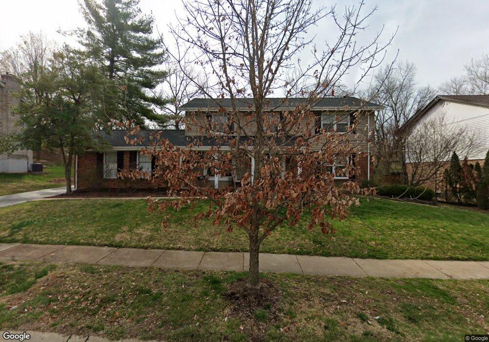
384 Dungate Dr Chesterfield, MO 63017
Estimated Value: $492,607 - $560,000
4
Beds
3
Baths
2,430
Sq Ft
$215/Sq Ft
Est. Value
About This Home
This home is located at 384 Dungate Dr, Chesterfield, MO 63017 and is currently estimated at $522,902, approximately $215 per square foot. 384 Dungate Dr is a home located in St. Louis County with nearby schools including Green Trails Elementary School, Parkway Central Middle School, and Parkway Central High School.
Ownership History
Date
Name
Owned For
Owner Type
Purchase Details
Closed on
Jun 17, 2010
Sold by
Ring Matthew D and Ring Susan R
Bought by
Wilson James and Wilson Michelle
Current Estimated Value
Home Financials for this Owner
Home Financials are based on the most recent Mortgage that was taken out on this home.
Original Mortgage
$248,000
Outstanding Balance
$165,393
Interest Rate
4.87%
Mortgage Type
New Conventional
Estimated Equity
$357,509
Purchase Details
Closed on
Sep 27, 2002
Sold by
Neely Judith L
Bought by
Ring Matthew D and Ring Susan R
Home Financials for this Owner
Home Financials are based on the most recent Mortgage that was taken out on this home.
Original Mortgage
$210,400
Interest Rate
6.2%
Mortgage Type
Balloon
Create a Home Valuation Report for This Property
The Home Valuation Report is an in-depth analysis detailing your home's value as well as a comparison with similar homes in the area
Home Values in the Area
Average Home Value in this Area
Purchase History
| Date | Buyer | Sale Price | Title Company |
|---|---|---|---|
| Wilson James | $310,000 | Investors Title Company | |
| Ring Matthew D | $263,000 | -- |
Source: Public Records
Mortgage History
| Date | Status | Borrower | Loan Amount |
|---|---|---|---|
| Open | Wilson James | $248,000 | |
| Previous Owner | Ring Matthew D | $210,400 |
Source: Public Records
Tax History
| Year | Tax Paid | Tax Assessment Tax Assessment Total Assessment is a certain percentage of the fair market value that is determined by local assessors to be the total taxable value of land and additions on the property. | Land | Improvement |
|---|---|---|---|---|
| 2025 | $5,077 | $90,840 | $48,370 | $42,470 |
| 2024 | $5,077 | $76,740 | $19,340 | $57,400 |
| 2023 | $4,870 | $76,740 | $19,340 | $57,400 |
| 2022 | $4,732 | $67,850 | $27,090 | $40,760 |
| 2021 | $4,712 | $67,850 | $27,090 | $40,760 |
| 2020 | $4,623 | $63,920 | $23,010 | $40,910 |
| 2019 | $4,522 | $63,920 | $23,010 | $40,910 |
| 2018 | $4,593 | $60,210 | $23,010 | $37,200 |
| 2017 | $4,468 | $60,210 | $23,010 | $37,200 |
| 2016 | $4,423 | $56,640 | $16,570 | $40,070 |
Source: Public Records
Map
Nearby Homes
- 394 Branchport Dr
- 224 Brayhill Ct
- 14778 Plumas Dr
- 135 Greentrails Dr S
- 14555 Coeur Dalene Ct
- 114 Trailswest Dr
- 15324 Appalachian Trail
- 14738 Thornbird Manor Pkwy
- 14342 Lake Tahoe Dr
- 1287 Still House Creek Rd
- 1203 Beaver Creek Rd
- 1102 Nooning Tree Dr
- 15216 Nooning Tree Ct
- 14815 Conway Rd
- 1275 Kennebec Rd
- 14327 Bramblewood Ct
- 330 Calliope Place
- 15423 Eaglepass Dr
- 400 Conway Meadows Dr Unit 1
- 1318 Conway Oaks Dr
- 376 Dungate Dr
- 388 Dungate Dr
- 355 Branchport Dr
- 385 Dungate Dr
- 363 Branchport Dr
- 368 Dungate Dr
- 379 Dungate Dr
- 392 Dungate Dr
- 347 Branchport Dr
- 367 Dungate Dr
- 378 Dinsmoor Dr
- 389 Dinsmoor Dr
- 356 Dungate Dr
- 339 Branchport Dr
- 366 Dinsmoor Dr
- 355 Dungate Dr
- 383 Dinsmoor Dr
- 395 Dungate Dr
- 362 Branchport Dr
- 350 Branchport Dr
Your Personal Tour Guide
Ask me questions while you tour the home.