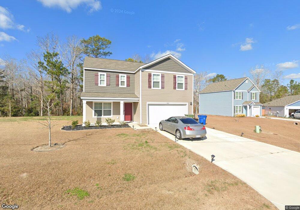
384 High Ridge Ct Sneads Ferry, NC 28460
Estimated Value: $352,000 - $392,230
4
Beds
3
Baths
2,382
Sq Ft
$154/Sq Ft
Est. Value
About This Home
This home is located at 384 High Ridge Ct, Sneads Ferry, NC 28460 and is currently estimated at $367,058, approximately $154 per square foot. 384 High Ridge Ct is a home with nearby schools including Dixon Elementary School, Dixon High School, and Born Again Christian Academy.
Ownership History
Date
Name
Owned For
Owner Type
Purchase Details
Closed on
Dec 6, 2024
Sold by
Matakevich Keith Raymond and Kowalow Kelsey Ann
Bought by
Lupardus Joseph C
Current Estimated Value
Home Financials for this Owner
Home Financials are based on the most recent Mortgage that was taken out on this home.
Original Mortgage
$364,164
Outstanding Balance
$361,159
Interest Rate
6.54%
Mortgage Type
VA
Estimated Equity
$5,899
Purchase Details
Closed on
Aug 30, 2021
Sold by
D R Horton Inc
Bought by
Matakevich Keith Raymond and Kowalow Kelsey Ann
Home Financials for this Owner
Home Financials are based on the most recent Mortgage that was taken out on this home.
Original Mortgage
$268,680
Interest Rate
2.7%
Mortgage Type
VA
Create a Home Valuation Report for This Property
The Home Valuation Report is an in-depth analysis detailing your home's value as well as a comparison with similar homes in the area
Home Values in the Area
Average Home Value in this Area
Purchase History
| Date | Buyer | Sale Price | Title Company |
|---|---|---|---|
| Lupardus Joseph C | $356,500 | None Listed On Document | |
| Lupardus Joseph C | $356,500 | None Listed On Document | |
| Matakevich Keith Raymond | $263,000 | None Available |
Source: Public Records
Mortgage History
| Date | Status | Borrower | Loan Amount |
|---|---|---|---|
| Open | Lupardus Joseph C | $364,164 | |
| Closed | Lupardus Joseph C | $364,164 | |
| Previous Owner | Matakevich Keith Raymond | $268,680 |
Source: Public Records
Tax History Compared to Growth
Tax History
| Year | Tax Paid | Tax Assessment Tax Assessment Total Assessment is a certain percentage of the fair market value that is determined by local assessors to be the total taxable value of land and additions on the property. | Land | Improvement |
|---|---|---|---|---|
| 2025 | $2,001 | $305,492 | $47,500 | $257,992 |
| 2024 | $2,001 | $305,492 | $47,500 | $257,992 |
| 2023 | $2,001 | $305,492 | $47,500 | $257,992 |
| 2022 | $2,001 | $305,492 | $47,500 | $257,992 |
| 2021 | $282 | $40,000 | $40,000 | $0 |
Source: Public Records
Map
Nearby Homes
- 386 High Ridge Ct
- 186 Everett Yopp Dr
- 811 Schoolfield Dr
- 809 Schoolfield Dr
- 813 Schoolfield Dr
- 815 Schoolfield Dr
- 803 Schoolfield Dr
- 817 Schoolfield Dr
- 819 Schoolfield Dr
- 805 Schoolfield Dr
- 807 Schoolfield Dr
- 821 Schoolfield Dr
- 823 Schoolfield Dr
- 825 Schoolfield Dr
- 801 School Field Dr Unit Lot 131
- 808 Schoolfield Dr Unit Lot 66
- 810 Schoolfield Dr
- 827 Schoolfield Dr
- 802 School Field Dr Unit Lot 63
- 804 Schoolfield Dr
- 382 High Ridge Ct Unit Lot 23
- 381 High Ridge Ct Unit Lot 28
- 383 High Ridge Ct Unit Lot 29
- 385 High Ridge Ct Unit Lot 30
- 388 High Ridge Ct
- 380 High Ridge Ct
- 377 High Ridge Ct Unit Lot 26
- 103 Two Sisters Terrace
- 390 High Ridge Ct
- 379 High Ridge Ct Unit Lot 27
- 105 Three Brothers Trail
- 103 Three Brothers Trail
- 106 Three Brothers Trail
- 102 Two Sisters Terrace
- 392 High Ridge Ct
- 387 High Ridge Ct Unit Lot 31
- 375 High Ridge Ct
- 389 High Ridge Ct Unit 32
- 394 High Ridge Ct
- 393 High Ridge Ct Unit Lot 34