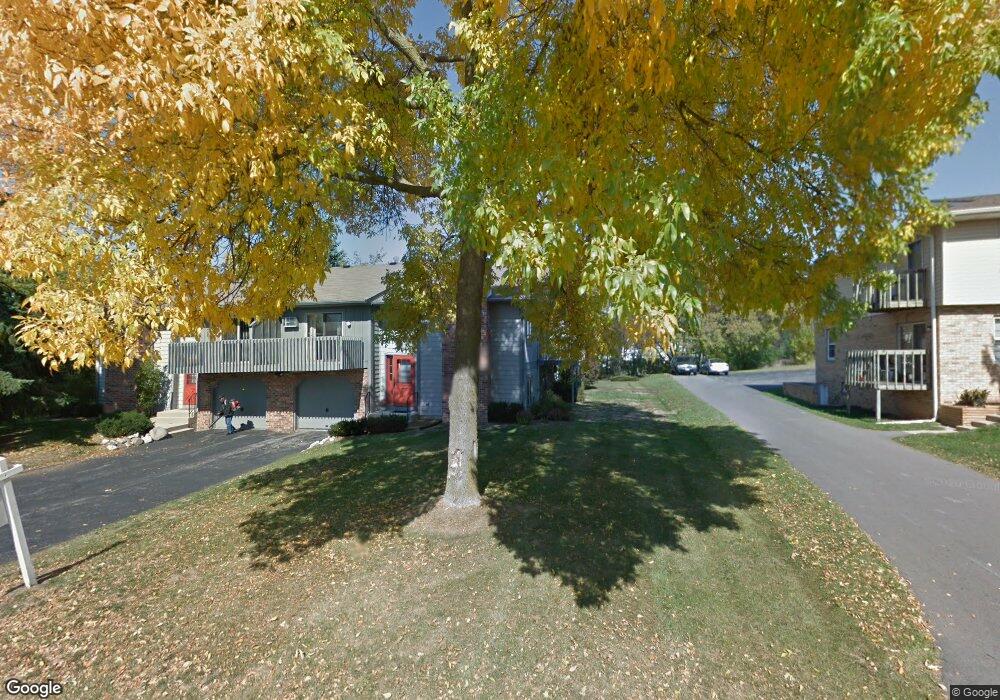
384 Manchester Ln Unit 3 Hartland, WI 53029
Estimated Value: $258,305 - $299,000
3
Beds
2
Baths
1,420
Sq Ft
$192/Sq Ft
Est. Value
About This Home
This home is located at 384 Manchester Ln Unit 3, Hartland, WI 53029 and is currently estimated at $272,826, approximately $192 per square foot. 384 Manchester Ln Unit 3 is a home located in Waukesha County with nearby schools including Arrowhead High School, St Charles Parish School, and Zion Lutheran School.
Ownership History
Date
Name
Owned For
Owner Type
Purchase Details
Closed on
Sep 30, 2002
Sold by
Stoehr John W and Stoehr Beverly J
Bought by
Moser Mechthilde G
Current Estimated Value
Home Financials for this Owner
Home Financials are based on the most recent Mortgage that was taken out on this home.
Original Mortgage
$102,400
Interest Rate
6.39%
Create a Home Valuation Report for This Property
The Home Valuation Report is an in-depth analysis detailing your home's value as well as a comparison with similar homes in the area
Home Values in the Area
Average Home Value in this Area
Purchase History
| Date | Buyer | Sale Price | Title Company |
|---|---|---|---|
| Moser Mechthilde G | $128,000 | -- |
Source: Public Records
Mortgage History
| Date | Status | Borrower | Loan Amount |
|---|---|---|---|
| Previous Owner | Moser Mechthilde G | $102,400 |
Source: Public Records
Tax History Compared to Growth
Tax History
| Year | Tax Paid | Tax Assessment Tax Assessment Total Assessment is a certain percentage of the fair market value that is determined by local assessors to be the total taxable value of land and additions on the property. | Land | Improvement |
|---|---|---|---|---|
| 2024 | $1,784 | $173,400 | $27,000 | $146,400 |
| 2023 | $1,655 | $173,400 | $27,000 | $146,400 |
| 2022 | $1,692 | $140,000 | $27,000 | $113,000 |
| 2021 | $1,700 | $140,000 | $27,000 | $113,000 |
| 2020 | $1,724 | $140,000 | $27,000 | $113,000 |
| 2019 | $1,726 | $140,000 | $27,000 | $113,000 |
| 2018 | $1,873 | $132,000 | $15,000 | $117,000 |
| 2017 | $1,976 | $132,000 | $15,000 | $117,000 |
| 2016 | $2,042 | $132,000 | $15,000 | $117,000 |
| 2015 | $2,142 | $132,000 | $15,000 | $117,000 |
| 2014 | $2,114 | $132,000 | $15,000 | $117,000 |
| 2013 | $2,114 | $136,000 | $15,000 | $121,000 |
Source: Public Records
Map
Nearby Homes
- 1019 Wellington Way
- 732 River Reserve Dr
- 617 Coventry Ln
- 809 Crescent Ln
- 733 Cardiff Ct
- 222 Granary Cir
- 459 Sunset Trail Unit 2
- W221N4564 Timber Hill Ct
- 345 Cottonwood Ave
- W289N4159 Farm Valley Ct
- N30W30257 Great Hill Ct
- N28W30264 Red Hawk Ct
- 3911 Campbell Trace
- W298N2808 Shady Ln
- 286 Hazel Ln
- N35W28682 Old North Shore Dr
- Pcl2 Hill St
- N30W28853 W Lakeside Dr
- 4821 Easy St Unit 8
- W283N3660 Yorkshire Trace
- 382 Manchester Ln
- 386 Manchester Ln
- 380 Manchester Ln Unit 1
- 350 Manchester Ln Unit 350
- 371 Manchester Ln Unit 373
- 356 Manchester Ln Unit 356
- 352 Manchester Ln Unit 352
- 343 Manchester Ln
- 401 Manchester Ln Unit 403
- 354 Manchester Ln Unit 354
- 330 Manchester Ln Unit 336
- 330 Manchester Ln Unit 330
- 404 Lindenwood Dr
- 336 Manchester Ln Unit 336
- 423 Manchester Ln
- 421 Manchester Ln Unit 423
- 306 Manchester Ln
- 304 Manchester Ln Unit 3
- 410 Lindenwood Dr
- 443 Manchester Ln