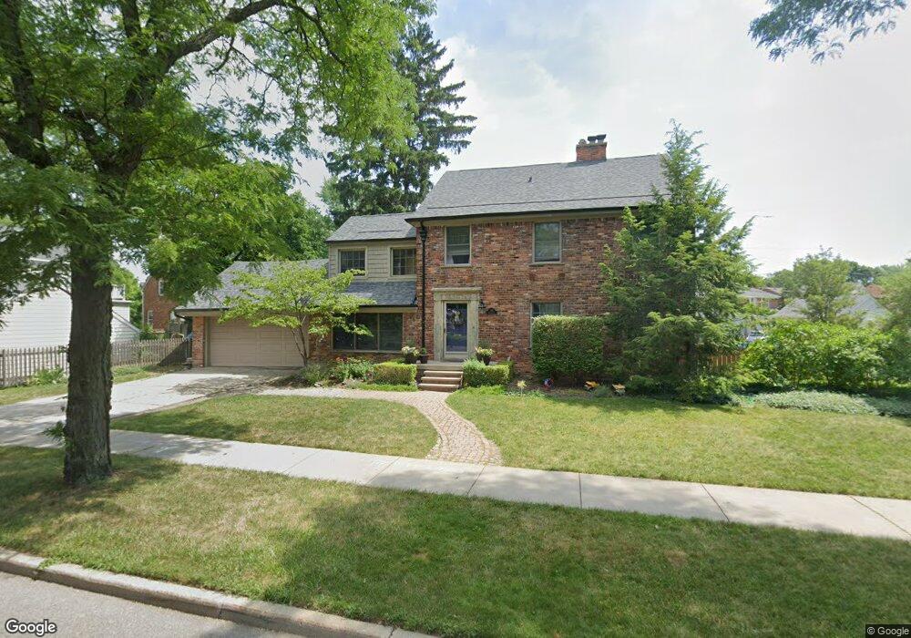
384 Moran Rd Grosse Pointe Farms, MI 48236
Estimated Value: $496,435 - $592,000
4
Beds
3
Baths
2,269
Sq Ft
$245/Sq Ft
Est. Value
About This Home
This home is located at 384 Moran Rd, Grosse Pointe Farms, MI 48236 and is currently estimated at $555,359, approximately $244 per square foot. 384 Moran Rd is a home located in Wayne County with nearby schools including Kerby Elementary School, Brownell Middle School, and Grosse Pointe South High School.
Ownership History
Date
Name
Owned For
Owner Type
Purchase Details
Closed on
Feb 28, 2013
Sold by
Gerow Daniel S and Gerow Paula M
Bought by
Murray Georgianna
Current Estimated Value
Create a Home Valuation Report for This Property
The Home Valuation Report is an in-depth analysis detailing your home's value as well as a comparison with similar homes in the area
Home Values in the Area
Average Home Value in this Area
Purchase History
| Date | Buyer | Sale Price | Title Company |
|---|---|---|---|
| Murray Georgianna | $215,000 | Etitle Agency Inc |
Source: Public Records
Tax History Compared to Growth
Tax History
| Year | Tax Paid | Tax Assessment Tax Assessment Total Assessment is a certain percentage of the fair market value that is determined by local assessors to be the total taxable value of land and additions on the property. | Land | Improvement |
|---|---|---|---|---|
| 2025 | $4,407 | $230,000 | $0 | $0 |
| 2024 | $4,407 | $212,000 | $0 | $0 |
| 2023 | $4,038 | $196,600 | $0 | $0 |
| 2022 | $4,038 | $180,400 | $0 | $0 |
| 2021 | $7,409 | $172,400 | $0 | $0 |
| 2019 | $7,285 | $164,900 | $0 | $0 |
| 2018 | $3,728 | $158,100 | $0 | $0 |
| 2017 | $6,469 | $154,600 | $0 | $0 |
| 2016 | $6,781 | $148,400 | $0 | $0 |
| 2015 | $13,432 | $144,800 | $0 | $0 |
| 2013 | $12,590 | $125,900 | $0 | $0 |
| 2012 | $3,282 | $123,400 | $40,400 | $83,000 |
Source: Public Records
Map
Nearby Homes
- 380 Merriweather Rd
- 343 Mount Vernon Ave
- 352 Mckinley Ave
- 317 Mount Vernon Ave
- 341 Mcmillan Rd
- 314 Mount Vernon Ave
- 302 Mount Vernon Ave
- 827 Fisher Rd
- 415 Lothrop Rd
- 975 Fisher Rd
- 276 Lewiston Rd
- 876 Washington Rd
- 259 Mount Vernon Ave
- 441 Manor St
- 194 Charlevoix Ave
- 745 Lincoln Rd
- 265 Williams Ave
- 218 Merriweather Rd
- 351 Moselle Place
- 240 Mckinley Ave
- 389 Merriweather Rd
- 387 Merriweather Rd
- 381 Merriweather Rd
- 354 Moran Rd
- 385 Moran Rd
- 383 Moran Rd
- 387 Moran Rd
- 352 Moran Rd
- 355 Merriweather Rd
- 381 Moran Rd
- 391 Moran Rd
- 353 Merriweather Rd
- 348 Moran Rd
- 349 Merriweather Rd
- 346 Moran Rd
- 377 Mcmillan Rd
- 390 Merriweather Rd
- 177 Williams Ave
- 345 Merriweather Rd
- 375 Mcmillan Rd