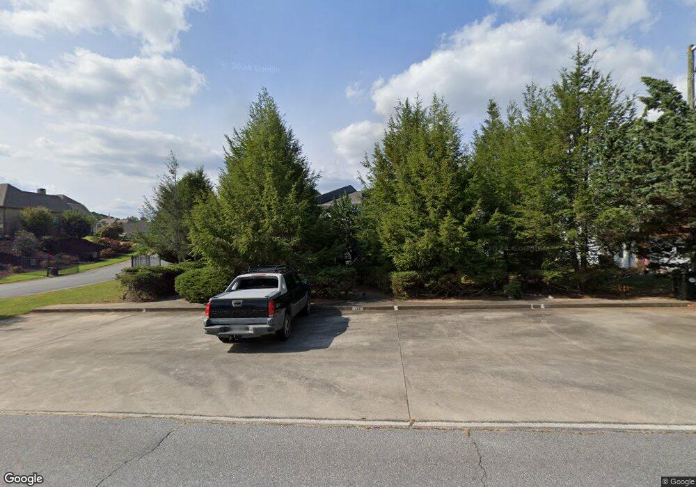
384 Mountain Dr Dahlonega, GA 30533
Estimated Value: $253,338 - $380,000
--
Bed
2
Baths
1,224
Sq Ft
$247/Sq Ft
Est. Value
About This Home
This home is located at 384 Mountain Dr, Dahlonega, GA 30533 and is currently estimated at $302,835, approximately $247 per square foot. 384 Mountain Dr is a home located in Lumpkin County with nearby schools including Lumpkin County High School.
Ownership History
Date
Name
Owned For
Owner Type
Purchase Details
Closed on
Nov 24, 2021
Sold by
Dover Victor Ray
Bought by
Mountain Drive Llc
Current Estimated Value
Purchase Details
Closed on
Sep 14, 2006
Sold by
Not Provided
Bought by
Dover Victor Ray and Dover Melissa M
Purchase Details
Closed on
Jan 6, 1992
Sold by
Crown Mtn Corporatin
Bought by
Dover Vinson
Purchase Details
Closed on
Jul 13, 1991
Sold by
Dover Vinson
Bought by
Crown Mtn Corporatin
Purchase Details
Closed on
Sep 14, 1990
Sold by
Dover Vinson
Bought by
Dover Vinson
Purchase Details
Closed on
Apr 18, 1990
Bought by
Dover Vinson
Create a Home Valuation Report for This Property
The Home Valuation Report is an in-depth analysis detailing your home's value as well as a comparison with similar homes in the area
Home Values in the Area
Average Home Value in this Area
Purchase History
| Date | Buyer | Sale Price | Title Company |
|---|---|---|---|
| Mountain Drive Llc | $200,000 | -- | |
| Dover Victor Ray | $200,000 | -- | |
| Dover Vinson | -- | -- | |
| Crown Mtn Corporatin | -- | -- | |
| Dover Vinson | $15,000 | -- | |
| Dover Vinson | $81,600 | -- |
Source: Public Records
Tax History Compared to Growth
Tax History
| Year | Tax Paid | Tax Assessment Tax Assessment Total Assessment is a certain percentage of the fair market value that is determined by local assessors to be the total taxable value of land and additions on the property. | Land | Improvement |
|---|---|---|---|---|
| 2024 | $2,283 | $80,348 | $12,000 | $68,348 |
| 2023 | $2,170 | $75,291 | $12,000 | $63,291 |
| 2022 | $1,911 | $62,540 | $12,000 | $50,540 |
| 2021 | $1,730 | $53,014 | $12,000 | $41,014 |
| 2020 | $1,753 | $51,710 | $12,000 | $39,710 |
| 2019 | $1,761 | $51,710 | $12,000 | $39,710 |
| 2018 | $1,704 | $46,811 | $12,000 | $34,811 |
| 2017 | $1,643 | $44,398 | $12,000 | $32,398 |
| 2016 | $1,556 | $41,120 | $12,000 | $29,120 |
| 2015 | $1,343 | $41,120 | $12,000 | $29,120 |
| 2014 | $1,343 | $41,484 | $12,000 | $29,484 |
| 2013 | -- | $42,212 | $12,000 | $30,212 |
Source: Public Records
Map
Nearby Homes
- 0 Crown Mountain Dr Unit 7568655
- 0 Alicia Ln
- 0 Deer Run Unit 10437845
- 0 Highway 9 S Unit 7548614
- 0 Highway 9 S Unit 10487179
- 19 Stoneybrook Dr
- 0 Calhoun Rd Unit 10598012
- 0 Calhoun Rd Unit 7643314
- 00 Calhoun Rd
- SUDBURY 24' TOWNHOME Plan at Mountain Park
- 332 Stoneybrook Dr
- 388 Stoneybrook Dr
- 396 Stoneybrook Dr
- 0 Highway 60 Unit 7241582
- 0 Placer Mining Rd Unit 7499268
- 0 Crown Mountain Unit 10572497
- 0 Crown Mountain Unit 10509297
- 0 Crown Mountain Way Unit 7666031
- Lot 20 Crown Mountain Way
- 0 Crown Mountain Way Unit 7498854
- 386 Mountain Dr
- 382 Mountain Dr
- 380 Mountain Dr
- 388 Mountain Dr
- 386 Mountain Dr
- 145 Village Dr
- 354 Mountain Dr
- 354 Mountain Dr Unit G
- 354 Mountain Dr Unit F
- 354 Mountain Dr Unit E
- 354 Mountain Dr Unit D
- 354 Mountain Dr Unit C
- 354 Mountain Dr Unit B
- 354 Mountain Dr
- 34 Village Dr
- 268 Village Dr Unit 38
- 419 Mountain Dr Unit 506
- 419 Mountain Dr
- 262 Village Dr Unit 37
- 262 Village Dr
