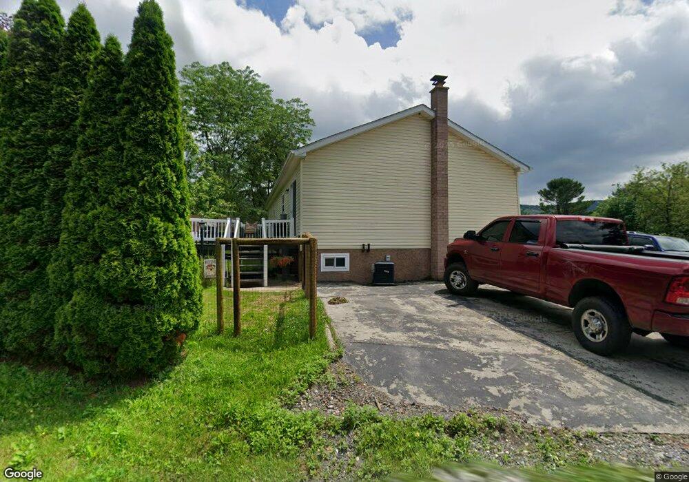
384 Moyers Station Rd Schuylkill Haven, PA 17972
Estimated Value: $274,803 - $333,000
3
Beds
2
Baths
1,456
Sq Ft
$205/Sq Ft
Est. Value
About This Home
This home is located at 384 Moyers Station Rd, Schuylkill Haven, PA 17972 and is currently estimated at $298,701, approximately $205 per square foot. 384 Moyers Station Rd is a home located in Schuylkill County with nearby schools including Pine Grove Elementary School, Pine Grove Area Middle School, and Pine Grove Area High School.
Ownership History
Date
Name
Owned For
Owner Type
Purchase Details
Closed on
May 13, 2024
Sold by
Humma Kenneth
Bought by
Humma Cody and Studlack Samantha
Current Estimated Value
Home Financials for this Owner
Home Financials are based on the most recent Mortgage that was taken out on this home.
Original Mortgage
$202,500
Outstanding Balance
$199,612
Interest Rate
6.79%
Mortgage Type
New Conventional
Estimated Equity
$99,089
Purchase Details
Closed on
Mar 23, 2007
Sold by
Habenicht Anna and Humma Edward J
Bought by
Humma Kenneth
Create a Home Valuation Report for This Property
The Home Valuation Report is an in-depth analysis detailing your home's value as well as a comparison with similar homes in the area
Home Values in the Area
Average Home Value in this Area
Purchase History
| Date | Buyer | Sale Price | Title Company |
|---|---|---|---|
| Humma Cody | $225,000 | None Listed On Document | |
| Humma Kenneth | $10,000 | None Available |
Source: Public Records
Mortgage History
| Date | Status | Borrower | Loan Amount |
|---|---|---|---|
| Open | Humma Cody | $202,500 |
Source: Public Records
Tax History Compared to Growth
Tax History
| Year | Tax Paid | Tax Assessment Tax Assessment Total Assessment is a certain percentage of the fair market value that is determined by local assessors to be the total taxable value of land and additions on the property. | Land | Improvement |
|---|---|---|---|---|
| 2025 | $3,759 | $56,210 | $12,500 | $43,710 |
| 2024 | $3,408 | $56,210 | $12,500 | $43,710 |
| 2023 | $3,408 | $56,210 | $12,500 | $43,710 |
| 2022 | $3,408 | $56,210 | $12,500 | $43,710 |
| 2021 | $3,442 | $56,210 | $12,500 | $43,710 |
| 2020 | $3,442 | $56,210 | $12,500 | $43,710 |
| 2018 | $3,329 | $56,210 | $12,500 | $43,710 |
| 2017 | $3,225 | $56,210 | $12,500 | $43,710 |
| 2015 | -- | $56,210 | $12,500 | $43,710 |
| 2011 | -- | $56,210 | $0 | $0 |
Source: Public Records
Map
Nearby Homes
- 13C Frieden Manor
- 0 Summer Hill Rd Unit PASK2024730
- 485 Airport Rd
- 0 Old Mt Rd Unit PABK2066502
- 1114 Deturksville Rd
- 979 Deturksville Rd
- 309 Club Rd
- 0 S Route 183 Unit PASK130762
- 30 Meadow Brook Dr
- 221 Kline Rd
- 238 Mohave Dr
- 430 Mohave Dr
- 174 & 175 Totem Dr
- 174 Totem Dr
- 141 Navajo Dr
- 1386 Long Run Rd
- 981 Horseman Dr
- 988 Horseman Dr
- 288 Hogan Dr
- 287 Hogan Dr
- 372 Moyers Station Rd
- 387 Moyers Station Rd
- 383 Moyers Station Rd
- 5 Log Ln
- 366 Moyers Station Rd
- 6 Log Ln
- 365 Moyers Station Rd
- 399 Moyers Station Rd
- 358 Moyers Station Rd
- 405 Moyers Station Rd
- 11 Log Ln
- 12 Log Ln
- 361 Moyers Station Rd
- 361 Moyers Station Rd
- 352 Moyers Station Rd
- 357 Moyers Station Rd
- 411 Moyers Station Rd
- 20 Log Ln
- 325 Moyers Station Rd
- 343 Moyers Station Rd