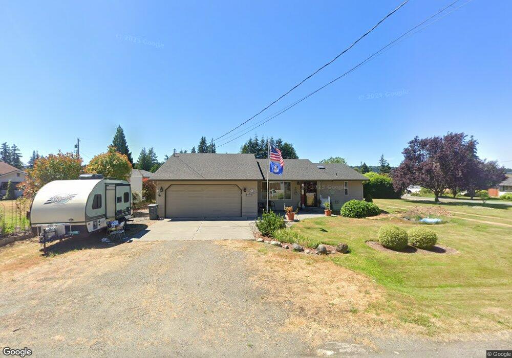
384 Piper Way Camano Island, WA 98282
Estimated Value: $567,762 - $590,000
2
Beds
2
Baths
1,453
Sq Ft
$397/Sq Ft
Est. Value
About This Home
This home is located at 384 Piper Way, Camano Island, WA 98282 and is currently estimated at $576,441, approximately $396 per square foot. 384 Piper Way is a home located in Island County with nearby schools including Utsalady Elementary School, Port Susan Middle School, and Stanwood High School.
Ownership History
Date
Name
Owned For
Owner Type
Purchase Details
Closed on
Mar 20, 2015
Sold by
Nance Rob and Nance Christi
Bought by
Reeves Paul
Current Estimated Value
Home Financials for this Owner
Home Financials are based on the most recent Mortgage that was taken out on this home.
Original Mortgage
$229,000
Outstanding Balance
$174,682
Interest Rate
3.65%
Mortgage Type
VA
Estimated Equity
$401,759
Create a Home Valuation Report for This Property
The Home Valuation Report is an in-depth analysis detailing your home's value as well as a comparison with similar homes in the area
Home Values in the Area
Average Home Value in this Area
Purchase History
| Date | Buyer | Sale Price | Title Company |
|---|---|---|---|
| Reeves Paul | $229,000 | Land Title & Escrow |
Source: Public Records
Mortgage History
| Date | Status | Borrower | Loan Amount |
|---|---|---|---|
| Open | Reeves Paul | $229,000 |
Source: Public Records
Tax History Compared to Growth
Tax History
| Year | Tax Paid | Tax Assessment Tax Assessment Total Assessment is a certain percentage of the fair market value that is determined by local assessors to be the total taxable value of land and additions on the property. | Land | Improvement |
|---|---|---|---|---|
| 2025 | $1,957 | $524,127 | $260,000 | $264,127 |
| 2024 | $4,074 | $517,546 | $250,000 | $267,546 |
| 2023 | $4,074 | $520,965 | $250,000 | $270,965 |
| 2022 | $3,494 | $458,464 | $210,000 | $248,464 |
| 2021 | $3,265 | $369,026 | $165,000 | $204,026 |
| 2020 | $3,155 | $333,632 | $135,000 | $198,632 |
| 2019 | $2,861 | $317,986 | $175,000 | $142,986 |
| 2018 | $2,623 | $288,426 | $145,000 | $143,426 |
| 2017 | $2,245 | $244,305 | $100,000 | $144,305 |
| 2016 | $2,075 | $231,065 | $85,000 | $146,065 |
| 2015 | $2,039 | $204,706 | $65,000 | $139,706 |
| 2013 | -- | $198,184 | $55,000 | $143,184 |
Source: Public Records
Map
Nearby Homes
- 326 Prestwick Dr
- 375 Glengarry Dr
- 269 E Lochwood Dr
- 251 Goodrich Rd
- 362 N Sunrise Blvd
- 474 Stirling Dr
- 245 David St
- 244 David St
- 157 Russell Rd
- 0 xx Nhn Wayne's Ridge Cir
- 0 Dodge Rd Unit NWM2434437
- 514 Waynes Ridge Cir
- 230 Rocky Mountain High Rd
- 828 State Highway 532
- 441 Windsun Way
- 534 Sundin Dr
- 446 Lehman Dr
- 221 Baker View Ln
- 169 Driftwood Shores Rd
- 25 Anadar Place
- 0 XX E Piper Way
- 256 Scotland Dr
- 248 Scotland Dr
- 0 E Piper Way
- 838 E Piper Way
- 383 Piper Way
- 242 Scotland Dr
- 379 E Piper Way
- 367 Piper Way
- 363 Piper Way
- 387 E Piper Way
- 359 Piper Way
- 373 Piper Way
- 247 Scotland Dr
- 253 Scotland Dr
- 236 Scotland Dr
- 391 Piper Way
- 241 Scotland Dr
- 259 Scotland Dr
- 384 Cambrae Dr