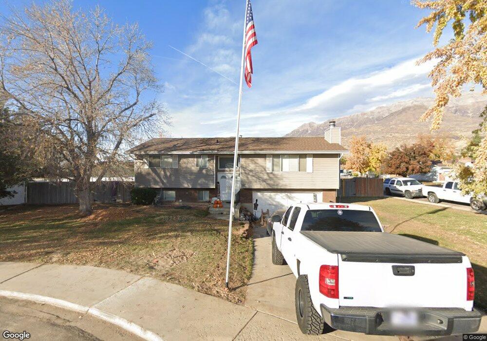
384 W 1480 N Orem, UT 84057
Windsor NeighborhoodEstimated Value: $503,000 - $576,000
3
Beds
3
Baths
1,284
Sq Ft
$416/Sq Ft
Est. Value
About This Home
This home is located at 384 W 1480 N, Orem, UT 84057 and is currently estimated at $533,598, approximately $415 per square foot. 384 W 1480 N is a home located in Utah County with nearby schools including Windsor School, Canyon View Junior High School, and Timpanogos High School.
Ownership History
Date
Name
Owned For
Owner Type
Purchase Details
Closed on
Apr 26, 2013
Sold by
Cann Robert D
Bought by
Cann Properties 384 Llc
Current Estimated Value
Home Financials for this Owner
Home Financials are based on the most recent Mortgage that was taken out on this home.
Original Mortgage
$69,999
Outstanding Balance
$49,735
Interest Rate
3.54%
Mortgage Type
New Conventional
Estimated Equity
$483,863
Purchase Details
Closed on
Apr 9, 2013
Sold by
Cann Properties 384 Llc
Bought by
Cann Robert D
Home Financials for this Owner
Home Financials are based on the most recent Mortgage that was taken out on this home.
Original Mortgage
$69,999
Outstanding Balance
$49,735
Interest Rate
3.54%
Mortgage Type
New Conventional
Estimated Equity
$483,863
Purchase Details
Closed on
May 31, 2012
Sold by
Cann Robert Dale and Cann Margaret Brimhall
Bought by
Cann Properties 384 Llc
Purchase Details
Closed on
Jul 28, 2003
Sold by
Cann Robert D and Cann Margaret Brimhall
Bought by
Cann Robert Dale and Cann Margaret Brimhall
Home Financials for this Owner
Home Financials are based on the most recent Mortgage that was taken out on this home.
Original Mortgage
$81,000
Interest Rate
5.13%
Mortgage Type
Purchase Money Mortgage
Purchase Details
Closed on
Sep 25, 1998
Sold by
Cann Robert Dale and Cann Margaret Brimhall
Bought by
Robert Dale Cann Family Protection Trust
Home Financials for this Owner
Home Financials are based on the most recent Mortgage that was taken out on this home.
Original Mortgage
$86,000
Interest Rate
6.88%
Create a Home Valuation Report for This Property
The Home Valuation Report is an in-depth analysis detailing your home's value as well as a comparison with similar homes in the area
Home Values in the Area
Average Home Value in this Area
Purchase History
| Date | Buyer | Sale Price | Title Company |
|---|---|---|---|
| Cann Properties 384 Llc | -- | First American Title Company | |
| Cann Robert D | -- | First American Title Co Llc | |
| Cann Properties 384 Llc | -- | None Available | |
| Cann Robert Dale | -- | -- | |
| Cann Robert D | -- | -- | |
| Robert Dale Cann Family Protection Trust | -- | -- | |
| Cann Robert Dale | -- | -- |
Source: Public Records
Mortgage History
| Date | Status | Borrower | Loan Amount |
|---|---|---|---|
| Open | Cann Properties 384 Llc | $69,999 | |
| Previous Owner | Cann Robert D | $81,000 | |
| Previous Owner | Cann Robert Dale | $86,000 |
Source: Public Records
Tax History Compared to Growth
Tax History
| Year | Tax Paid | Tax Assessment Tax Assessment Total Assessment is a certain percentage of the fair market value that is determined by local assessors to be the total taxable value of land and additions on the property. | Land | Improvement |
|---|---|---|---|---|
| 2025 | $2,036 | $272,690 | -- | -- |
| 2024 | $2,036 | $248,985 | $0 | $0 |
| 2023 | $1,882 | $247,390 | $0 | $0 |
| 2022 | $1,976 | $251,570 | $0 | $0 |
| 2021 | $1,681 | $324,200 | $162,600 | $161,600 |
| 2020 | $1,522 | $288,500 | $130,100 | $158,400 |
| 2019 | $1,359 | $267,800 | $130,100 | $137,700 |
| 2018 | $1,383 | $260,400 | $122,700 | $137,700 |
| 2017 | $1,198 | $120,835 | $0 | $0 |
| 2016 | $1,262 | $117,370 | $0 | $0 |
| 2015 | $1,281 | $112,695 | $0 | $0 |
| 2014 | $1,155 | $101,145 | $0 | $0 |
Source: Public Records
Map
Nearby Homes
- 385 W 1520 N
- 396 W 1480 N
- 397 W 1520 N
- 361 W 1500 N
- 383 W 1480 N
- 362 W 1500 N
- 395 W 1480 N
- 1474 N 375 W
- 1518 N 375 W
- 1461 N Amiron Way Unit A
- 1461 N Amiron Way
- 1461 N Amiron Way Unit D
- 398 W 1520 N
- 335 W 1500 N
- 388 W 1520 N
- 336 W 1500 N
- 1464 N Amiron Way Unit C
- 1464 N Amiron Way Unit B
- 1464 N Amiron Way Unit A
- 1464 N Amiron Way Unit D