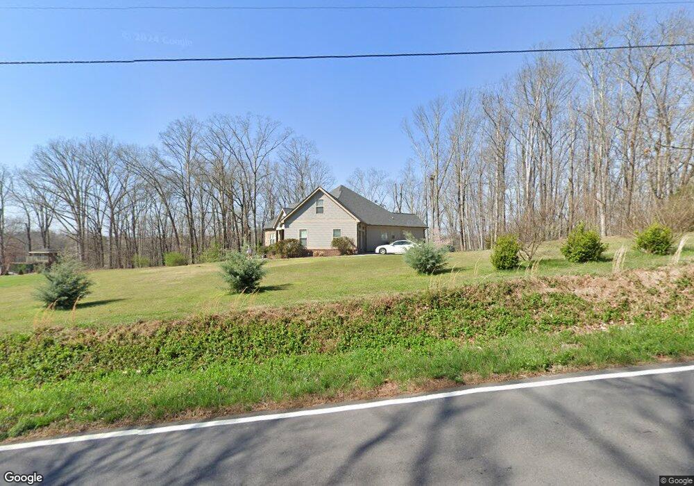
384 Westbrook Rd Ringgold, GA 30736
Beaumont NeighborhoodEstimated Value: $346,000 - $456,000
Studio
1
Bath
2,195
Sq Ft
$193/Sq Ft
Est. Value
About This Home
This home is located at 384 Westbrook Rd, Ringgold, GA 30736 and is currently estimated at $424,491, approximately $193 per square foot. 384 Westbrook Rd is a home with nearby schools including Woodstation Elementary School, Heritage Middle School, and Heritage High School.
Ownership History
Date
Name
Owned For
Owner Type
Purchase Details
Closed on
Aug 5, 2014
Sold by
Mcworter Sherri
Bought by
Mcwhorter William C and Mcwhorter Sherri
Current Estimated Value
Home Financials for this Owner
Home Financials are based on the most recent Mortgage that was taken out on this home.
Original Mortgage
$188,261
Outstanding Balance
$142,301
Interest Rate
4.19%
Mortgage Type
New Conventional
Estimated Equity
$282,190
Purchase Details
Closed on
Feb 6, 2014
Sold by
Mcworter Sherri
Bought by
Mcwhorter Sherri
Purchase Details
Closed on
Aug 11, 2004
Bought by
Mcworter Sherri
Create a Home Valuation Report for This Property
The Home Valuation Report is an in-depth analysis detailing your home's value as well as a comparison with similar homes in the area
Home Values in the Area
Average Home Value in this Area
Purchase History
| Date | Buyer | Sale Price | Title Company |
|---|---|---|---|
| Mcwhorter William C | -- | -- | |
| Mcwhorter Sherri | -- | -- | |
| Mcworter Sherri | -- | -- |
Source: Public Records
Mortgage History
| Date | Status | Borrower | Loan Amount |
|---|---|---|---|
| Open | Mcwhorter William C | $188,261 |
Source: Public Records
Tax History
| Year | Tax Paid | Tax Assessment Tax Assessment Total Assessment is a certain percentage of the fair market value that is determined by local assessors to be the total taxable value of land and additions on the property. | Land | Improvement |
|---|---|---|---|---|
| 2025 | $3,249 | $204,105 | $36,597 | $167,508 |
| 2024 | $3,650 | $173,137 | $12,797 | $160,340 |
| 2023 | $2,939 | $133,260 | $12,797 | $120,463 |
| 2022 | $2,342 | $106,594 | $12,188 | $94,406 |
| 2021 | $2,189 | $106,594 | $12,188 | $94,406 |
| 2020 | $2,236 | $96,648 | $11,608 | $85,040 |
| 2019 | $2,214 | $96,648 | $11,608 | $85,040 |
| 2018 | $2,388 | $96,648 | $11,608 | $85,040 |
| 2017 | $2,237 | $92,528 | $11,608 | $80,920 |
| 2016 | $2,169 | $85,474 | $11,234 | $74,240 |
| 2015 | -- | $85,474 | $11,234 | $74,240 |
| 2014 | -- | $16,380 | $16,380 | $0 |
| 2013 | -- | $16,380 | $16,379 | $0 |
Source: Public Records
Map
Nearby Homes
- 3774 Mount Pisgah Rd
- 2583 Davis Ridge Rd
- 756 Bowman Rd
- 379 N Beaumont Rd
- 0 Pineywood Dr Unit 1515968
- 489 493 Meadowlark Dr
- 489 Meadowlark Dr
- 87 Peavine Rd
- 270 Jones Rd
- 1053 Old Three Notch Rd
- 713 Mount Pisgah Rd
- 0 Alabama Hwy Unit 10586300
- 0 Alabama Hwy Unit 1518818
- 235 Potts Rd
- 1308 Spring Meadows Dr
- 223 Cooper Rd
- 12466 Alabama Hwy
- 25 Golden Pond Ln
- 36 Pheonix Cir
- 453 Harvest Ln
- 458 Westbrook Rd
- 322 Westbrook Rd
- 2448 Yates Springs Rd
- 125 Howard Leonard Rd
- 210 Westbrook Rd
- 497 Westbrook Rd
- 233 Westbrook Rd
- 2226 Yates Springs Rd
- 3279 Mount Pisgah Rd
- 184 Westbrook Rd
- 2335 Yates Springs Rd
- 157 Howard Leonard Rd
- 157 Howard Leonard Rd
- 121 Westbrook Rd
- 3119 Mount Pisgah Rd
- 3201 Mount Pisgah Rd
- 3239 Mount Pisgah Rd
- 3173 Mount Pisgah Rd
- 2385 Yates Springs Rd
- 581 Westbrook Rd
Your Personal Tour Guide
Ask me questions while you tour the home.