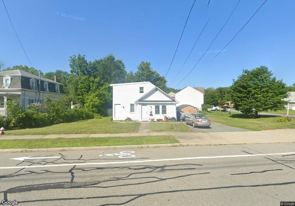
3841 Acushnet Ave New Bedford, MA 02745
Estimated Value: $537,007 - $591,000
3
Beds
2
Baths
1,476
Sq Ft
$378/Sq Ft
Est. Value
About This Home
This home is located at 3841 Acushnet Ave, New Bedford, MA 02745 and is currently estimated at $558,002, approximately $378 per square foot. 3841 Acushnet Ave is a home located in Bristol County with nearby schools including Casimir Pulaski Elementary School, Normandin Middle School, and New Bedford High School.
Ownership History
Date
Name
Owned For
Owner Type
Purchase Details
Closed on
Jun 21, 2013
Sold by
Oceanfront Inc
Bought by
Moriarty Patrick R and Moriarty Christine L
Current Estimated Value
Home Financials for this Owner
Home Financials are based on the most recent Mortgage that was taken out on this home.
Original Mortgage
$120,000
Outstanding Balance
$90,839
Interest Rate
5%
Mortgage Type
New Conventional
Estimated Equity
$467,163
Purchase Details
Closed on
Apr 1, 2011
Sold by
Santos Albert
Bought by
Oceanfront Inc
Purchase Details
Closed on
Mar 31, 2011
Sold by
Fhlmc
Bought by
Santos Albert
Purchase Details
Closed on
Aug 25, 2010
Sold by
Perreira Manuel and Bank Of America Na
Bought by
Fhlmc
Purchase Details
Closed on
Apr 1, 2005
Sold by
Leaver Michael B Est
Bought by
Perreira Manuel
Purchase Details
Closed on
Jan 15, 2004
Sold by
Leaver Evelyn F
Bought by
Leaver Michael B
Create a Home Valuation Report for This Property
The Home Valuation Report is an in-depth analysis detailing your home's value as well as a comparison with similar homes in the area
Home Values in the Area
Average Home Value in this Area
Purchase History
| Date | Buyer | Sale Price | Title Company |
|---|---|---|---|
| Moriarty Patrick R | $150,000 | -- | |
| Moriarty Patrick R | $150,000 | -- | |
| Moriarty Patrick R | $150,000 | -- | |
| Oceanfront Inc | -- | -- | |
| Oceanfront Inc | -- | -- | |
| Santos Albert | $111,000 | -- | |
| Santos Albert | $111,000 | -- | |
| Fhlmc | $143,000 | -- | |
| Fhlmc | $143,000 | -- | |
| Perreira Manuel | $210,000 | -- | |
| Perreira Manuel | $210,000 | -- | |
| Leaver Michael B | -- | -- | |
| Leaver Michael B | -- | -- |
Source: Public Records
Mortgage History
| Date | Status | Borrower | Loan Amount |
|---|---|---|---|
| Open | Moriarty Patrick R | $120,000 | |
| Closed | Moriarty Patrick R | $120,000 |
Source: Public Records
Tax History Compared to Growth
Tax History
| Year | Tax Paid | Tax Assessment Tax Assessment Total Assessment is a certain percentage of the fair market value that is determined by local assessors to be the total taxable value of land and additions on the property. | Land | Improvement |
|---|---|---|---|---|
| 2025 | $5,311 | $469,600 | $144,600 | $325,000 |
| 2024 | $5,388 | $449,000 | $135,600 | $313,400 |
| 2023 | $5,485 | $383,800 | $115,200 | $268,600 |
| 2022 | $5,110 | $328,800 | $115,200 | $213,600 |
| 2021 | $4,917 | $315,400 | $113,000 | $202,400 |
| 2020 | $4,733 | $292,900 | $113,000 | $179,900 |
| 2019 | $4,653 | $282,500 | $113,000 | $169,500 |
| 2018 | $4,310 | $259,200 | $113,000 | $146,200 |
| 2017 | $3,785 | $226,800 | $110,700 | $116,100 |
| 2016 | $3,443 | $208,800 | $101,700 | $107,100 |
| 2015 | $3,133 | $199,200 | $99,400 | $99,800 |
| 2014 | $3,149 | $207,700 | $101,700 | $106,000 |
Source: Public Records
Map
Nearby Homes
- SS Charbonneau Ln
- 1063 Westgate St
- 34 Poplar Rd
- 145 Heritage Dr
- 210 Heritage Dr
- 64 Blaze Rd
- 26 Blueberry Dr
- 62 Longview Rd
- 1069 Cherokee St
- 2 Woodland Rd
- 16 Swallow St
- 1269 Bartlett St
- 8 Holly Tree Ln
- 13 Luscomb Ln
- 700 Pine Hill Dr
- 12 Randall St
- 888 Hillcrest Rd
- 1045 Forbes St
- 67 Morses Ln
- 1350 Phillips Rd
- 16 Araujo Ct
- 3837 Acushnet Ave
- 26 Araujo Ct
- 32 Araujo Ct
- 3842 Acushnet Ave
- 3863 Acushnet Ave
- 19 Araujo Ct
- 3823 Acushnet Ave
- 112 Araujo Ct
- 3860 Acushnet Ave
- 3852 Acushnet Ave
- 3871 Acushnet Ave
- 29 Araujo Ct
- 3830 Acushnet Ave
- 36 Araujo Ct
- 37 Araujo Ct
- 3870 Acushnet Ave
- 1059 Westgate St
- 3811 Acushnet Ave
- 3818 Acushnet Ave