Estimated Value: $204,000 - $327,935
3
Beds
2
Baths
1,640
Sq Ft
$164/Sq Ft
Est. Value
About This Home
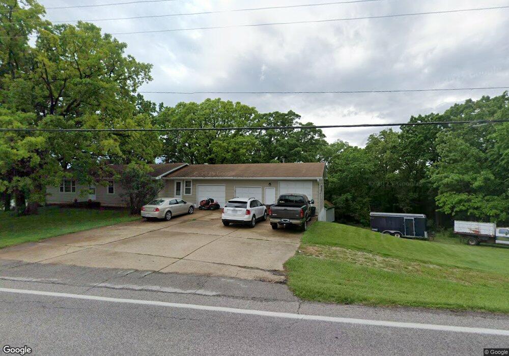
This home is located at 3841 Highway A, Union, MO 63084 and is currently estimated at $268,984, approximately $164 per square foot. 3841 Highway A is a home located in Franklin County with nearby schools including Washington High School, Immaculate Conception School, and St. Gertrude Catholic School.
Ownership History
Date
Name
Owned For
Owner Type
Purchase Details
Closed on
Mar 11, 2011
Sold by
Homesales Inc
Bought by
Holland Richard
Current Estimated Value
Purchase Details
Closed on
Jun 9, 2010
Sold by
Boland Nicholas M
Bought by
Homesales Inc
Purchase Details
Closed on
Apr 29, 2008
Sold by
Gregory Rebecca
Bought by
Boland Nicolas M
Home Financials for this Owner
Home Financials are based on the most recent Mortgage that was taken out on this home.
Original Mortgage
$131,070
Interest Rate
5.89%
Mortgage Type
New Conventional
Create a Home Valuation Report for This Property
The Home Valuation Report is an in-depth analysis detailing your home's value as well as a comparison with similar homes in the area
Home Values in the Area
Average Home Value in this Area
Purchase History
| Date | Buyer | Sale Price | Title Company |
|---|---|---|---|
| Holland Richard | $85,000 | None Available | |
| Homesales Inc | $113,050 | None Available | |
| Boland Nicolas M | -- | None Available |
Source: Public Records
Mortgage History
| Date | Status | Borrower | Loan Amount |
|---|---|---|---|
| Previous Owner | Boland Nicolas M | $131,070 |
Source: Public Records
Tax History Compared to Growth
Tax History
| Year | Tax Paid | Tax Assessment Tax Assessment Total Assessment is a certain percentage of the fair market value that is determined by local assessors to be the total taxable value of land and additions on the property. | Land | Improvement |
|---|---|---|---|---|
| 2024 | $1,707 | $30,820 | $0 | $0 |
| 2023 | $1,707 | $30,820 | $0 | $0 |
| 2022 | $1,694 | $30,493 | $0 | $0 |
| 2021 | $1,694 | $30,493 | $0 | $0 |
| 2020 | $1,620 | $28,058 | $0 | $0 |
| 2019 | $1,614 | $28,058 | $0 | $0 |
| 2018 | $1,509 | $27,626 | $0 | $0 |
| 2017 | $1,512 | $27,626 | $0 | $0 |
| 2016 | $1,418 | $25,764 | $0 | $0 |
| 2015 | $1,417 | $25,764 | $0 | $0 |
| 2014 | $1,431 | $26,013 | $0 | $0 |
Source: Public Records
Map
Nearby Homes
- 873 W Park Rd
- 21 Forest Ln
- 3 Mount Vernon Ct
- 1017 Delmar Ave
- 7 Georgetown Ct
- 33 Hickory Cir
- 101 Hickory Cir
- 54 Hickory Cir
- 89 Hickory Cir
- 186 Little Rock Creek Ct
- 620 Union Ave
- 613 Rock Creek Dr
- 541 Rock Creek Dr
- 510 N Oak St
- 613 W State St
- 7 Bertha Ln
- 1103 W Main St
- 204 Wally Ave
- 506 W Main St
- 614 E State St
- 396 Cedar Terrace Dr
- 395 Cedar Terrace Dr
- 388 Cedar Terrace Dr
- 3826 Highway A
- 380 Cedar Terrace Dr
- 381 Cedar Terrace Dr
- 3820 Highway A
- 3871 Highway A
- 950 Wildwood Ln
- 0 Wildwood Ridge Unit 15003610
- 0 Wildwood Ridge Unit 20088676
- 373 Cedar Terrace Dr
- 372 Cedar Terrace Dr
- 207 Quail Ridge Ct
- 205 Quail Ridge Ct
- 209 Quail Ridge Ct
- 203 Quail Ridge Ct
- 3812 Highway A
- 3878 Highway A
- 201 Quail Ridge Ct