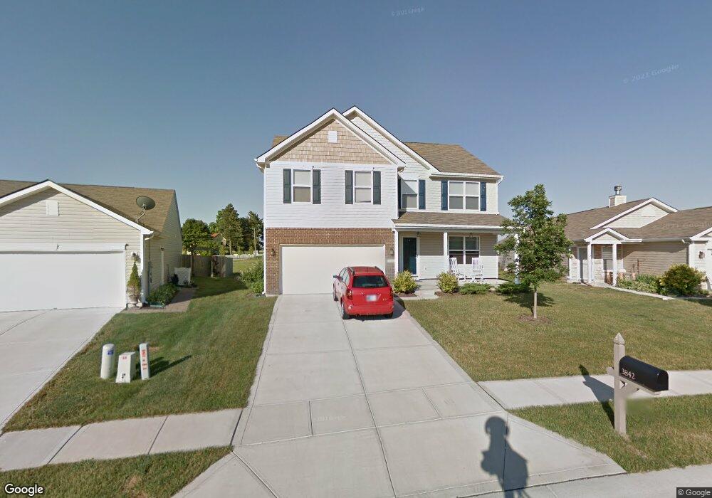
3842 Dusty Sands Rd Whitestown, IN 46075
Estimated Value: $374,000 - $467,540
4
Beds
4
Baths
2,440
Sq Ft
$174/Sq Ft
Est. Value
About This Home
This home is located at 3842 Dusty Sands Rd, Whitestown, IN 46075 and is currently estimated at $425,135, approximately $174 per square foot. 3842 Dusty Sands Rd is a home located in Boone County with nearby schools including Perry Worth Elementary School, Lebanon Middle School, and Lebanon Senior High School.
Ownership History
Date
Name
Owned For
Owner Type
Purchase Details
Closed on
Sep 26, 2022
Sold by
Harmer Kelsey
Bought by
Carrico Shaun Michael
Current Estimated Value
Purchase Details
Closed on
Apr 13, 2018
Sold by
Conrad Tim and Conrad Melinda J
Bought by
Harmer David and Harmer Kelsey
Home Financials for this Owner
Home Financials are based on the most recent Mortgage that was taken out on this home.
Original Mortgage
$176,000
Interest Rate
4.46%
Mortgage Type
Construction
Purchase Details
Closed on
Sep 25, 2009
Sold by
Beazer Homes Indiana Llp
Bought by
Conrad Tim and Conrad Melinda J
Home Financials for this Owner
Home Financials are based on the most recent Mortgage that was taken out on this home.
Original Mortgage
$142,000
Interest Rate
5.19%
Mortgage Type
New Conventional
Create a Home Valuation Report for This Property
The Home Valuation Report is an in-depth analysis detailing your home's value as well as a comparison with similar homes in the area
Home Values in the Area
Average Home Value in this Area
Purchase History
| Date | Buyer | Sale Price | Title Company |
|---|---|---|---|
| Carrico Shaun Michael | $450,000 | Meridian Title Corporation | |
| Harmer David | $220,000 | None Available | |
| Conrad Tim | -- | -- |
Source: Public Records
Mortgage History
| Date | Status | Borrower | Loan Amount |
|---|---|---|---|
| Previous Owner | Harmer David | $176,000 | |
| Previous Owner | Conrad Tim | $142,000 |
Source: Public Records
Tax History Compared to Growth
Tax History
| Year | Tax Paid | Tax Assessment Tax Assessment Total Assessment is a certain percentage of the fair market value that is determined by local assessors to be the total taxable value of land and additions on the property. | Land | Improvement |
|---|---|---|---|---|
| 2025 | $5,075 | $459,000 | $35,000 | $424,000 |
| 2024 | $5,075 | $438,500 | $35,000 | $403,500 |
| 2023 | $5,154 | $437,000 | $35,000 | $402,000 |
| 2022 | $4,053 | $326,400 | $35,000 | $291,400 |
| 2021 | $3,201 | $277,300 | $35,000 | $242,300 |
| 2020 | $3,085 | $264,800 | $35,000 | $229,800 |
| 2019 | $2,878 | $245,100 | $35,000 | $210,100 |
| 2018 | $2,616 | $225,000 | $35,000 | $190,000 |
| 2017 | $2,548 | $215,700 | $35,000 | $180,700 |
| 2016 | $2,512 | $214,100 | $35,000 | $179,100 |
| 2014 | $2,131 | $190,900 | $35,000 | $155,900 |
| 2013 | $2,046 | $182,300 | $35,000 | $147,300 |
Source: Public Records
Map
Nearby Homes
- 3830 Indigo Blue Blvd
- 3784 Dusty Sands Rd
- 3902 Riverstone Dr
- 3888 Riverstone Dr
- 3922 Sterling Dr
- 2543 Lamar Dr
- 3743 Indigo Blue Blvd
- 3511 Firethorn Dr
- 6831 Orchard Run Cir
- 3413 Roundlake Ln
- 5925 Sterling Dr
- 3421 Firethorn Dr
- 3822 Limelight Ln
- 3391 Roundlake Ln
- 5792 Waterstone Way
- 3696 White Cliff Way
- 5791 Waterstone Way
- 3610 Duncan Ct
- 6917 Wheatley Rd
- 6926 Wheatley Rd
- 3838 Dusty Sands Rd
- 3848 Dusty Sands Rd
- 3854 Dusty Sands Rd
- 3832 Dusty Sands Rd
- 3824 Dusty Sands Rd
- 3856 Dusty Sands Rd
- 3835 Dusty Sands Rd
- 3845 Dusty Sands Rd
- 3827 Dusty Sands Rd
- 3862 Dusty Sands Rd
- 3851 Dusty Sands Rd
- 3816 Dusty Sands Rd
- 3821 Dusty Sands Rd
- 3859 Dusty Sands Rd
- 3814 Dusty Sands Rd
- 3817 Dusty Sands Rd
- 3868 Dusty Sands Rd
- 4010 Poplar Dr
- 3806 Dusty Sands Rd
- 3809 Dusty Sands Rd