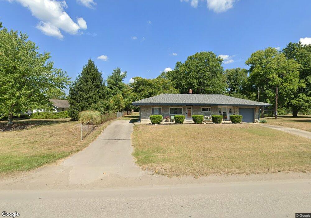
3845 Round Bottom Rd Cincinnati, OH 45244
Estimated Value: $200,000 - $365,000
3
Beds
1
Bath
992
Sq Ft
$257/Sq Ft
Est. Value
About This Home
This home is located at 3845 Round Bottom Rd, Cincinnati, OH 45244 and is currently estimated at $255,304, approximately $257 per square foot. 3845 Round Bottom Rd is a home located in Hamilton County with nearby schools including Mercer Elementary School, Nagel Middle School, and Turpin High School.
Ownership History
Date
Name
Owned For
Owner Type
Purchase Details
Closed on
May 28, 2025
Sold by
Jones Bobby D and Jones Gloria A
Bought by
Camp Dennison Properties Llc
Current Estimated Value
Purchase Details
Closed on
May 7, 2025
Sold by
Jones Bobby D and Jones Gloria A
Bought by
Jones Bobby D and Jones Gloria A
Create a Home Valuation Report for This Property
The Home Valuation Report is an in-depth analysis detailing your home's value as well as a comparison with similar homes in the area
Home Values in the Area
Average Home Value in this Area
Purchase History
| Date | Buyer | Sale Price | Title Company |
|---|---|---|---|
| Camp Dennison Properties Llc | $350,000 | None Listed On Document | |
| Camp Dennison Properties Llc | $350,000 | None Listed On Document | |
| Jones Bobby D | -- | None Listed On Document | |
| Jones Bobby D | -- | None Listed On Document |
Source: Public Records
Tax History
| Year | Tax Paid | Tax Assessment Tax Assessment Total Assessment is a certain percentage of the fair market value that is determined by local assessors to be the total taxable value of land and additions on the property. | Land | Improvement |
|---|---|---|---|---|
| 2025 | $2,696 | $57,646 | $14,354 | $43,292 |
| 2024 | $2,654 | $57,646 | $14,354 | $43,292 |
| 2023 | $2,709 | $57,646 | $14,354 | $43,292 |
| 2022 | $2,062 | $41,644 | $13,157 | $28,487 |
| 2021 | $2,000 | $41,644 | $13,157 | $28,487 |
| 2020 | $2,036 | $41,644 | $13,157 | $28,487 |
| 2019 | $1,970 | $37,857 | $11,960 | $25,897 |
| 2018 | $1,841 | $37,857 | $11,960 | $25,897 |
| 2017 | $1,741 | $37,857 | $11,960 | $25,897 |
| 2016 | $1,666 | $36,029 | $11,662 | $24,367 |
| 2015 | $1,725 | $36,029 | $11,662 | $24,367 |
| 2014 | $1,727 | $36,029 | $11,662 | $24,367 |
| 2013 | $1,604 | $35,673 | $11,547 | $24,126 |
Source: Public Records
Map
Nearby Homes
- 3420 Oyster Bay Ct
- 0 Pearl St Unit 1225343
- 0 Pearl St Unit 1841806
- 3305 Scioto Dr
- 4085 Walton Creek Rd
- 7410 Orchard St
- 7412 Orchard St
- 7408 Orchard St
- 7406 Orchard St
- 7411 Elm St
- 11 Spring Hill Dr
- 14 Spring Knoll Dr
- 6912 Edith St
- 6809 Jefferson St
- 3130 Wolf Run Ct
- 3758 Miami Run
- 3771 Miami Run
- 3754 Miami Run
- 3762 Miami Run
- 3746 Miami Run
- 3853 Round Bottom Rd
- 3863 Round Bottom Rd
- 3829 Round Bottom Rd
- 3839 Round Bottom Rd
- 3867 Round Bottom Rd
- 3828 Round Bottom Rd
- 3819 Round Bottom Rd
- 3872 Round Bottom Rd
- 3807 Round Bottom Rd
- 3826 Round Bottom Rd
- 3856 Round Bottom Rd
- 3851 Edwards Rd
- 3765 Round Bottom Rd
- 3761 Round Bottom Rd
- 3950 Round Bottom Rd
- 3679 Round Bottom Rd
- 3669 Round Bottom Rd
- 7607 Main St
- 7868 Wooster Pike
- 7860 Wooster Pike
Your Personal Tour Guide
Ask me questions while you tour the home.