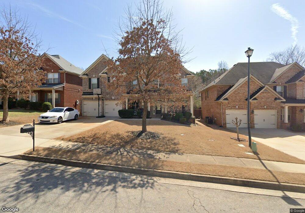
385 Astoria Way 0 McDonough, GA 30253
Estimated Value: $455,000 - $517,000
5
Beds
4
Baths
4,111
Sq Ft
$117/Sq Ft
Est. Value
About This Home
This home is located at 385 Astoria Way 0, McDonough, GA 30253 and is currently estimated at $482,097, approximately $117 per square foot. 385 Astoria Way 0 is a home located in Henry County with nearby schools including Union Grove Middle School, Union Grove High School, and Hickory Flat Elementary School.
Ownership History
Date
Name
Owned For
Owner Type
Purchase Details
Closed on
Feb 12, 2021
Sold by
Okafor Onyinye
Bought by
Oum Ouk Davy
Current Estimated Value
Home Financials for this Owner
Home Financials are based on the most recent Mortgage that was taken out on this home.
Original Mortgage
$310,400
Outstanding Balance
$277,619
Interest Rate
2.7%
Mortgage Type
New Conventional
Estimated Equity
$204,478
Purchase Details
Closed on
May 29, 2013
Sold by
Peachtree Communities At C
Bought by
Okafor Onyinye
Home Financials for this Owner
Home Financials are based on the most recent Mortgage that was taken out on this home.
Original Mortgage
$224,655
Interest Rate
3.5%
Mortgage Type
FHA
Purchase Details
Closed on
Sep 28, 2012
Sold by
Eastside Commercial Bank
Bought by
Peachtree Communities At Clark
Create a Home Valuation Report for This Property
The Home Valuation Report is an in-depth analysis detailing your home's value as well as a comparison with similar homes in the area
Home Values in the Area
Average Home Value in this Area
Purchase History
| Date | Buyer | Sale Price | Title Company |
|---|---|---|---|
| Oum Ouk Davy | $320,000 | -- | |
| Okafor Onyinye | $228,800 | -- | |
| Peachtree Communities At Clark | $84,000 | -- |
Source: Public Records
Mortgage History
| Date | Status | Borrower | Loan Amount |
|---|---|---|---|
| Open | Oum Ouk Davy | $310,400 | |
| Previous Owner | Okafor Onyinye | $224,655 |
Source: Public Records
Tax History Compared to Growth
Tax History
| Year | Tax Paid | Tax Assessment Tax Assessment Total Assessment is a certain percentage of the fair market value that is determined by local assessors to be the total taxable value of land and additions on the property. | Land | Improvement |
|---|---|---|---|---|
| 2025 | $7,593 | $199,000 | $18,000 | $181,000 |
| 2024 | $7,593 | $190,040 | $18,000 | $172,040 |
| 2023 | $7,986 | $193,640 | $18,000 | $175,640 |
| 2022 | $5,115 | $128,000 | $10,240 | $117,760 |
| 2021 | $5,085 | $127,240 | $12,000 | $115,240 |
| 2020 | $5,170 | $129,480 | $12,000 | $117,480 |
| 2019 | $4,947 | $124,720 | $12,000 | $112,720 |
| 2018 | $4,497 | $112,960 | $10,000 | $102,960 |
| 2016 | $3,501 | $95,680 | $10,000 | $85,680 |
| 2015 | $3,589 | $95,520 | $10,800 | $84,720 |
| 2014 | $3,532 | $91,520 | $9,426 | $82,094 |
Source: Public Records
Map
Nearby Homes
- 466 Astoria Way
- 124 Crown Walk
- 479 Sawtooth Ln
- 172 Summit View Dr
- 176 Cranapple Ln
- 1181 Paramount Dr
- 221 Summit View Dr
- 126 Country Acres Ct
- 1872 Hwy 42 N
- 345 Brannan Rd
- 209 Braemar Ct
- 113 Glenmore Ln
- 240 Brannan Rd
- 441 Aviemore Loop
- 1739A Highway 42
- 245 Bald Ave
- 212 Himalaya Way
- 248 Cranapple Ln
- 146 Himalaya Way
- 236 Himalaya Way
- 385 Astoria Way
- 385 Astoria Way Unit 9
- 389 Astoria Way
- 389 Astoria Way Unit 10
- 381 Astoria Way
- 393 Astoria Way Unit 11
- 377 Astoria Way
- 377 Astoria Way Unit 7
- 397 Astoria Way Unit 12
- 389 Whitney Ln
- 389 Whitney Ln Unit 51
- 373 Astoria Way
- 384 Astoria Way
- 384 Astoria Way Unit 33
- 388 Astoria Way
- 388 Astoria Way Unit 32
- 401 Astoria Way Unit 13
- 401 Astoria Way
- 380 Astoria Way
- 392 Astoria Way