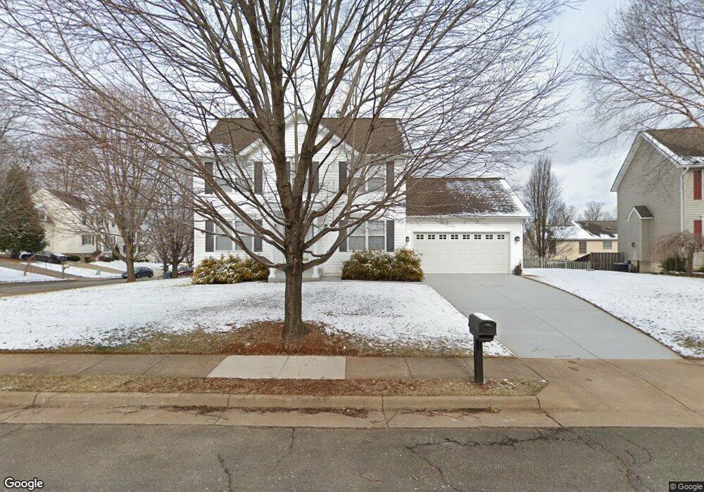
385 Gale Ct Warrenton, VA 20186
Estimated Value: $521,000 - $588,000
3
Beds
3
Baths
1,680
Sq Ft
$324/Sq Ft
Est. Value
About This Home
This home is located at 385 Gale Ct, Warrenton, VA 20186 and is currently estimated at $544,987, approximately $324 per square foot. 385 Gale Ct is a home located in Fauquier County with nearby schools including James G. Brumfield Elementary School, W.C. Taylor Middle School, and Fauquier High School.
Ownership History
Date
Name
Owned For
Owner Type
Purchase Details
Closed on
Nov 29, 2004
Sold by
Renner John
Bought by
Lane Stanley W
Current Estimated Value
Home Financials for this Owner
Home Financials are based on the most recent Mortgage that was taken out on this home.
Original Mortgage
$279,920
Outstanding Balance
$140,371
Interest Rate
5.75%
Mortgage Type
New Conventional
Estimated Equity
$404,616
Purchase Details
Closed on
Oct 29, 1999
Sold by
Springer William F
Bought by
Dimensions New
Create a Home Valuation Report for This Property
The Home Valuation Report is an in-depth analysis detailing your home's value as well as a comparison with similar homes in the area
Home Values in the Area
Average Home Value in this Area
Purchase History
| Date | Buyer | Sale Price | Title Company |
|---|---|---|---|
| Lane Stanley W | $349,900 | -- | |
| Dimensions New | $45,000 | -- |
Source: Public Records
Mortgage History
| Date | Status | Borrower | Loan Amount |
|---|---|---|---|
| Open | Lane Stanley W | $279,920 |
Source: Public Records
Tax History Compared to Growth
Tax History
| Year | Tax Paid | Tax Assessment Tax Assessment Total Assessment is a certain percentage of the fair market value that is determined by local assessors to be the total taxable value of land and additions on the property. | Land | Improvement |
|---|---|---|---|---|
| 2025 | $3,842 | $397,300 | $110,000 | $287,300 |
| 2024 | $3,747 | $397,300 | $110,000 | $287,300 |
| 2023 | $3,588 | $397,300 | $110,000 | $287,300 |
| 2022 | $3,588 | $397,300 | $110,000 | $287,300 |
| 2021 | $3,213 | $323,200 | $110,000 | $213,200 |
| 2020 | $3,213 | $323,200 | $110,000 | $213,200 |
| 2019 | $3,213 | $323,200 | $110,000 | $213,200 |
| 2018 | $3,174 | $323,200 | $110,000 | $213,200 |
| 2016 | $3,098 | $298,200 | $110,000 | $188,200 |
| 2015 | -- | $298,200 | $110,000 | $188,200 |
| 2014 | -- | $298,200 | $110,000 | $188,200 |
Source: Public Records
Map
Nearby Homes
- 252 Onyx Way
- 0 Walker Dr Unit A-112 VAFQ2015996
- 0 Walker Dr Unit A-113 VAFQ2015994
- 0 Walker Dr Unit A-104 VAFQ2015992
- 0 Walker Dr Unit A-103 VAFQ2015990
- 0 Walker Dr Unit A-102 VAFQ2015988
- 0 Walker Dr Unit A-101 VAFQ2015948
- 173 Autumn Wind Ct
- 156 Lapis Ct Unit 23
- 2 Millfield Dr
- 168 High St
- 20 N Calhoun St
- 7785 Millfield Dr
- 107 Haiti St
- 141 Haiti St
- 6529 Bob White Dr
- 134 Haiti St
- 27 Durham Hill Ln
- 124 Old Mill Ln
- 8183 Major Watters Ct
- 225 Breezewood Dr
- 389 Gale Ct
- Gale Ct
- Gale Ct
- 233 Breezewood Dr
- 221 Breezewood Dr
- 388 Driftwood Ct
- 234 Breezewood Dr
- 392 Driftwood Ct
- 230 Breezewood Dr
- 393 Gale Ct
- 238 Breezewood Dr
- 226 Breezewood Dr
- 237 Breezewood Dr
- 396 Driftwood Ct
- Driftwood Ct
- 397 Gale Ct
- 242 Breezewood Dr
- 394 Gale Ct
- 222 Breezewood Dr