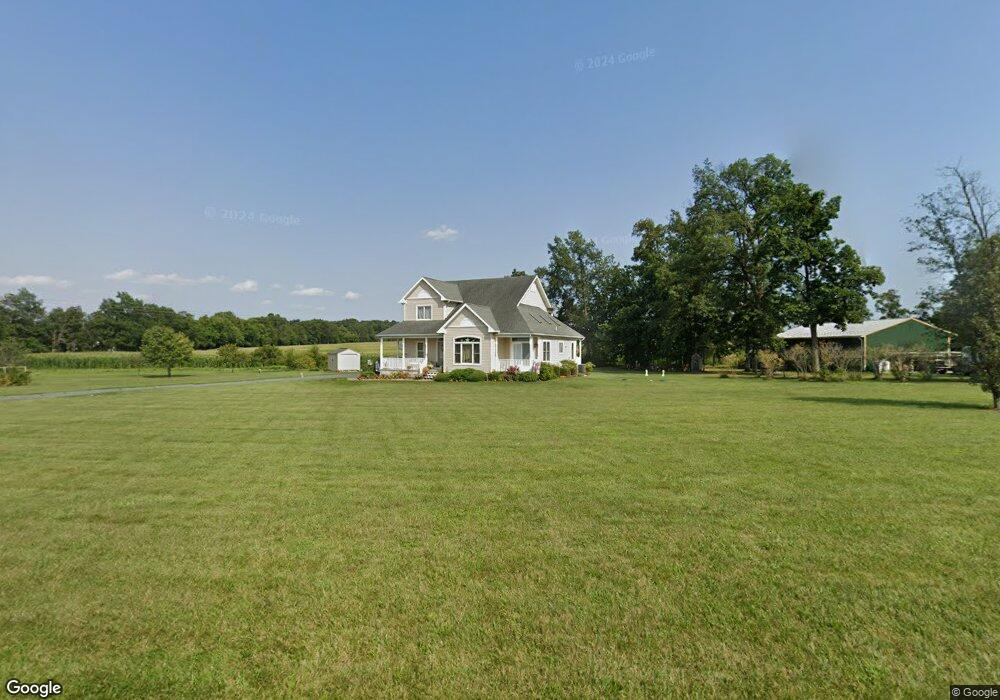
385 Hickory Rd Unit 11 Littlestown, PA 17340
Estimated Value: $505,703 - $593,000
3
Beds
3
Baths
2,307
Sq Ft
$234/Sq Ft
Est. Value
About This Home
This home is located at 385 Hickory Rd Unit 11, Littlestown, PA 17340 and is currently estimated at $539,176, approximately $233 per square foot. 385 Hickory Rd Unit 11 is a home located in Adams County with nearby schools including Rolling Acres El School, Maple Avenue Middle School, and Littlestown Senior High School.
Ownership History
Date
Name
Owned For
Owner Type
Purchase Details
Closed on
Sep 20, 2011
Sold by
Bitzel Fred E
Bought by
Bitzle Fred E and Bitzle Dauphne L
Current Estimated Value
Purchase Details
Closed on
Jul 8, 2010
Sold by
Barton Real Estate Llc
Bought by
Bitzel Fred E
Home Financials for this Owner
Home Financials are based on the most recent Mortgage that was taken out on this home.
Original Mortgage
$232,000
Interest Rate
4.82%
Mortgage Type
New Conventional
Create a Home Valuation Report for This Property
The Home Valuation Report is an in-depth analysis detailing your home's value as well as a comparison with similar homes in the area
Home Values in the Area
Average Home Value in this Area
Purchase History
| Date | Buyer | Sale Price | Title Company |
|---|---|---|---|
| Bitzle Fred E | -- | None Available | |
| Bitzel Fred E | $290,000 | -- |
Source: Public Records
Mortgage History
| Date | Status | Borrower | Loan Amount |
|---|---|---|---|
| Previous Owner | Bitzel Fred E | $232,000 |
Source: Public Records
Tax History Compared to Growth
Tax History
| Year | Tax Paid | Tax Assessment Tax Assessment Total Assessment is a certain percentage of the fair market value that is determined by local assessors to be the total taxable value of land and additions on the property. | Land | Improvement |
|---|---|---|---|---|
| 2025 | $5,775 | $349,800 | $104,100 | $245,700 |
| 2024 | $6,242 | $349,800 | $104,100 | $245,700 |
| 2023 | $6,116 | $349,800 | $104,100 | $245,700 |
| 2022 | $6,071 | $349,800 | $104,100 | $245,700 |
| 2021 | $5,400 | $319,900 | $104,100 | $215,800 |
| 2020 | $4,913 | $319,900 | $104,100 | $215,800 |
| 2019 | $4,878 | $319,900 | $104,100 | $215,800 |
| 2018 | $5,092 | $319,900 | $104,100 | $215,800 |
| 2017 | $4,933 | $319,900 | $104,100 | $215,800 |
| 2016 | -- | $319,900 | $104,100 | $215,800 |
| 2015 | -- | $319,900 | $104,100 | $215,800 |
| 2014 | -- | $319,900 | $104,100 | $215,800 |
Source: Public Records
Map
Nearby Homes
- 3801 Baltimore Pike
- 48 Cannon Ln Unit 105
- 202 Plunkert Rd Unit 2
- 464 Locust Ln
- 89 Maple St Unit 68
- 27 Maple St
- 67 Cedarfield Dr
- 25 Harvest Dr
- 8 Maple St
- 138 Cedarfield Dr Unit 71
- 230 W Crest View Ln
- 34 W Hanover St
- 1 Hickory Ave
- 824 Hancock Dr Unit 824
- 975 Hoffman Home Rd Unit 6
- 871 Sherman Dr Unit 871
- 795 Burnside Dr Unit 795
- 549 Grant Dr Unit 549
- 729 Heritage Dr Unit 729
- 1125 White Church Rd