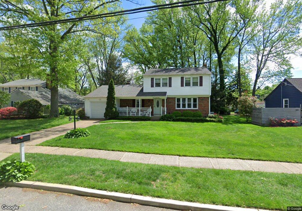
385 Nottingham Rd West Deptford, NJ 08096
West Deptford Township NeighborhoodEstimated Value: $362,628 - $454,000
--
Bed
--
Bath
1,668
Sq Ft
$256/Sq Ft
Est. Value
About This Home
This home is located at 385 Nottingham Rd, West Deptford, NJ 08096 and is currently estimated at $427,657, approximately $256 per square foot. 385 Nottingham Rd is a home located in Gloucester County with nearby schools including Green-Fields Elementary School, Oakview Elementary School, and Red Bank Elementary School.
Ownership History
Date
Name
Owned For
Owner Type
Purchase Details
Closed on
Sep 25, 1997
Sold by
Pine Judith M and Ludlam Donald E
Bought by
Kerr David P and Kerr Cynthia K
Current Estimated Value
Home Financials for this Owner
Home Financials are based on the most recent Mortgage that was taken out on this home.
Original Mortgage
$123,000
Outstanding Balance
$19,796
Interest Rate
7.47%
Estimated Equity
$407,861
Create a Home Valuation Report for This Property
The Home Valuation Report is an in-depth analysis detailing your home's value as well as a comparison with similar homes in the area
Home Values in the Area
Average Home Value in this Area
Purchase History
| Date | Buyer | Sale Price | Title Company |
|---|---|---|---|
| Kerr David P | $146,000 | Congress Title Corp |
Source: Public Records
Mortgage History
| Date | Status | Borrower | Loan Amount |
|---|---|---|---|
| Open | Kerr David P | $123,000 |
Source: Public Records
Tax History Compared to Growth
Tax History
| Year | Tax Paid | Tax Assessment Tax Assessment Total Assessment is a certain percentage of the fair market value that is determined by local assessors to be the total taxable value of land and additions on the property. | Land | Improvement |
|---|---|---|---|---|
| 2025 | $8,262 | $236,600 | $69,200 | $167,400 |
| 2024 | $8,156 | $236,600 | $69,200 | $167,400 |
| 2023 | $8,156 | $236,600 | $69,200 | $167,400 |
| 2022 | $8,118 | $236,600 | $69,200 | $167,400 |
| 2021 | $8,089 | $236,600 | $69,200 | $167,400 |
| 2020 | $8,070 | $236,600 | $69,200 | $167,400 |
| 2019 | $7,846 | $236,600 | $69,200 | $167,400 |
| 2018 | $7,633 | $236,600 | $69,200 | $167,400 |
| 2017 | $7,455 | $236,600 | $69,200 | $167,400 |
| 2016 | $7,247 | $236,600 | $69,200 | $167,400 |
| 2015 | $6,904 | $236,600 | $69,200 | $167,400 |
| 2014 | $6,561 | $236,600 | $69,200 | $167,400 |
Source: Public Records
Map
Nearby Homes
- 1102 Barnesdale Rd
- 1220 Royal Ln
- 4 Saint Emilion Ct
- 1311 Barnesdale Rd
- 87 Woodway Dr Unit 87
- 1810 Fernwood Dr
- 863 Doncaster Dr
- 740 Carter Hill Dr
- 558 Prince St
- 640 Worcester Dr
- 12 Highbridge Ln Unit I2
- 125 Lionheart Ln Unit C125
- 609 Salem Ave
- 1012 Moore Rd Unit 6
- 438 S Columbia St
- 608 Salem Ave
- 344 S Girard St
- 1066 Buckingham Dr
- 1091 Buckingham Dr Unit 45
- 51 Holly Dr
- 381 Nottingham Rd
- 389 Nottingham Rd
- 377 Nottingham Rd
- 1217 Barnesdale Ct
- 1209 Barnesdale Ct
- 1225 Barnesdale Ct
- 1201 Barnesdale Ct
- 384 Nottingham Rd
- 373 Nottingham Rd
- 380 Nottingham Rd
- 376 Nottingham Rd
- 388 Nottingham Rd
- 369 Nottingham Rd
- 392 Nottingham Rd
- 871 Marian Rd
- 867 Marian Rd
- 372 Nottingham Rd
- 877 Marian Rd
- 490 Westwood Dr
- 1119 Barnesdale Rd