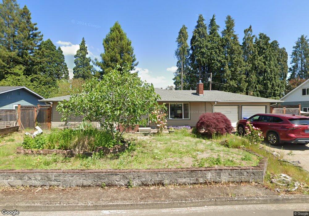
385 Shamrock Ave Eugene, OR 97404
Santa Clara NeighborhoodEstimated Value: $489,312 - $615,000
4
Beds
3
Baths
1,942
Sq Ft
$289/Sq Ft
Est. Value
About This Home
This home is located at 385 Shamrock Ave, Eugene, OR 97404 and is currently estimated at $562,078, approximately $289 per square foot. 385 Shamrock Ave is a home located in Lane County with nearby schools including Awbrey Park Elementary School, Madison Middle School, and North Eugene High School.
Ownership History
Date
Name
Owned For
Owner Type
Purchase Details
Closed on
Jan 4, 2023
Sold by
Freeman Allen W
Bought by
Allen W Freeman Living Trust and Freeman
Current Estimated Value
Purchase Details
Closed on
Mar 31, 2011
Sold by
Lemkau Kearney W and Lemkau Jana L
Bought by
Freeman Allen W and Freeman Marcia C
Home Financials for this Owner
Home Financials are based on the most recent Mortgage that was taken out on this home.
Original Mortgage
$266,000
Interest Rate
4.96%
Mortgage Type
VA
Create a Home Valuation Report for This Property
The Home Valuation Report is an in-depth analysis detailing your home's value as well as a comparison with similar homes in the area
Home Values in the Area
Average Home Value in this Area
Purchase History
| Date | Buyer | Sale Price | Title Company |
|---|---|---|---|
| Allen W Freeman Living Trust | -- | None Listed On Document | |
| Freeman Allen W | $266,000 | Cascade Title Company |
Source: Public Records
Mortgage History
| Date | Status | Borrower | Loan Amount |
|---|---|---|---|
| Previous Owner | Freeman Allen W | $266,000 |
Source: Public Records
Tax History
| Year | Tax Paid | Tax Assessment Tax Assessment Total Assessment is a certain percentage of the fair market value that is determined by local assessors to be the total taxable value of land and additions on the property. | Land | Improvement |
|---|---|---|---|---|
| 2025 | $3,192 | $280,955 | -- | -- |
| 2024 | $3,175 | $272,772 | -- | -- |
| 2023 | $3,175 | $264,828 | $0 | $0 |
| 2022 | $2,984 | $257,115 | $0 | $0 |
| 2021 | $2,738 | $249,627 | $0 | $0 |
| 2020 | $2,696 | $242,357 | $0 | $0 |
| 2019 | $2,569 | $235,299 | $0 | $0 |
| 2018 | $2,352 | $221,792 | $0 | $0 |
| 2017 | $2,172 | $221,792 | $0 | $0 |
| 2016 | $2,042 | $215,332 | $0 | $0 |
| 2015 | $1,995 | $209,060 | $0 | $0 |
| 2014 | $1,888 | $202,971 | $0 | $0 |
Source: Public Records
Map
Nearby Homes
- 514 Warrington Ave
- 528 Nottingham Ave
- 355 River Loop 2
- 4483 Thunderbird St
- 329 Dean Ave
- 556 Cinderella Loop
- 4471 Spring Meadow Ave
- 4366 Berry Ln
- 47 van Fossen Ct
- 110 Calumet Ave
- 4795 Thunderbird St
- 3910 Andover St
- 3708 Kirsten St
- 850 E Beacon Dr
- 4490 Doyle St
- 212 Chimney Rock Ln
- 591 Argon Ave
- 2011 River Loop 1
- 90 Daniel Dr
- 709 Tyson Ln
- 409 Shamrock Ave
- 363 Shamrock Ave
- 390 Shamrock Ave
- 368 Shamrock Ave
- 339 Shamrock Ave
- 433 Shamrock Ave
- 422 Shamrock Ave
- 444 Shamrock Ave
- 4089 Kildare St
- 465 Shamrock Ave
- 315 Shamrock Ave
- 4075 Kildare St
- 496 Spring Creek Dr
- 4083 Kildare St
- 4071 Kildare St
- 472 Spring Creek Dr
- 468 Shamrock Ave
- 4173 Kildare St
- 4169 Kildare St
- 488 Spring Creek Dr
Your Personal Tour Guide
Ask me questions while you tour the home.