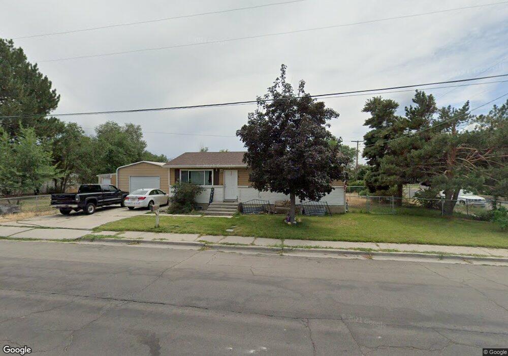
385 W 300 N American Fork, UT 84003
Estimated Value: $473,000 - $523,000
5
Beds
2
Baths
2,080
Sq Ft
$243/Sq Ft
Est. Value
About This Home
This home is located at 385 W 300 N, American Fork, UT 84003 and is currently estimated at $505,203, approximately $242 per square foot. 385 W 300 N is a home located in Utah County with nearby schools including Shelley Elementary School, American Fork Junior High School, and American Fork High School.
Ownership History
Date
Name
Owned For
Owner Type
Purchase Details
Closed on
Jun 15, 2017
Sold by
Stevens Chet
Bought by
Stevens Chet
Current Estimated Value
Home Financials for this Owner
Home Financials are based on the most recent Mortgage that was taken out on this home.
Original Mortgage
$163,500
Outstanding Balance
$135,998
Interest Rate
4.02%
Mortgage Type
New Conventional
Estimated Equity
$369,205
Purchase Details
Closed on
May 16, 2017
Sold by
Gleed Douglas B
Bought by
Stevens Chet
Home Financials for this Owner
Home Financials are based on the most recent Mortgage that was taken out on this home.
Original Mortgage
$163,500
Outstanding Balance
$135,998
Interest Rate
4.02%
Mortgage Type
New Conventional
Estimated Equity
$369,205
Purchase Details
Closed on
Dec 16, 2008
Sold by
Beckstead Amy M
Bought by
Gleed Douglas B
Home Financials for this Owner
Home Financials are based on the most recent Mortgage that was taken out on this home.
Original Mortgage
$201,235
Interest Rate
6.16%
Mortgage Type
VA
Purchase Details
Closed on
Oct 31, 2006
Sold by
Gleed Douglas B
Bought by
Gleed Douglas B and Beckstead Amy M
Home Financials for this Owner
Home Financials are based on the most recent Mortgage that was taken out on this home.
Original Mortgage
$152,000
Interest Rate
7.99%
Mortgage Type
New Conventional
Purchase Details
Closed on
Dec 12, 2005
Sold by
Reece Gus Ryan and Reece Ginger
Bought by
Gr Reece Investments Llc
Home Financials for this Owner
Home Financials are based on the most recent Mortgage that was taken out on this home.
Original Mortgage
$111,750
Interest Rate
6.07%
Mortgage Type
Fannie Mae Freddie Mac
Purchase Details
Closed on
Nov 30, 2005
Sold by
Melva Thorup Wright Family Revocable Tr and Thomson Judith W
Bought by
Reece Gus Ryan and Reece Ginger
Home Financials for this Owner
Home Financials are based on the most recent Mortgage that was taken out on this home.
Original Mortgage
$111,750
Interest Rate
6.07%
Mortgage Type
Fannie Mae Freddie Mac
Purchase Details
Closed on
Aug 14, 2003
Sold by
Wright Melva T
Bought by
Melva Thorup Wright Family Revocable Tr and Wright Melva Thorup
Create a Home Valuation Report for This Property
The Home Valuation Report is an in-depth analysis detailing your home's value as well as a comparison with similar homes in the area
Home Values in the Area
Average Home Value in this Area
Purchase History
| Date | Buyer | Sale Price | Title Company |
|---|---|---|---|
| Stevens Chet | -- | Monument Title Insurance | |
| Stevens Chet | -- | Stewart Title | |
| Gleed Douglas B | -- | Affiliated First Title Comp | |
| Gleed Douglas B | -- | Equity Title Insurance Agen | |
| Gleed Douglas B | -- | United Title Services | |
| Gr Reece Investments Llc | -- | Executive Title | |
| Reece Gus Ryan | -- | Executive Title | |
| Melva Thorup Wright Family Revocable Tr | -- | None Available |
Source: Public Records
Mortgage History
| Date | Status | Borrower | Loan Amount |
|---|---|---|---|
| Open | Stevens Chet | $163,500 | |
| Previous Owner | Gleed Douglas B | $201,235 | |
| Previous Owner | Gleed Douglas B | $152,000 | |
| Previous Owner | Reece Gus Ryan | $111,750 |
Source: Public Records
Tax History Compared to Growth
Tax History
| Year | Tax Paid | Tax Assessment Tax Assessment Total Assessment is a certain percentage of the fair market value that is determined by local assessors to be the total taxable value of land and additions on the property. | Land | Improvement |
|---|---|---|---|---|
| 2025 | $2,240 | $271,150 | $193,700 | $299,300 |
| 2024 | $2,240 | $248,930 | $0 | $0 |
| 2023 | $2,116 | $249,260 | $0 | $0 |
| 2022 | $2,035 | $236,555 | $0 | $0 |
| 2021 | $1,741 | $316,100 | $139,000 | $177,100 |
| 2020 | $1,627 | $286,600 | $124,100 | $162,500 |
| 2019 | $1,476 | $268,900 | $106,400 | $162,500 |
| 2018 | $1,361 | $237,100 | $95,800 | $141,300 |
| 2017 | $1,307 | $122,870 | $0 | $0 |
| 2016 | $1,311 | $114,510 | $0 | $0 |
| 2015 | $1,311 | $108,680 | $0 | $0 |
| 2014 | $1,474 | $120,505 | $0 | $0 |
Source: Public Records
Map
Nearby Homes
- 356 N 480 W
- 370 W Pacific Dr Unit 1
- 399 W Pacific Dr
- 120 N 350 W Unit 127
- 120 N 350 W Unit 133
- 120 N 350 W Unit 130
- 540 N 300 W
- 365 N 100 W
- 641 N 420 W
- 217 W Main St
- 129 W Pacific Dr
- 105 N 100 W
- 55 Roosevelt Ave
- 777 W State Rd
- 82 S Lincoln Ave
- 351 Washington Ave
- 374 N Center St
- 621 N 100 W
- 55 S 200 W
- 782 N 200 W